- Colome, South Dakota
-
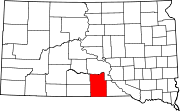
Colome, South Dakota — City — Location in Tripp County and the state of South Dakota
Coordinates: 43°15′36″N 99°42′58″W / 43.26°N 99.71611°WCoordinates: 43°15′36″N 99°42′58″W / 43.26°N 99.71611°W Country United States State South Dakota County Tripp Incorporated 1910[1] Government – Mayor Roger Hauf[citation needed] Area – Total 0.3 sq mi (0.7 km2) – Land 0.3 sq mi (0.7 km2) – Water 0 sq mi (0 km2) Elevation 2,283 ft (696 m) Population (2010) – Total 296 – Density 986.7/sq mi (422.8/km2) Time zone Central (CST) (UTC-6) – Summer (DST) CDT (UTC-5) ZIP code 57528 Area code(s) 605 FIPS code 46-13300[2] GNIS feature ID 1254435[3] Colome is a city in Tripp County, South Dakota, United States. The population was 296 as of the 2010 census.
Contents
Geography
According to the United States Census Bureau, the city has a total area of 0.3 square miles (0.78 km2), all land.
Demographics
As of the census[2] of 2000, there were 340 people, 148 households, and 95 families residing in the city. The population density was 1,271.0 people per square mile (486.2/km²). There were 170 housing units at an average density of 635.5 per square mile (243.1/km²). The racial makeup of the city was 94.12% White, 2.06% Native American, 0.29% Asian, and 3.53% from two or more races. Hispanic or Latino of any race were 0.29% of the population.
There were 148 households out of which 31.8% had children under the age of 18 living with them, 53.4% were married couples living together, 8.1% had a female householder with no husband present, and 35.8% were non-families. 34.5% of all households were made up of individuals and 18.2% had someone living alone who was 65 years of age or older. The average household size was 2.29 and the average family size was 2.93.
In the city the population was spread out with 27.4% under the age of 18, 7.1% from 18 to 24, 24.4% from 25 to 44, 22.4% from 45 to 64, and 18.8% who were 65 years of age or older. The median age was 38 years. For every 100 females there were 92.1 males. For every 100 females age 18 and over, there were 83.0 males.
The median income for a household in the city was $26,771, and the median income for a family was $31,875. Males had a median income of $23,281 versus $18,917 for females. The per capita income for the city was $12,844. About 23.6% of families and 21.3% of the population were below the poverty line, including 21.1% of those under age 18 and 11.7% of those age 65 or over.
History
Colome was founded in June 1908 upon the opening of Tripp County to homesteading. On November 28, 1910 the Chicago and Northwestern Railway reached town on its Norfolk, Nebraska branch line. In June 1978 the final train passed through Colome on its way back back to Norfolk and the railway line was abandoned.[4]
References
- ^ "SD Towns". South Dakota State Historical Society. http://history.sd.gov/Archives/forms/exhibits/SD%20Towns.pdf. Retrieved 2010-02-11.
- ^ a b "American FactFinder". United States Census Bureau. http://factfinder.census.gov. Retrieved 2008-01-31.
- ^ "US Board on Geographic Names". United States Geological Survey. 2007-10-25. http://geonames.usgs.gov. Retrieved 2008-01-31.
- ^ Linnaus, Dr. Vernon F and Bartels, MIchael M. Rails to the Rosebud. South Platte Press, 2008
External links
Municipalities and communities of Tripp County, South Dakota Cities Colome | Winner
Town CDP Unincorporated
communitiesCarter | Clearfield | Ideal | Jordan Junction | Keyapaha | Millboro | Wewela
Indian reservation Footnotes ‡This populated place also has portions in an adjacent county or counties
Categories:- Cities in South Dakota
- Populated places in Tripp County, South Dakota


Wikimedia Foundation. 2010.