- Iroquois, South Dakota
Infobox Settlement
official_name = Iroquois, South Dakota
other_name =
native_name =
nickname =
settlement_type =City
motto =
imagesize =
image_caption =
flag_size =
image_
seal_size =
image_shield =
shield_size =
image_blank_emblem =
blank_emblem_type =
blank_emblem_size =
imagesize =
image_caption =
flag_size =
image_
seal_size =
image_shield =
shield_size =
image_blank_emblem =
blank_emblem_type =
blank_emblem_size =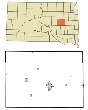
mapsize = 250px
map_caption = Location in Beadle County|Kingsbury County and the state ofSouth Dakota
mapsize1 =
map_caption1 =
image_dot_
dot_mapsize =
dot_map_caption =
dot_x =
dot_y =
pushpin_
pushpin_label_position =
pushpin_map_caption =
pushpin_mapsize =
subdivision_type = Country
subdivision_name =United States
subdivision_type1 = State
subdivision_name1 =South Dakota
subdivision_type2 = Counties
subdivision_name2 = Kingsbury, Beadle
subdivision_type3 =
subdivision_name3 =
subdivision_type4 =
subdivision_name4 =
government_footnotes =
government_type =
leader_title =
leader_name =
leader_title1 =
leader_name1 =
leader_title2 =
leader_name2 =
leader_title3 =
leader_name3 =
leader_title4 =
leader_name4 =
established_title =
established_date =
established_title2 =
established_date2 =
established_title3 =
established_date3 =
area_magnitude =
unit_pref = Imperial
area_footnotes =
area_total_km2 = 1.4
area_land_km2 = 1.4
area_water_km2 = 0
area_total_sq_mi = 0.5
area_land_sq_mi = 0.5
area_water_sq_mi = 0
area_water_percent =
area_urban_km2 =
area_urban_sq_mi =
area_metro_km2 =
area_metro_sq_mi =
area_blank1_title =
area_blank1_km2 =
area_blank1_sq_mi =
population_as_of = 2000
population_footnotes =
population_note =
population_total = 278
population_density_km2 = 198.6
population_density_sq_mi = 556
population_metro =
population_density_metro_km2 =
population_density_metro_sq_mi =
population_urban =
population_density_urban_km2 =
population_density_urban_sq_mi =
population_blank1_title =
population_blank1 =
population_density_blank1_km2 =
population_density_blank1_sq_mi =
timezone = Central (CST)
utc_offset = -6
timezone_DST = CDT
utc_offset_DST = -5
latd = 44 |latm = 21 |lats = 59 |latNS = N
longd = 97 |longm = 51 |longs = 0 |longEW = W
elevation_footnotes =
elevation_m = 427
elevation_ft = 1401
postal_code_type =ZIP code
postal_code = 57353
area_code = 605
blank_name = FIPS code
blank_info = 46-32020GR|2
blank1_name = GNIS feature ID
blank1_info = 1255781GR|3
website =
footnotes =Iroquois is a city in Beadle and Kingsbury Counties in the
U.S. state ofSouth Dakota . The population was 278 at the 2000 census. The school building (kindergarten - twelfth grade) is located in Kingsbury County, while the school parking lot is located in Beadle County. Highway 14 runs directly through Iroquois, and the store that runs along it is closed on Sundays.Geography
Iroquois is located at coor dms|44|21|59|N|97|51|0|W|city (44.366437, -97.850095)GR|1.
According to the
United States Census Bureau , the city has a total area of 0.5square mile s (1.4km² ), all of it land.Iroquois has been assigned the
ZIP code 57353 and theFIPS place code 32020.Demographics
As of the
census GR|2 of 2000, there were 278 people, 113 households, and 77 families residing in the city. Thepopulation density was 521.0 people per square mile (202.5/km²). There were 121 housing units at an average density of 226.7/sq mi (88.1/km²). The racial makeup of the city was 95.68% White, 0.36% Native American, 0.36% Asian, 1.44% from other races, and 2.16% from two or more races. Hispanic or Latino of any race were 2.52% of the population.There were 113 households out of which 31.9% had children under the age of 18 living with them, 56.6% were married couples living together, 10.6% had a female householder with no husband present, and 31.0% were non-families. 31.0% of all households were made up of individuals and 11.5% had someone living alone who was 65 years of age or older. The average household size was 2.46 and the average family size was 3.06.
In the city the population was spread out with 28.4% under the age of 18, 6.1% from 18 to 24, 28.8% from 25 to 44, 16.9% from 45 to 64, and 19.8% who were 65 years of age or older. The median age was 37 years. For every 100 females there were 85.3 males. For every 100 females age 18 and over, there were 93.2 males.
The median income for a household in the city was $25,625, and the median income for a family was $36,250. Males had a median income of $25,417 versus $16,806 for females. The
per capita income for the city was $13,277. About 18.8% of families and 17.4% of the population were below thepoverty line , including 24.7% of those under the age of eighteen and 9.8% of those sixty five or over.Community
There are two churches within the city limits: the United Methodist Church (Rev. Kris Larson) and St. Paul's Catholic Church (Fr. Cathal Gallagher).
Iroquois High School was South Dakota State 9B Football Champions in 2006-2007. They beat Colome SD with the final score 64 to 26.
Iroquois is the hometown of the band Mantua.
References
External links
Wikimedia Foundation. 2010.