- Mbandaka
-
Mbandaka Ville de Mbandaka Location in the Democratic Republic of the Congo
 Mbandaka
Coordinates: 0°04′N 18°16′E / 0.067°N 18.267°ECoordinates: 0°04′N 18°16′E / 0.067°N 18.267°E Country Democratic Republic of the Congo Province Équateur Province Area[1] - Total 600 km2 (231.7 sq mi) Population (2004)[2] - Total 729,257 Time zone WAT (UTC+1) Mbandaka, formerly known as Coquilhatville or Coquilhatstad (named after Camille-Aimé Coquilhat), is a city on the Congo River in the Democratic Republic of Congo, lying near the confluence of the Congo and Ruki Rivers. The capital of the Equateur Province, it is home to an airport and is linked by ferry to Kinshasa and Boende. The city's population is approximately 729,257 (2004).
Mbandaka is largely populated by people of the Mongo ethnic group, although people from many different regions live in the city. The main languages spoken in Mbandaka are Lingala, French and Mongo.
Years of war and neglect have taken a heavy toll on the city infrastructure, with no electricity or running water in large sectors of the city. Most of the streets and avenues of the city are dirt roads.
 Commercial centre of Mbandaka, Democratic Republic of the Congo, 2008
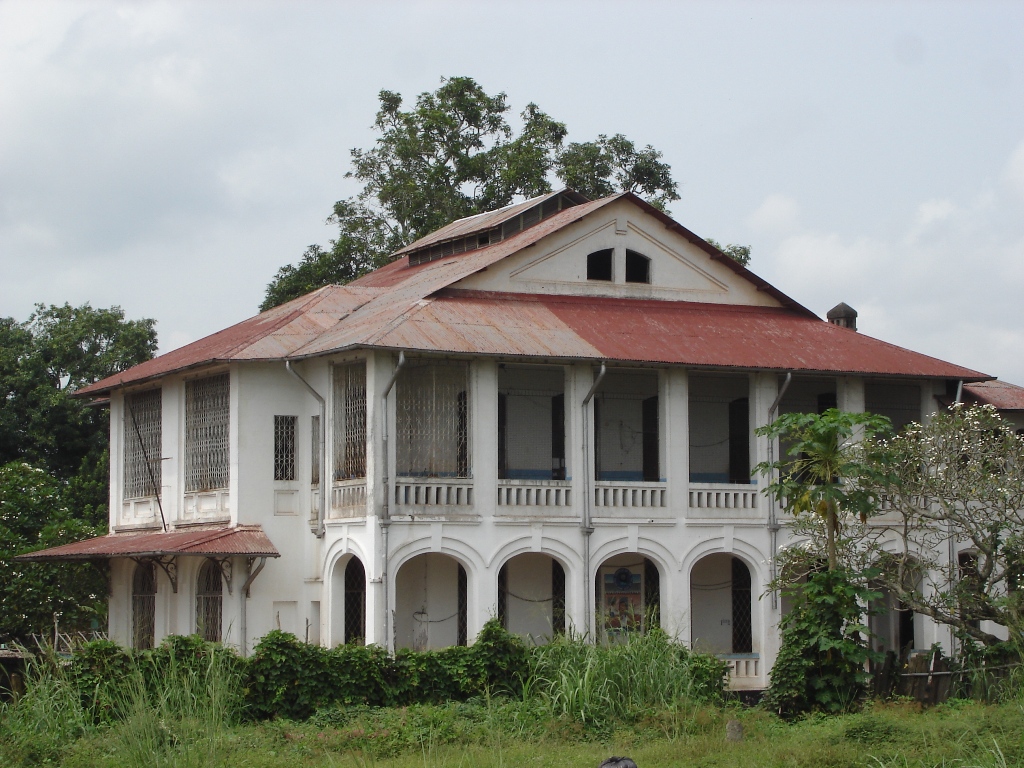
 Church of the Mission of the Brothers of the Sacred Heart at Bamanya, Equateur province, 2008
 Banque du Congo belge, Mbandaka
Contents
History
Mbandaka was founded in 1883 by Henry Morton Stanley with the name of "Equateur". In fact the Town Hall is about 6.6 kilometers north of the Geographic Equator Line. Stanley placed a large "Equator Stone" near the river bank south of the city to mark the point where he believed the Equator to cross the river. It remains there today. Due to its symbolic location close to the equator and the Congo River there were early plans to locate the capital of the Congo Free State in Mbandaka. Although plans were made they were never realized and thus remained solely on the drawing board. These plans included an infrastructure for an estimated population of 100,000 people, a train station, a Catholic cathedral, a governors residence and a palace for future visits of Leopold II.[3]
In 1886, at the beginning of their colonial rule, the Belgians changed the city's name to "Coquilhatville".
During the colonial time in 1938 works started on a bridge over the Congo River connecting Mbandaka with the French Congo. Work was abandoned at the outbreak of WWII and today only the foundations of the bridge pillars remain. In the 1930s several other projects were started by the Belgian colonial administration, including several factories and a new city hall. The city hall was completed only after the war in 1947 and was at that time, with a height of 39 meters, the tallest building in the Belgian Congo. On top of the city hall was a statue of Leopold II. The city hall was destroyed by a fire in 1963.[4]
In 1966 the name was changed once again, this time by the new independent government, to "Mbandaka" to honor a prominent local leader.
Hundreds of people (mainly Hutu refugees, women and children) in the city were massacred on May 13, 1997 near the end of the First Congo Civil War.
Notable places
Catholic Mission station and Central African history research centre of Bamanya
A large research center for Central African history, originally set up by Fathers Gustaaf Hulstaert (1900-1990) and Honoré Vinck, is at the Catholic Mission station of Bamanya (Brothers of the Sacred Heart), 10 kilometres east of Mbandaka [5].
Botanic Garden of Eala
One of the finest botanical gardens representing central Africa is at nearby Eala, about 7 kms east of the town centre. The Botanic Garden of Eala (founded in 1900) contains the floral richness of Central Africa with between 4,000 and 5,000 species. It covers approximately 370 hectares with special collections (125 ha), forest (190 ha), marsh (50 ha) and savanna "Euobe" (7 ha). The garden is neglected and unfenced and there is illegal logging. The last catalogue was published in 1924.
First Habitat for Humanity International housing project
Mbandaka is the home of the world's first project of Habitat for Humanity International. Habitat for Humanity's founder Millard Fuller served as missionary with the Disciples of Christ Church in Mbandaka from 1973-76. The housing project Fuller started in Mbandaka in 1973 became the original project of Habitat for Humanity when Fuller founded Habitat upon his return to the United States.
Climate
Mbandaka features a tropical rainforest climate under Koppen's climate classification. The city does feature wetter and drier months, with the driest month, January averaging around 80 mm of precipitation per year. However the city does not have a dry season, all months average above 60 mm of precipitation in a year. Temperatures are relatively constant throughout the course of the year, with average temperatures ranging from 23-26 degrees Celsius during the course of the year.
Mbandaka, Democratic Republic of the Congo Climate chart (explanation) J F M A M J J A S O N D 80311910032201503220140312013031201103019100301710029172003019210301919030191203019Average max. and min. temperatures in °C Precipitation totals in mm Source: [1] Imperial conversion J F M A M J J A S O N D 3.188663.990685.990685.588685.188684.386663.986633.984637.986668.386667.586664.78666Average max. and min. temperatures in °F Precipitation totals in inches References
- ^ "Villes de RD Congo - Mbandaka" (in French). MONUC. 2006-05-29. http://www.monuc.org/news.aspx?newsID=11221. Retrieved 2008-09-16.
- ^ "Villes de RD Congo - Mbandaka" (in French). MONUC. 2006-05-29. http://www.monuc.org/news.aspx?newsID=11221. Retrieved 2008-09-16.
- ^ Le Congo: de la colonisation belge à l'indépendance, Auguste Maurel, page 94-95
- ^ Le Congo : de la colonisation belge à l'indépendance, Auguste Maurel, page 153-155
- ^ See: www.aequatoria.be
External links
- The Botanical Gardens of Zaire and the Present State of Biodiversity in Zaire
- "Villes de RD Congo - Mbandaka" (in French). MONUC. 2006-05-29. http://www.monuc.org/news.aspx?newsID=11221. Retrieved 2008-09-16.
Boende (Tshuapa) • Bukavu (Sud-Kivu) • Bunia (Ituri) • Buta (Bas-Uele) • Gbadolite (Nord-Ubangi) • Gemena (Sud-Ubangi) • Goma (Nord-Kivu) • Inongo (Mai-Ndombe) • Isiro (Haut-Uele) • Lisala (Mongala) • Lodja (Sankuru) • Lubumbashi (Haut‑Katanga) • Luebo (Kasaï) • Kabinda (Lomami) • Kalemie (Tanganyika) • Kamina (Haut-Lomami) • Kananga (Lulua) • Kenge (Kwango) • Kinshasa • Kikwit (Kwilu) • Kindu (Maniema) • Kisangani (Tshopo) • Kolwezi (Lualaba) • Matadi (Kongo Central) • Mbandaka (Équateur) • Mbuji-Mayi (Kasaï Oriental) Provinces are shown between bracketsCategories:
- Mbandaka
- Populated places established in 1883
- Populated places in Équateur Province
- Communities on the Congo River


Wikimedia Foundation. 2010.