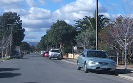
North Plympton, South Australia

North Plympton, South Australia
North Plympton
AdelaideSouth Australia
North plympton.JPG
Postcode: 5037
LGA: City of West Torrens
State District:
Federal Division: Hindmarsh
Suburbs around North Plympton:
Adelaide Airport Adelaide Airport, Netley, Marleston Marleston
Adelaide Airport, Novar Gardens North Plympton Kurralta Park, Plympton
Novar Gardens Camden Park, Plympton Plympton

North Plympton is a suburb of Adelaide, South Australia, in the City of West Torrens.

Parkin House, which dates from before 1860 and houses an important piano collection, is situated at 4 Lewis Crescent, North Plympton

Coordinates: 34°57′27″S 138°33′01″E / 34.9575°S 138.55028°E / -34.9575; 138.55028


Wikimedia Foundation. 2010.

Игры ⚽ Нужен реферат?

Look at other dictionaries:

  • Plympton, South Australia — Infobox Australian Place| type = suburb name = Plympton state = sa city=Adelaide lga = City of West Torrens postcode = 5038 stategov = Ashford fedgov = Hindmarsh near n= North Plympton near ne= Kurralta Park near e= Kurralta Park, Glandore near s …   Wikipedia

  • Plympton Park, South Australia — Infobox Australian Place | type = suburb name = Plympton Park city = Adelaide state = sa caption = lga = City of Marion postcode = 5038 est = pop = 2,954 (2006 census) [Census 2006 AUS|id =SSC42346|name=Plympton Park (State… …   Wikipedia

  • Clovelly Park, South Australia — Clovelly Park Adelaide, South Australia English Avenue, looking east towards South Road …   Wikipedia

  • Novar Gardens, South Australia — Novar Gardens Adelaide, South Australia Postcode: 5040 LGA: City of West Torrens State District …   Wikipedia

  • Mile End, South Australia — Mile End Adelaide, South Australia Henley Beach Road, looking east into the city …   Wikipedia

  • Ascot Park, South Australia — Infobox Australian Place | type = suburb name = Ascot Park city = Adelaide state = South Australia caption = lga = City of Marion postcode = 5043 est = pop = 2,613 (2001) [Census 2001 AUS|id=SSC41066|name=Ascot Park (State Suburb)|accessdate=2007 …   Wikipedia

  • Oaklands Park, South Australia — Oaklands Park South Australia Population: 3,126(2006 Census) …   Wikipedia

  • Clarence Park, South Australia — Clarence Park Adelaide, South Australia Churchill Avenue, looking south towards Cross Road …   Wikipedia

  • List of postcodes in South Australia/numeric sort — Postcodes are used by Australia Post to identify postal districts in Australia. This list is sorted numerically to facilitate seeing which towns/suburbs share a postcode.5000s inner suburbs* 5000 Adelaide * 5001 GPO Boxes * 5005 University of… …   Wikipedia

  • Netley, South Australia — Netley Adelaide, South Australia Population: 1,630 (2006)[1] Postcode: 5037 …   Wikipedia

Share the article and excerpts

Direct link
Do a right-click on the link above
and select “Copy Link”