- Méautis
-
Méautis

 MéautisLocation within Lower Normandy region
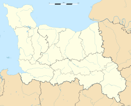 Méautis
Administration Country France Region Lower Normandy Department Manche Arrondissement Saint-Lô Canton Carentan Intercommunality Carentan-en-Cotentin Mayor Marie-Christine Mette
(2008–2014)Statistics Elevation 0–29 m (0–95 ft)
(avg. 42 m/138 ft)Land area1 16.98 km2 (6.56 sq mi) Population2 651 (2006) - Density 38 /km2 (98 /sq mi) INSEE/Postal code 50298/ 50500 1 French Land Register data, which excludes lakes, ponds, glaciers > 1 km² (0.386 sq mi or 247 acres) and river estuaries. 2 Population without double counting: residents of multiple communes (e.g., students and military personnel) only counted once. Coordinates: 49°16′42″N 1°17′59″W / 49.27836°N 1.29973°W
Méautis is a commune in the Manche department in Normandy in north-western France.
World War II
After the liberation of the area by Allied Forces in 1944, engineers of the Ninth Air Force IX Engineering Command began construction of a combat Advanced Landing Ground outside of the town. Declared operational on 17 August, the airfield was designated as "A-17", it was used by the 50th Fighter Group which flew P-47 Thunderbolts until early September when the unit moved into Central France. Afterward, the airfield was closed.[1][2]
References
- ^ Johnson, David C. (1988), U.S. Army Air Forces Continental Airfields (ETO), D-Day to V-E Day; Research Division, USAF Historical Research Center, Maxwell AFB, Alabama.
- ^ Maurer, Maurer. Air Force Combat Units of World War II. Maxwell AFB, Alabama: Office of Air Force History, 1983. ISBN 0-89201-092-4.
See also
Categories:- Communes of Manche
- Manche geography stubs


Wikimedia Foundation. 2010.