- Montbray
-
For the Anglo-Norman baronial house, see Mowbray.
Montbray
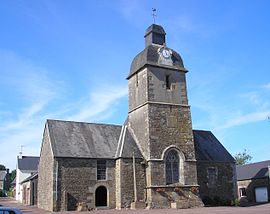
La chapelle Saint-Pierre 
 MontbrayLocation within Lower Normandy region
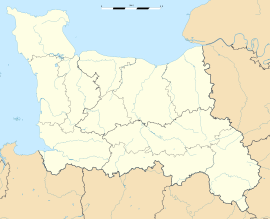 Montbray
Administration Country France Region Lower Normandy Department Manche Arrondissement Saint-Lô Canton Percy Intercommunality Communauté de communes du canton de Percy Mayor Michel Delabroise
(2008–2014)Statistics Elevation 79–266 m (259–873 ft)
(avg. 90 m/300 ft)Land area1 14.04 km2 (5.42 sq mi) Population2 376 (2006) - Density 27 /km2 (70 /sq mi) INSEE/Postal code 50338/ 50410 1 French Land Register data, which excludes lakes, ponds, glaciers > 1 km² (0.386 sq mi or 247 acres) and river estuaries. 2 Population without double counting: residents of multiple communes (e.g., students and military personnel) only counted once. Coordinates: 48°52′52″N 1°05′40″W / 48.8811111111°N 1.09444444444°W
Montbray is a commune in the Manche department in Normandy in north-western France.
See also
The village has an ancient château which belongs to the commune and houses the marie and the village nursery school. The village also has a church, a bar, a bakery, a garage and a children's play area with picnic tables and a pond.
Categories:- Communes of Manche
- Manche geography stubs


Wikimedia Foundation. 2010.