- Nehalem, Oregon
-
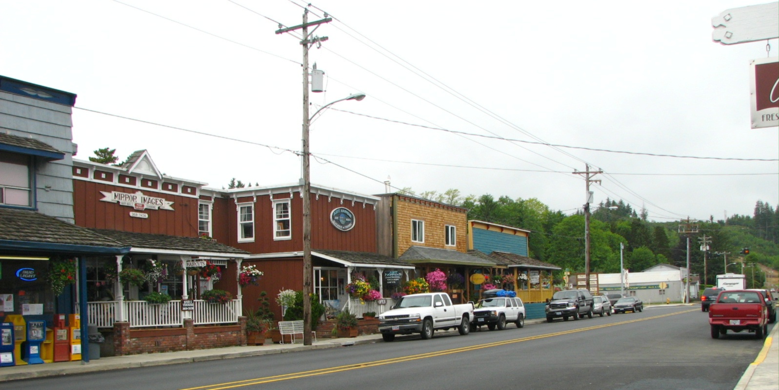
Nehalem, Oregon — City — The Nehalem business district looking east along Highway 101. Location in Oregon
Coordinates: 45°42′57″N 123°53′44″W / 45.71583°N 123.89556°WCoordinates: 45°42′57″N 123°53′44″W / 45.71583°N 123.89556°W Country United States State Oregon County Tillamook Incorporated 1889 Government – Mayor Shirley Kalkhoven Area – Total 0.2 sq mi (0.6 km2) – Land 0.2 sq mi (0.6 km2) – Water 0 sq mi (0 km2) Elevation 11 ft (3.35 m) Population (2000) – Total 203 – Density 860.6/sq mi (326.6/km2) Time zone Pacific (UTC-8) – Summer (DST) Pacific (UTC-7) ZIP code 97131 Area code(s) 503 FIPS code 41-51700[1] GNIS feature ID 1136565[2] Website www.ci.nehalem.or.us Nehalem is a city in Tillamook County, Oregon, United States. Incorporated in 1889, the city is located on the Nehalem River at Nehalem Bay of the Pacific Ocean. It is bisected by U.S. Route 101. The population was 203 at the 2000 census.
Contents
History
Nehalem was named for the Nehalem Indians. They were also known as the Tillamook.
Nehalem was once a thriving logging community, but with the decline of the logging industry, the local economy has drastically declined. The city used to stretch out over the river on log planks, where a lumber mill once cut the logs that came down a railroad track on the Nehalem River. Wood pilings that held up this railroad track can still be found in the North Fork Nehalem River. On the front face of Nehalem Elementary school there is an original facade which says "Union High School" from when the area was more populous and could support both an elementary school and a high school. Currently there is an elementary school and a community pool with a small annex which hosts a few classes for Tillamook Community College.
The city suffers from occasional floods. The flood of 1997 in particular was very severe; especially to local dairy farms.[citation needed]
The Portland band Everclear has a song, "Nehalem", on their Sparkle and Fade album about life in the small town.
Nehalem was the location for the HGTV Dream Home contest in 2000 where a lucky contestant won a furnished home and an automobile.
Geography
According to the United States Census Bureau, the city has a total area of 0.2 square miles (0.52 km2), all of it land.[3]
The business district of the city runs for one block along Highway 101 with the Nehalem River running alongside. All the buildings are raised up to avoid the flooding from the river.[citation needed] Nehalem has one traffic signal.[citation needed]
Demographics
As of the census[1] of 2000, there were 203 people, 84 households, and 58 families residing in the city. The population density was 860.6 people per square mile (326.6/km²). There were 121 housing units at an average density of 513.0 per square mile (194.7/km²). The racial makeup of the city was 98.03% White, and 1.97% from two or more races. Hispanic or Latino of any race were 1.48% of the population.
There were 84 households out of which 25.0% had children under the age of 18 living with them, 56.0% were married couples living together, 10.7% had a female householder with no husband present, and 29.8% were non-families. 22.6% of all households were made up of individuals and 9.5% had someone living alone who was 65 years of age or older. The average household size was 2.42 and the average family size was 2.88.
In the city the population was spread out with 25.1% under the age of 18, 4.4% from 18 to 24, 24.1% from 25 to 44, 24.1% from 45 to 64, and 22.2% who were 65 years of age or older. The median age was 42 years. For every 100 females there were 107.1 males. For every 100 females age 18 and over, there were 94.9 males.
The median income for a household in the city was $40,250, and the median income for a family was $47,679. Males had a median income of $30,000 versus $27,813 for females. The per capita income for the city was $15,408. About 9.0% of families and 7.7% of the population were below the poverty line, including 5.5% of those under the age of eighteen and 3.0% of those sixty five or over.
References
- ^ a b "American FactFinder". United States Census Bureau. http://factfinder.census.gov. Retrieved 2008-01-31.
- ^ "US Board on Geographic Names". United States Geological Survey. 2007-10-25. http://geonames.usgs.gov. Retrieved 2008-01-31.
- ^ "US Gazetteer files: 2010, 2000, and 1990". United States Census Bureau. 2011-02-12. http://www.census.gov/geo/www/gazetteer/gazette.html. Retrieved 2011-04-23.
External links
- Entry for Nehalem in the Oregon Blue Book
- Nehalem profile from the Oregon Economic & Community Development Department
Municipalities and communities of Tillamook County, Oregon Cities 
CDPs Beaver | Cape Meares | Cloverdale | Hebo | Neskowin | Netarts | Oceanside | Pacific City
Unincorporated
communitiesBarview | Brighton | Castle Rock | Dolph | Idaville | Idiotville | Jordan Creek | Manhattan Beach | Meda | Mohler | Neahkahnie Beach | Nedonna Beach | Tierra Del Mar | Twin Rocks | Woods
Categories:- Cities in Oregon
- Populated coastal places in Oregon
- Populated places in Tillamook County, Oregon
- Port cities in Oregon


Wikimedia Foundation. 2010.