- Derby, Western Australia
-
Derby
Western Australia
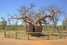
This boab tree near Derby was actually used as a prison, hence the name the "Boab Prison Tree"Population: 3,093[1] Established: 1880s Postcode: 6728 Coordinates: 17°23′S 123°41′E / 17.39°S 123.68°ECoordinates: 17°23′S 123°41′E / 17.39°S 123.68°E Elevation: 8 m (26 ft) LGA: Shire of Derby-West Kimberley State District: Kimberley Federal Division: Durack Mean max temp Mean min temp Annual rainfall 33.9 °C
93 °F21.7 °C
71 °F622.4 mm
24.5 inDerby (
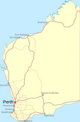
 /ˈdɜrbi/ derr-bee)[2] is a town in the Kimberley region of Western Australia. At the 2006 census, Derby had a population of 3,093.[1] Along with Broome and Kununurra, it is one of only three towns in the Kimberley to have a population over 2,000. Located on King Sound, Derby has the highest tides in Australia, with the peak differential between low and high tide reaching 11.8 metres.[3]
Contents
History
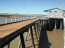
During World War II, Derby was bombed by Japanese planes because of an air base and jetty that was steadily used by Australian forces. More recently, refugees are housed at Royal Australian Air Force Base Curtin, which is located to the south of Derby.
Culture
The Boab festival is a week long festival that includes traditional events such as mud football, watermelon seed spitting, the Mardi Gras and other festivities[citation needed].
Historically, Derby has played a major role in the Australian Royal Flying Doctor Service for the Kimberley Region. The Kimberley School of the Air is also located in Derby.
Derby has two other schools Holy Rosary School Derby and Derby District High School. Derby District High School follows Chris Sarra's vision of 'Stronger Smarter', which aims to raise the expectations of the school as a community.
References
- ^ a b Australian Bureau of Statistics (25 October 2007). "Derby (Urban Centre/Locality)". 2006 Census QuickStats. http://www.censusdata.abs.gov.au/ABSNavigation/prenav/LocationSearch?collection=Census&period=2006&areacode=UCL507000&producttype=QuickStats&breadcrumb=PL&action=401. Retrieved 2008-06-02.
- ^ Macquarie Dictionary, Fourth Edition (2005). Melbourne, The Macquarie Library Pty Ltd. ISBN 1-876429-14-3
- ^ Derby tides at derbytourism.com.au. Retrieved 7 January 2007
Further reading
- Derby's history at a glance: A chronology of Derby history, 1688-1992. Boab Babbler, 26 February 1993, p. 20
Categories:- Towns in Western Australia
- Port cities in Australia
- Kimberley (Western Australia)
- Coastal towns in Western Australia
- Western Australia geography stubs
Wikimedia Foundation. 2010.


