- Port Orford, Oregon
Infobox Settlement
official_name = Port Orford, Oregon
settlement_type =City
nickname =
motto =
imagesize = 200px
image_caption = 1990 Aerial view of Port Orford
image_
image_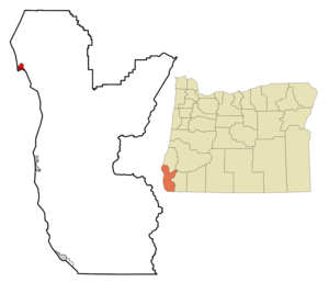
mapsize = 250x200px
map_caption = Location inOregon
mapsize1 =
map_caption1 =
subdivision_type = Country
subdivision_name =United States
subdivision_type1 = State
subdivision_name1 =Oregon
subdivision_type2 = County
subdivision_name2 = Curry
government_type =
leader_title =Mayor
leader_name = Jim Auborn
established_title = Incorporated
established_date = 1935
area_magnitude =
area_total_sq_mi = 1.6
area_total_km2 = 4.2
area_land_sq_mi = 1.6
area_land_km2 = 4.1
area_water_sq_mi = 0.04
area_water_km2 = 0.1
area_urban_sq_mi =
area_urban_km2 =
area_metro_sq_mi =
area_metro_km2 =
population_as_of = 2000
population_note =
population_total = 1153
population_metro =
population_urban =
population_density_km2 = 278.2
population_density_sq_mi = 719.1
timezone = Pacific
utc_offset = -8
timezone_DST = Pacific
utc_offset_DST = -7
latd = 42 |latm = 44 |lats = 59 |latNS = N
longd = 124 |longm = 29 |longs = 53 |longEW = W
elevation_m = 18.0
elevation_ft = 59
website = http://www.portorford.org
postal_code_type =ZIP code
postal_code = 97465
area_code = 541
blank_name = FIPS code
blank_info = 41-59250GR|2
blank1_name = GNIS feature ID
blank1_info = 1147902GR|3
footnotes =Port Orford is a city in Curry County,
Oregon ,United States .It is on the southern
Oregon Coast , at the northern end of what coastal Oregonians call theBanana Belt , because the weather from Port Orford south is noticeably warmer than the weather north of Cape Blanco. The population was 1,153 at the 2000 census.The town takes its name from
George Vancouver 's original name for Cape Blanco, which he named for George,Earl of Orford , "a much respected friend."History
Native Americans originally lived in the area.
Captain
William Tichenor was the first to settle in the area of the town, which was an important early center for shippingPort Orford Cedar . It was the county seat for Curry between 1855 and 1859; while it was not formally incorporated until 1935, it was the first town to do so in the county.In October 1941 then-mayor Gilbert Gable, frustrated with the poor condition of the state roads around Port Orford, which hampered economic development, suggested that a number of counties along the
Oregon andCalifornia state border should secede and create theState of Jefferson . This movement came to an end with US involvement inWorld War II .Fact|date=December 2007The Port is an open water dock (no natural protection} and boasts the only
drydock port on the west coast. The fishing boats are lifted in and out of the water by operated cranes, set on custom made dollies, and parked in rows on the dock. As a result it is known as a "dolly dock". Fact|date=December 2007Geography
Port Orford is located at coor dms|42|44|59|N|124|29|53|W|city (42.749713, -124.497952)GR|1. It is 28 miles north of
Gold Beach onU.S. Route 101 .The
Port Orford Heads State Park is located in Port Orford on a scenic headland and historic Coast Guard station. The city is adjacent to Cape Blanco, considered by many to be the westernmost point in thelower 48 states, however this is disputed (seeCape Alava inWashington ). It is also located just north ofHumbug Mountain , which is considered the tallest mountain in the lower 48 to descend directly into anocean .According to the
United States Census Bureau , the city has a total area of 1.6square mile s (4.2km² ), of which, 1.6 square miles (4.1 km²) of it is land and 0.04 square miles (0.1 km²) of it (2.44%) is water. A lake or naturallagoon exists within city boundaries as well as a large amount ofwetlands .Demographics
As of the
census GR|2 of 2000, there were 1,153 people, 571 households, and 311 families residing in the city. Thepopulation density was 719.1 people per square mile (278.2/km²). There were 662 housing units at an average density of 412.9/sq mi (159.7/km²). The racial makeup of the city was 95.40% White, 0.09% African American, 1.39% Native American, 0.26% Asian, 0.17% Pacific Islander, 0.87% from other races, and 1.82% from two or more races. Hispanic or Latino of any race were 2.60% of the population.There were 571 households out of which 19.6% had children under the age of 18 living with them, 44.0% were married couples living together, 9% had a female householder with no husband present, and 45% were non-families. 39% of all households were made up of individuals and 18.2% had someone living alone who was 65 years of age or older. The average household size was 2 people and the average family size was 2.66.
In the city the population was spread out with 18.8% under the age of 18, 3.4% from 18 to 24, 19.7% from 25 to 44, 30.8% from 45 to 64, and 27.3% who were 65 years of age or older. The median age was 50 years. For every 100 females there were 92.2 males.
The median income for a household in the city was $23,289, and the median income for a family was $29,653. Males had a median income of $35,221 versus $15,179 for females. The
per capita income for the city was $16,442. About 16.1% of families and 17.8% of the population were below thepoverty line , including 21.9% of those under age 18 and 9.2% of those age 65 or over.References
External links
* [http://www.portorford.org City of Port Orford]
* [http://www.2cj.com/driftwood/ Port Orford School District]
* [http://www.polibrary.org/ Port Orford Library]
* [http://www.stansellguitars.com/Port_Orford_cedar_Facts.htm Port Orford Cedar]
Wikimedia Foundation. 2010.