- Cowlington, Oklahoma
-
Cowlington, Oklahoma — Town — Location of Cowlington, Oklahoma
Coordinates: 35°18′26″N 94°47′29″W / 35.30722°N 94.79139°WCoordinates: 35°18′26″N 94°47′29″W / 35.30722°N 94.79139°W Country United States State Oklahoma County Le Flore Area – Total 0.9 sq mi (2.4 km2) – Land 0.9 sq mi (2.4 km2) – Water 0.0 sq mi (0.0 km2) Elevation 469 ft (143 m) Population (2000) – Total 133 – Density 145.3/sq mi (56.1/km2) Time zone Central (CST) (UTC-6) – Summer (DST) CDT (UTC-5) FIPS code 40-17850[1] GNIS feature ID 1102933[2] Cowlington is a town in Le Flore County, Oklahoma, United States. It is part of the Fort Smith, Arkansas-Oklahoma Metropolitan Statistical Area. The population was 133 at the 2000 census.
Contents
Geography
Cowlington is located at 35°18′26″N 94°47′29″W / 35.30722°N 94.79139°W (35.307146, -94.791413)[3].
According to the United States Census Bureau, the town has a total area of 0.9 square miles (2.3 km2), all of it land.
Demographics
As of the census[1] of 2000, there were 133 people, 55 households, and 38 families residing in the town. The population density was 145.3 people per square mile (55.8/km²). There were 67 housing units at an average density of 73.2 per square mile (28.1/km²). The racial makeup of the town was 74.44% White, 8.27% Native American, 3.76% from other races, and 13.53% from two or more races. Hispanic or Latino of any race were 3.76% of the population.
There were 55 households out of which 27.3% had children under the age of 18 living with them, 52.7% were married couples living together, 9.1% had a female householder with no husband present, and 30.9% were non-families. 30.9% of all households were made up of individuals and 16.4% had someone living alone who was 65 years of age or older. The average household size was 2.42 and the average family size was 3.03.
In the town the population was spread out with 27.8% under the age of 18, 7.5% from 18 to 24, 27.1% from 25 to 44, 19.5% from 45 to 64, and 18.0% who were 65 years of age or older. The median age was 36 years. For every 100 females there were 95.6 males. For every 100 females age 18 and over, there were 95.9 males.
The median income for a household in the town was $16,591, and the median income for a family was $19,167. Males had a median income of $16,875 versus $23,125 for females. The per capita income for the town was $9,323. There were 6.3% of families and 9.6% of the population living below the poverty line, including no under eighteens and 8.7% of those over 64.
References
- ^ a b "American FactFinder". United States Census Bureau. http://factfinder.census.gov. Retrieved 2008-01-31.
- ^ "US Board on Geographic Names". United States Geological Survey. 2007-10-25. http://geonames.usgs.gov. Retrieved 2008-01-31.
- ^ "US Gazetteer files: 2010, 2000, and 1990". United States Census Bureau. 2011-02-12. http://www.census.gov/geo/www/gazetteer/gazette.html. Retrieved 2011-04-23.
External links
Municipalities and communities of Le Flore County, Oklahoma Cities 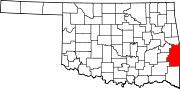
Towns Arkoma | Bokoshe | Cameron | Cowlington | Fanshawe‡ | Fort Coffee | Howe | Le Flore | Panama | Pocola | Rock Island | Shady Point | Spiro | Talihina | Wister
Unincorporated
communitiesBig Cedar | Big Creek | Braden | Calhoun | Conser | Forest Hill | Forrester | Gilmore | Glendale | Haw Creek | Hill | Hodgen | Honobia‡ | Hontubby | Lenox | Loving | Milton | Monroe | Montclair Addition | Muse | Neff | Octavia | Page | Petros | Reichert | Scullyville | Stapp | Stony Point | Summerfield | Tahona | Tucker | Whitesboro | Williams | Zoe
Footnotes ‡This populated place also has portions in an adjacent county or counties
Categories:- Populated places in Le Flore County, Oklahoma
- Towns in Oklahoma
- Fort Smith metropolitan area


Wikimedia Foundation. 2010.