- Olustee, Oklahoma
-
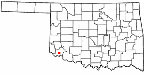
Olustee, Oklahoma — Town — Location of Olustee, Oklahoma
Coordinates: 34°32′49″N 99°25′23″W / 34.54694°N 99.42306°WCoordinates: 34°32′49″N 99°25′23″W / 34.54694°N 99.42306°W Country United States State Oklahoma County Jackson Area – Total 0.8 sq mi (2.1 km2) – Land 0.8 sq mi (2.1 km2) – Water 0.0 sq mi (0.0 km2) Elevation 1,332 ft (406 m) Population (2010) – Total 607 – Density 758.8/sq mi (289/km2) Time zone Central (CST) (UTC-6) – Summer (DST) CDT (UTC-5) ZIP code 73560 Area code(s) 580 FIPS code 40-55450[1] GNIS feature ID 1096265[2] Olustee is a town in Jackson County, Oklahoma, United States. The population was 607 at the 2010 census.
Geography
Olustee is located at 34°32′49″N 99°25′23″W / 34.54694°N 99.42306°W (34.546999, -99.423166)[3].
According to the United States Census Bureau, the town has a total area of 0.8 square miles (2.1 km2), all of it land.
Demographics
Historical populations Census Pop. %± 1910 850 — 1940 248 — 2000 680 — 2010 607 −10.7% As of the census[1] of 2000, there were 680 people, 250 households, and 185 families residing in the town. The population density was 823.8 people per square mile (316.3/km²). There were 280 housing units at an average density of 339.2 per square mile (130.3/km²). The racial makeup of the town was 70.15% White, 0.74% African American, 3.97% Native American, 0.59% Asian, 19.71% from other races, and 4.85% from two or more races. Hispanic or Latino of any race were 32.79% of the population.
There were 25000 households out of which 42.8% had children under the age of 18 living with them, 55.6% were married couples living together, 13.6% had a female householder with no husband present, and 26.0% were non-families. 23.6% of all households were made up of individuals and 11.6% had someone living alone who was 65 years of age or older. The average household size was 2.72 and the average family size was 3.16.
In the town the population was spread out with 33.5% under the age of 18, 8.2% from 18 to 24, 24.3% from 25 to 44, 21.6% from 45 to 64, and 12.4% who were 65 years of age or older. The median age was 33 years. For every 100 females there were 92.1 males. For every 100 females age 18 and over, there were 86.8 males.
The median income for a household in the town was $25,125, and the median income for a family was $28,375. Males had a median income of $24,500 versus $20,893 for females. The per capita income for the town was $10,189. About 19.5% of families and 24.7% of the population were below the poverty line, including 30.0% of those under age 18 and 28.0% of those age 65 or over.
References
- ^ a b "American FactFinder". United States Census Bureau. http://factfinder.census.gov. Retrieved 2008-01-31.
- ^ "US Board on Geographic Names". United States Geological Survey. 2007-10-25. http://geonames.usgs.gov. Retrieved 2008-01-31.
- ^ "US Gazetteer files: 2010, 2000, and 1990". United States Census Bureau. 2011-02-12. http://www.census.gov/geo/www/gazetteer/gazette.html. Retrieved 2011-04-23.
Municipalities and communities of Jackson County, Oklahoma City 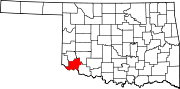
Towns Unincorporated
communitiesHess | Humphreys | Victory | Warren
Ghost town Aaron
Categories:- Populated places in Jackson County, Oklahoma
- Towns in Oklahoma

Wikimedia Foundation. 2010.