- Cleora, Oklahoma
-
Cleora, Oklahoma — CDP — Location of Cleora, Oklahoma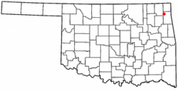
Coordinates: 36°33′28″N 94°55′48″W / 36.55778°N 94.93°WCoordinates: 36°33′28″N 94°55′48″W / 36.55778°N 94.93°W Country United States State Oklahoma County Delaware Area – Total 12.4 sq mi (32.1 km2) – Land 12.1 sq mi (31.2 km2) – Water 0.3 sq mi (0.9 km2) Elevation 797 ft (243 m) Population (2000) – Total 1,113 – Density 92.3/sq mi (35.6/km2) Time zone Central (CST) (UTC-6) – Summer (DST) CDT (UTC-5) FIPS code 40-15250[1] GNIS feature ID 1100301[2] Cleora is a census-designated place (CDP) in Delaware County, Oklahoma, United States, along State Highway 85. The population was 1,113 at the 2000 census. The Cleora Post Office existed from November 28, 1900 until October 15, 1954. Cleora was established in District 2 of the old Indian Territory. It was named for Cleora Ann Lundy, a relative of the postmaster.
Contents
Geography
Cleora is located at 36°33′28″N 94°55′48″W / 36.55778°N 94.93°W (36.557836, -94.929952)[3].
According to the United States Census Bureau, the CDP has a total area of 12.4 square miles (32 km2), of which, 12.1 square miles (31 km2) of it is land and 0.3 square miles (0.78 km2) of it (2.66%) is water.
Demographics
As of the census[1] of 2000, there were 1,113 people, 518 households, and 386 families residing in the CDP. The population density was 92.3 people per square mile (35.6/km²). There were 1,326 housing units at an average density of 110.0/sq mi (42.5/km²). The racial makeup of the CDP was 86.25% White, 0.09% African American, 11.05% Native American, 0.09% from other races, and 2.52% from two or more races. Hispanic or Latino of any race were 0.45% of the population.
There were 518 households out of which 16.8% had children under the age of 18 living with them, 67.8% were married couples living together, 3.5% had a female householder with no husband present, and 25.3% were non-families. 21.6% of all households were made up of individuals and 12.4% had someone living alone who was 65 years of age or older. The average household size was 2.15 and the average family size was 2.44.
In the CDP the population was spread out with 14.7% under the age of 18, 4.3% from 18 to 24, 16.3% from 25 to 44, 38.1% from 45 to 64, and 26.6% who were 65 years of age or older. The median age was 54 years. For every 100 females there were 97.0 males. For every 100 females age 18 and over, there were 93.7 males.
The median income for a household in the CDP was $35,368, and the median income for a family was $42,411. Males had a median income of $37,411 versus $26,184 for females. The per capita income for the CDP was $29,245. About 8.0% of families and 9.0% of the population were below the poverty line, including 8.7% of those under age 18 and 5.8% of those age 65 or over.
References
- ^ a b "American FactFinder". United States Census Bureau. http://factfinder.census.gov. Retrieved 2008-01-31.
- ^ "US Board on Geographic Names". United States Geological Survey. 2007-10-25. http://geonames.usgs.gov. Retrieved 2008-01-31.
- ^ "US Gazetteer files: 2010, 2000, and 1990". United States Census Bureau. 2011-02-12. http://www.census.gov/geo/www/gazetteer/gazette.html. Retrieved 2011-04-23.
Further reading
- Shirk, George H. Oklahoma Place Names; University of Oklahoma Press; Norman, Oklahoma; 1987: ISBN 0-8061-2028-2.
Municipalities and communities of Delaware County, Oklahoma Cities 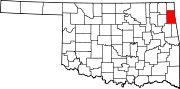
Towns Bernice | Colcord | Kansas | Oaks‡ | West Siloam Springs
CDPs Brush Creek | Bull Hollow | Cayuga | Cleora | Cloud Creek | Copeland | Dennis | Dodge | Dripping Springs | Flint Creek | Leach | New Eucha | Old Eucha | Rocky Ford | Sycamore | Tagg Flats | Twin Oaks | Zena
Unincorporated
communitiesFootnotes ‡This populated place also has portions in an adjacent county or counties
Categories:- Populated places in Delaware County, Oklahoma
- Census-designated places in Oklahoma


Wikimedia Foundation. 2010.