Coskata, Inc. — Coskata redirects here. For the community in the northeastern United States, see Coskata, Massachusetts. Coskata, Inc. is a Warrenville, Illinois based energy company researching the production of cellulosic ethanol from woodchips. Costaka s… … Wikipedia
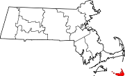
Coskata-Coatue Wildlife Refuge — The Coskata Coatue Wildlife Refuge is a nature preserve on Nantucket Island and is managed by the Trustees of Reservations. It encompasses miles of beaches, the largest red cedar woodland in New England and Great Point Light.[1] References ^ http … Wikipedia
Massachusetts — This article is about the U.S. state. For other uses, see Massachusetts (disambiguation). Commonwealth of Massachusetts … Wikipedia
Massachusetts Military Reservation — Coordinates: 41°42′15″N 70°32′30″W / 41.70417°N 70.54167°W / 41.70417; 70.54167 The Massachusetts Military Reservation … Wikipedia
List of Massachusetts state forests — Massachusetts, with forests covering 3,060,000 acres (12,400 km2) (59%) of its land area, administers more than 500,000 acres (2,000 km2)[1] of state forest, wildlife and watershed land under the cabinet level Executive Office of Energy … Wikipedia
Nantucket, Massachusetts — Infobox Settlement official name = Town County of Nantucket, Massachusetts nickname = motto = imagesize = image caption = Nantucket image mapsize = 250x200px map caption = Location in Nantucket County in Massachusetts mapsize1 = map caption1 =… … Wikipedia
Executive Office of Energy and Environmental Affairs (Massachusetts) — The Massachusetts Executive Office of Energy and Environmental Affairs consists of the Department of Agricultural Resources, the Department of Conservation and Recreation, the Department of Environmental Protection, the Department of Energy… … Wikipedia
Division of Fisheries and Wildlife (Massachusetts) — The Massachusetts Division of Fisheries and Wildlife, sometimes referred to as MassWildlife, is an agency of the Massachusetts Department of Fish and Game, within the Executive Office of Energy and Environmental Affairs. MassWildlife is overseen… … Wikipedia
Natural Bridge State Park (Massachusetts) — Natural Bridge State Park Massachusetts State Park … Wikipedia
List of Massachusetts state parks — This list of Massachusetts State Parks contains the 143 state parks in the Commonwealth of Massachusetts, as of 2009. The Bureau of State Parks and Recreation division of Department of Conservation and Recreation (Massachusetts) (DCR) is… … Wikipedia
 Coskata, Massachusetts