- Sugarcreek, Ohio
Infobox Settlement
official_name = Sugarcreek, Ohio
settlement_type = Village
nickname =
motto =
imagesize =
image_caption =
image_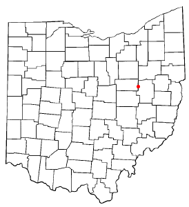
mapsize = 250x200px
map_caption = Location of Sugarcreek, Ohio
mapsize1 =
map_caption1 =subdivision_type = Country
subdivision_name =United States
subdivision_type1 = State
subdivision_name1 =Ohio
subdivision_type2 = County
subdivision_name2 = Tuscarawasgovernment_footnotes =
government_type =
leader_title =
leader_name =
leader_title1 =
leader_name1 =
established_title =
established_date =unit_pref = Imperial
area_footnotes =area_magnitude =
area_total_km2 = 9.8
area_land_km2 = 9.8
area_water_km2 = 0.0
area_total_sq_mi = 3.8
area_land_sq_mi = 3.8
area_water_sq_mi = 0.0population_as_of = 2000
population_footnotes =
population_total = 2174
population_density_km2 = 220.9
population_density_sq_mi = 572.2timezone = Eastern (EST)
utc_offset = -5
timezone_DST = EDT
utc_offset_DST = -4
elevation_footnotes = GR|3
elevation_m = 306
elevation_ft = 1004
latd = 40 |latm = 30 |lats = 24 |latNS = N
longd = 81 |longm = 38 |longs = 30 |longEW = Wpostal_code_type =
ZIP code
postal_code = 44681
area_code = 330
blank_name = FIPS code
blank_info = 39-75210GR|2
blank1_name = GNIS feature ID
blank1_info = 1062554GR|3
website =
footnotes =Sugarcreek is a village in Tuscarawas County,
Ohio ,United States . The population was 2,174 at the 2000 census. It is known as the "Little Switzerland of Ohio."fact|date=August 2007History
The village of Shanesville was founded in 1814 by Abraham Shane at the intersection of two Indian trails (currently Ohio State Routes 39 and 93). This village was surpassed in size and stature by Sugarcreek (then known as East Shanesville, but renamed based on Sugar Creek) when the railroads came in the mid-1800s. Shanesville was administratively merged with Sugarcreek in 1969. [http://www.neohiotravel.com/histories/sugarhist.htm]
Geography
Sugarcreek is located at coor dms|40|30|24|N|81|38|30|W|city (40.506637, -81.641728),GR|1 along the South Fork of Sugar Creek. [
DeLorme (1991). "Ohio Atlas & Gazetteer". Yarmouth, Maine: DeLorme. p. 51. ISBN 0-89933-233-1.]According to the
United States Census Bureau , the village has a total area of 3.8square mile s (9.8km² ), all of it land.Demographics
As of the
census GR|2 of 2000, there were 2,174 people, 873 households, and 639 families residing in the village. Thepopulation density was 572.2 people per square mile (220.9/km²). There were 923 housing units at an average density of 242.9/sq mi (93.8/km²). The racial makeup of the village was 99.13% White, 0.14% African American, 0.05% Native American, 0.46% Asian, 0.05% from other races, and 0.18% from two or more races. Hispanic or Latino of any race were 0.05% of the population.There were 873 households out of which 33.4% had children under the age of 18 living with them, 66.0% were married couples living together, 4.9% had a female householder with no husband present, and 26.8% were non-families. 25.5% of all households were made up of individuals and 15.0% had someone living alone who was 65 years of age or older. The average household size was 2.49 and the average family size was 3.00.
In the village the population was spread out with 25.2% under the age of 18, 8.7% from 18 to 24, 27.0% from 25 to 44, 21.2% from 45 to 64, and 17.8% who were 65 years of age or older. The median age was 38 years. For every 100 females there were 95.3 males. For every 100 females age 18 and over, there were 91.0 males.
The median income for a household in the village was $36,360, and the median income for a family was $43,707. Males had a median income of $32,068 versus $19,792 for females. The
per capita income for the village was $16,107. About 6.8% of families and 7.2% of the population were below thepoverty line , including 9.3% of those under age 18 and 10.2% of those age 65 or over.References
External links
Wikimedia Foundation. 2010.