- Mirabile Township, Caldwell County, Missouri
-
Mirabile Township — Township — 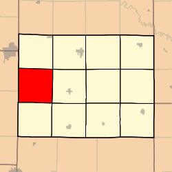
Coordinates: 39°39′52″N 094°08′05″W / 39.66444°N 94.13472°WCoordinates: 39°39′52″N 094°08′05″W / 39.66444°N 94.13472°W Country United States State Missouri County Caldwell Area – Total 35.82 sq mi (92.77 km2) – Land 35.76 sq mi (92.62 km2) – Water 0.06 sq mi (0.16 km2) 0.17% Elevation[1] 928 ft (283 m) Population (2000) – Total 362 – Density 10.1/sq mi (3.9/km2) Time zone Central (CST) (UTC-6) – Summer (DST) CDT (UTC-5) ZIP code 64671 Area code(s) 660 FIPS code 29-48872[2] GNIS feature ID 0766367 Mirabile Township is one of twelve townships in Caldwell County, Missouri, USA. As of the 2000 census, its population was 362. Mirabile is also the name of the school district.
Geography
Mirabile Township covers an area of 35.82 square miles (92.8 km2) and contains no incorporated settlements. It contains three cemeteries: Hill, Morris and Paxton.
The streams of Brushy Creek, Plum Creek, Sheep Creek and Willow Branch run through this township.
References
- ^ "US Board on Geographic Names". United States Geological Survey. 2007-10-25. http://geonames.usgs.gov. Retrieved 2008-01-31.
- ^ "American FactFinder". United States Census Bureau. http://factfinder.census.gov. Retrieved 2008-01-31.
External links
Municipalities and communities of Caldwell County, Missouri Cities 
Townships Categories:- Townships in Caldwell County, Missouri
- Missouri geography stubs


Wikimedia Foundation. 2010.