- Coon Island Township, Butler County, Missouri
-
Coon Island Township — Township — 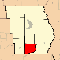
Coordinates: 36°33′04″N 090°23′56″W / 36.55111°N 90.39889°WCoordinates: 36°33′04″N 090°23′56″W / 36.55111°N 90.39889°W Country United States State Missouri County Butler Area - Total 38.19 sq mi (98.91 km2) - Land 38.17 sq mi (98.87 km2) - Water 0.01 sq mi (0.03 km2) 0.03% Elevation[1] 299 ft (91 m) Population (2000) - Total 219 - Density 5.7/sq mi (2.2/km2) FIPS code 29-16264[2] GNIS feature ID 0766352 Coon Island Township is one of ten townships in Butler County, Missouri, USA. As of the 2000 census, its population was 219.
Geography
Coon Island Township covers an area of 38.19 square miles (98.9 km2) and contains no incorporated settlements. It contains one cemetery, Coon Island.
Allred Lake is within this township. The streams of Big Hunting Slough, Caney Slough and Little Hunting Slough run through this township.
References
- ^ "US Board on Geographic Names". United States Geological Survey. 2007-10-25. http://geonames.usgs.gov. Retrieved 2008-01-31.
- ^ "American FactFinder". United States Census Bureau. http://factfinder.census.gov. Retrieved 2008-01-31.
External links
Municipalities and communities of Butler County, Missouri County seat: Poplar Bluff Cities Fisk | Neelyville | Poplar Bluff | Qulin

Townships Ash Hill | Beaver Dam | Black River | Cane Creek | Coon Island | Epps | Gillis Bluff | Neely | Poplar Bluff | St. Francois
Unincorporated
communitiesBroseley | Fagus | Harviell | Hendrickson | Rombauer
Categories:- Townships in Butler County, Missouri
- Missouri geography stubs


Wikimedia Foundation. 2010.