- Cohiniac
-
Cohiniac
Kaouennieg

 CohiniacLocation within Brittany region
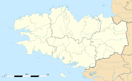 Cohiniac
Administration Country France Region Brittany Department Côtes-d'Armor Arrondissement Saint-Brieuc Canton Châtelaudren Intercommunality Pays de Châtelaudren–Plouagat Mayor Michel Querrien
(2001–2008)Statistics Elevation 139–246 m (456–807 ft) Land area1 12.26 km2 (4.73 sq mi) Population2 350 (2008) - Density 29 /km2 (75 /sq mi) INSEE/Postal code 22045/ 22800 1 French Land Register data, which excludes lakes, ponds, glaciers > 1 km² (0.386 sq mi or 247 acres) and river estuaries. 2 Population without double counting: residents of multiple communes (e.g., students and military personnel) only counted once. Coordinates: 48°27′42″N 2°56′51″W / 48.4616666667°N 2.9475°W
Cohiniac (Breton: Kaouennieg, Gallo: Coheinyac) is a commune in the Côtes-d'Armor department in Bretagne in northwestern France.
Contents
Population
Historical population of Cohiniac 1962 1968 1975 1982 1990 1999 2008 397 408 393 390 370 351 350 Inhabitants of Cohiniac are called cohiniacais.
See also
References
External links
Categories:- Communes of Côtes-d'Armor
- Côtes-d'Armor geography stubs


Wikimedia Foundation. 2010.