- U.S. Route 395 in Nevada
-
This article is about the section of U.S. Route 395 in Nevada. For the entire length of the highway, see U.S. Route 395.
U.S. Route 395

Route information Maintained by NDOT Length: 87.274 mi[2] (140.5 km)
[1]Major junctions South end:  US 395 at California state line at Topaz Lake
 US 50 in Carson City
 I-80 in Reno
North end: US 395 at California state line near PeavineHighway system United States Numbered Highways
List • Bannered • Divided • Replaced←  SR 379
SR 396  →
→In the U.S. state of Nevada, U.S. Route 395 (US 395) clips a corner of Nevada near Lake Tahoe and serves the cities of Gardnerville, Minden, Carson City and Reno. Most of US 395 north of Carson City is a freeway and is built up to Interstate standards. Part of the freeway section is also currently designated as unsigned Interstate 580.
Contents
Route description

U.S. 395 enters Nevada at Topaz Lake as a two lane highway and gradually winds its way to Carson Valley where it becomes the principal thoroughfare for the Minden-Gardnerville area. Upon entering the Carson Valley 395 becomes a 4 lane highway through Minden and Gardnerville. Upon leaving Minden the highway becomes a 4 lane divided highway and turns due north towards Carson City.
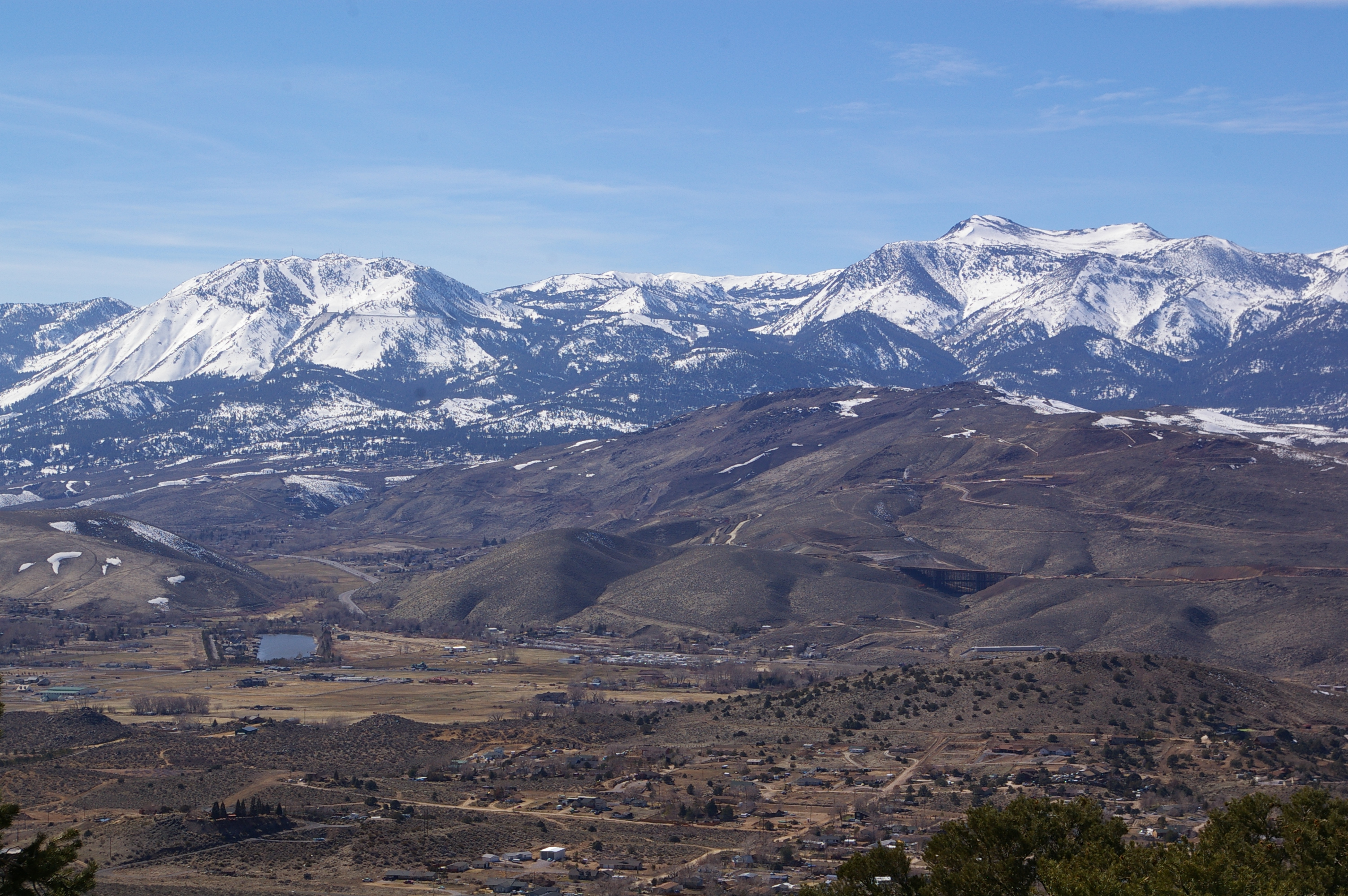
 Current US 395 and future I-580 (under construction) in Pleasant Valley, as seen from Geiger Grade (SR 341)
The highway currently serves as Carson Street, the main street of Carson City. However, a freeway bypass is currently under construction, with the northern half open to traffic. Temporarily US 395, and US 50, are routed along Fairview Drive to connect the freeway and Carson Street. This freeway is planned to become Interstate 580 but is currently signed as US 395.[3]
Upon exiting Carson City, the highway continues north through Washoe Valley. Midway through Washoe Valley the freeway portion temporarily ends. The highway also crosses Pleasant Valley before entering Reno. A new freeway portion through Pleasant Valley is also currently under construction.[4] Upon entering Reno the freeway portion resumes as a 6 lane freeway and is designated the Martin Luther King Jr. freeway. The highway heads north to intersect Interstate 80 near downtown Reno. Shortly afterward, US 395 turns northwest to serve the north valleys of greater Reno area before returning to California at Bordertown.
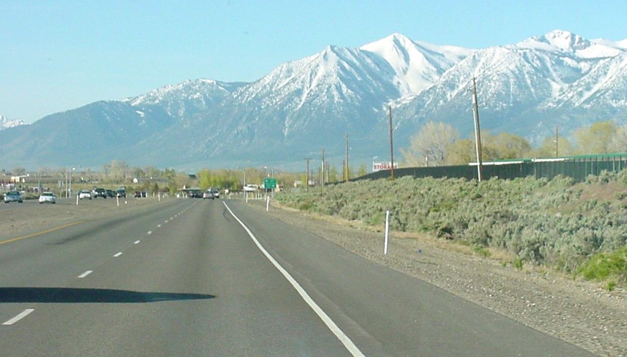
The entire route through Nevada closely follows the eastern edge of the Sierra Nevada range. Several prominent peaks are visible from the highway, including Jobs Peak and Mount Rose.
Major intersections
- Note: Mileposts in Nevada reset at county lines. Freeway exits are numbered according to statewide mileage.
County Location[2] Mile[2] Exit Destinations Notes Douglas
0.00–33.96Topaz Lake 0.00 California state line Holbrook Junction  SR 208 – Yerington
Gardnerville  SR 756
Minden  SR 88 – Woodfords, Lake Tahoe
 SR 757 (Muller Lane)
 SR 206 (Genoa Lane) – Genoa
 SR 759 (Airport Road) – Minden-Tahoe Airport
Carson City
0.00–9.56Clear Creek Road (SR 705) US 50 west – Lake TahoeSouth end of US 50 & SR 529 overlap Snyder Avenue (SR 518) 


 US 395 Bus. north (South Carson Street)
North end of SR 529 overlap; South end of temporary US 395/50 alignment on Fairview Drive South end of freeway 38 Fairview Drive Southbound exit and northbound entrance; North end of temporary US 395/50 alignment on Fairview Drive 39 US 50 east (William Street) – Dayton, FallonServes Downtown Carson City; North end of US 50 overlap 41 College Parkway (SR 531) 42 Arrowhead Drive Northbound exit and southbound entrance 43
US 395 Bus. south (North Carson Street)Southbound exit and northbound entrance Washoe
0.00–42.1044 Eastlake Boulevard (to SR 429) Former SR 428; serves Washoe Lake State Park 46 Bellevue Road North end of freeway Washoe City  SR 429 (Bowers Mansion Road)
Reno  SR 341 (Geiger Grade) – Virginia City
South end of freeway 56  SR 431 (Mount Rose Highway) – North Lake Tahoe
Southbound exit and northbound entrance 57B US 395 south (SR 430) – Virginia City, Carson City, South Lake TahoeSouthbound exit and northbound entrance 57A South Virginia Street north (US 395 Bus. / SR 430) Southbound exit and northbound entrance 59 Damonte Ranch Parkway 60 South Meadows Parkway (SR 426) 61 South Virginia Street (US 395 Bus. / SR 430) 62 Neil Road South end of unsigned I-580 overlap 63 South Virginia Street (US 395 Bus.), Kietzke Lane Southbound exit and northbound entrance 64 Moana Lane Serves Reno-Sparks Convention Center 65 Plumb Lane (SR 653), Villanova Drive – Reno-Tahoe International AirportSigned as exits 65A (Villanova Drive, Plumb Lane) and 65B (airport) southbound 66 Mill Street 67 East Second Street, Glendale Avenue (SR 648) 68 I-80 – Elko, SacramentoSigned as exits 68A (I-80 east) and 68B (I-80 west) northbound; North end of unsigned I-580 overlap 69 Oddie Boulevard (SR 663) 70 North McCarran Boulevard (SR 659), Clear Acre Lane (SR 443) Signed as exits 70A (McCarran Boulevard) and 70B (Clear Acre Lane) northbound; serves Sun Valley 71 Dandini Boulevard, Parr Boulevard 72 Panther Valley (US 395 Bus.) to North Virginia Street 73 Golden Valley Road 74 Lemmon Drive 76 Stead Boulevard (SR 673) Serves Reno-Stead Airport 78 Red Rock Road 80 Cold Springs Valley 83 Bordertown 42.10 North end of freeway / California state line 1.000 mi = 1.609 km; 1.000 km = 0.621 mi
Concurrency terminus • Closed/Former • Incomplete access • Unopened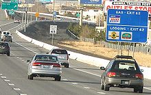 Northbound US 395, approaching the Neil Road exit
References
- ^ This figure uses NDOT proposed mileage for the uncompleted freeway segment in Carson City and I-580 mileage for the concurrent section in Reno.
- ^ a b c "State Maintained Highways of Nevada: Descriptions & Maps". Nevada Department of Transportation. January 2011. http://www.nevadadot.com/reports_pubs/State_Maintained/. Retrieved 20 February 2011.
- ^ "Carson City Freeway". Nevada Department of Transportation. http://www.ccfreeway.com/. Retrieved 2008-01-28.
- ^ "I-580 Freeway Extension Project". Nevada Department of Transportation. http://www.freewayextension.com/. Retrieved 2008-10-28.
External links
U.S. Route 395Previous state:
CaliforniaNevada Next state:
CaliforniaCategories:- U.S. Route 95
- U.S. Highways in Nevada


Wikimedia Foundation. 2010.