- Niverville, Manitoba
-
- For other uses, see Niverville.
Town of Niverville Motto: Where you belong Location of Niverville in Manitoba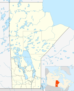
 Town of Niverville
Coordinates: 49°36′20″N 97°02′30″W / 49.60556°N 97.04167°WCoordinates: 49°36′20″N 97°02′30″W / 49.60556°N 97.04167°W Country Canada Province Manitoba Region Eastman Rural Municipality Hanover Established 1874 Government - Mayor Greg Fehr - Governing Body Town Council - MP (Provencher) Vic Toews - MLA (Morris) Mavis Taillieu Elevation 236 m (774 ft) Population (2006) - Total 2,464 - Density 280/km2 (725.2/sq mi) Time zone CST (UTC-6) - Summer (DST) CDT (UTC-5) Postal Code R0A 1E0 Website Town of Niverville Niverville is a small town in the Canadian province of Manitoba, located 28.6 km south of the Perimeter Highway which encircles the provincial capital, Winnipeg. This primarily farming community has seen an influx of people moving from the city looking to raise a family outside of the 'big city' influence. This migration has made Niverville one of the youngest and fastest growing communities in Manitoba. The town is located at the crossing of Provincial Road 311 and the CPR Emerson rail line, between Provincial Trunk Highways 75 and 59, providing an excellent rail link and two high-speed four-lane transport routes to and from the provincial capital, as well as to the USA, which is 82.5 km to the south. Niverville's population as of the 2006 census was 2464, up 28.3% from its 2001 level of 1921.[1] A recent estimate placed the town at 3200 inhabitants. The town lies between the northwest corner of the Rural Municipality of Hanover and the southeastern portion of the Rural Municipality of Ritchot.
Contents
History
Niverville is named for an 18th century explorer and fur trader – Joseph-Claude Boucher, Chevalier de Niverville. This choice of name was made by the Canadian Pacific Railway in 1877 – one year before the railway into town was built and an official town plan was actually registered.
Niverville's history is closely tied to grain. Although first settled by people of British ancestry, with names like Stott, Church, and Wallace, an influx of the first Canadian Mennonite farmers in 1874 soon saw their population eclipse that of the earlier group. These settlers, with farming skills vastly more suitable than those of the Anglophones due to their experience with farming on the Asian steppes, came from Russia, landing at the nearby junction of the Red and Rat rivers, making their way east to what was known as the East Reserve, essentially a gift of land from the Canadian government. The first grain elevator in western Canada, a unique round structure, had recently been built in Niverville by William Hespeler, a man whose name has recently been appropriated for Niverville's newest and largest park. It was from this elevator that the first western Canadian barley was shipped to overseas markets. The hardiness and determination of the early Mennonite settlers, coming from a harsh environment in Russia, ensured that this unforgiving land would be transformed into a place from which livelihoods could be wrested, albeit at considerable effort and cost. In later years, these generous settlers sent grain in relief to others suffering famine in Russia. Many inhabitants today are from Mennonite or British stock, with a growing number of immigrants of other backgrounds.[2]
One odd piece of Niverville history is the Rock Festival which took place in the summer of 1970 on an abandoned farm 1.5 miles east of the junction of highways 59 and 305. Widely publicized, it attracted approximately 12,000 young folks, mainly from Winnipeg, to hear a variety of rock and folk bands. Having nowhere to park save a summerfallowed field and some dirt roads, everything turned into a sea of mud when a sudden thunderstorm struck, cutting the festival short. Not wishing to lose the opportunity, many festival patrons shed all clothing (including underwear) and splashed around in the rain and mud while waiting for any one of several local Mennonite farmers who cashed in on the opportunity, charging $5 apiece to tow cars back to the pavement of Highway 59.[3]
Geography
The town lies well within the Red River Valley, at an altitude of 773 feet above sea level. Surrounding the town are large tracks of farm land, with the Red River only 3 miles to the West. The Red River Valley lay, some 10,800 years ago, beneath the pristine and expansive glacial Lake Agassiz, and the resulting rich black soils produce some of the finest crops in the world, including hard red spring wheat and canola. Sugar beets have also been successfully produced here.
Niverville has been threatened by spring flooding from the Red River of the North, most recently in "Flood of the Century" when temporary dikes were hastily thrown up to protect the town from the river. To protect itself from future floods, the town has, since 1997, constructed a permanent dike to the west of the town, shielding it from the Red. Aquifers which are charged to the east in Sandilands Provincial Forest extend beneath Niverville, providing abundant water resources. Where they have been permitted to remain, poplar bluffs shade the land providing habitat for the rare yellow lady's slipper and the tiger lily.[citation needed] Many bird species (Purple Martin, Barn Swallow, English Sparrow, Wren, Killdeer, Meadowlark, Scarlet Tanager, American Robin) choose the Niverville area for their summer range.[citation needed]
Sociology
Niverville is part of the Hanover School Division and has two schools, Niverville Elementary School (K-6), and Niverville Collegiate Institute (7-12) to provide education for the students of Niverville. Niverville Collegiate Institute has a strong sports programme and its sports teams, the NCI Panthers, have achieved success in volleyball, basketball, soccer, and badminton, winning banners and trophies in tournaments and provincial championships since the late 1970s.
Niverville has several recreational facilities, including the Niverville Centennial Arena, home of the Niverville Clippers, the Niverville Curling Club, an outdoor tennis court located at Niverville Collegiate, the Elite Fitness and Dance gym, Opa's Park, the fairgrounds (located behind the arena) which hosted the Heartland Rodeo Association finals in 2007, and Hespeler Park, which has a tobogganing hill, soccer pitches, baseball diamonds, a beach volleyball court, and a small biking trail. The Crow Wing Trail also runs through the town.
Six churches serve the various Christian faith communities of the town. [4]
Niverville's signature event is the annual Niverville Old Tyme Country Fair, which is held the second weekend of June. During the three day event, Niverville's Main Street is shut down to traffic, and Midway rides, as well as food and farmers market stands are set up. Various events, such as fireworks and a parade are also held. As the popularity of the fair grew, so did its budget, and today professional acts such as Dean Gunnarson, Doc Walker and Brent Butt have been seen.
There are several significant employers in Niverville, including Spectis Moulders (polyurethane architectural products), The Puratone Corporation (agribusiness), and Wm. Dyck and Sons (full service lumberyard). Services include banking through the Niverville Credit Union, groceries through the Niverville Bigway, gasoline sales through Country Snacks Red River Co-op, DVD rentals through Country Snacks and Connie's Cafe, hair care, construction trades, several restaurants, medical and dental clinics, a pharmacy, accountants, insurance brokers, law offices, car washes, massages, Niverville Heritage and Hespeler cemeteries, and a postal outlet (R0A 1E0), with an 18 hole golf course currently under construction. Several new developments including Fifth Avenue Estates, Crow Wing Developments, Stonecroft (Von Ast Construction) and Vista Cove have expanded the size and population of the town, helping to draw in many Winnipeggers and new immigrants to the area. Housing in Niverville ranges from several apartment buildings to semi-detached dwellings to single-unit housing. EMR services, a small RCMP detachment and the volunteer Niverville Fire Department serve the area. Advanced medical care is available from several nearby hospitals in Steinbach, St. Pierre Jolys, and Winnipeg. The Niverville Heritage Centre provides space for various events including weddings, graduations, and Remembrance Day services, and the addition of the Niverville Credit Union Manor provides assisted living and supportive care for seniors.[5]
The Good Times Hockey League is an eight-team recreational hockey league that plays out of the Niverville Centennial Arena and the Ste. Agathe Arena.
Notable Nivervillians
- Amanda Falk, Christian recording artist[6]
- Jared Funk, Canadian paralympian[7]
- David Richert, professional race car driver[8]
References
- ^ Manitoba Bureau of Statistics, "2006 Census of Population Southeast Region Population Counts".
- ^ Statistics Canada, "2006 Community Profile".
- ^ Niverville Chamber of Commerce, "Niverville Area History".
- ^ Town of Niverville, "Town of Niverville".
- ^ NCU Manor, "NCU- Assisted Living and Supportive Care".
- ^ Amanda Falk, "Amanda Falk's Myspace Page".
- ^ Canadian Paralympic Committee, "Jared Funk's Canadian Paralympic Committee Profile".
- ^ David Richtert Racing, "www.richtertracing.com".
External links
- Town of Niverville
- Niverville Chamber of Commerce
- Niverville Arts and Culture Group
- Niverville Active Living
- Map of Niverville at Statcan
 Subdivisions of Manitoba
Subdivisions Cities  Category:Manitoba ·
  Portal:Manitoba ·
  WikiProject:ManitobaCategories:
- Towns in Manitoba

Wikimedia Foundation. 2010.