Hulland Ward

Hulland Ward

Coordinates: 53°01′16″N 1°37′19″W / 53.021°N 1.622°W / 53.021; -1.622

Hulland Ward
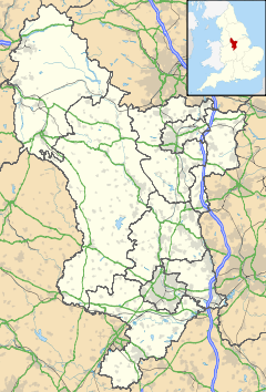
Hulland Ward is located in Derbyshire
Hulland Ward

 Hulland Ward shown within Derbyshire
OS grid reference SK254471
District Derbyshire Dales
Shire county Derbyshire
Region East Midlands
Country England
Sovereign state United Kingdom
Post town ASHBOURNE
Postcode district DE6
Police Derbyshire
Fire Derbyshire
Ambulance East Midlands
EU Parliament East Midlands
List of places: UK • England • Derbyshire

Hulland Ward is a village and civil parish in the Derbyshire Dales district of Derbyshire roughly 7 miles west of Belper, Derbyshire England on the A517 road. The parish includes the hamlets of Biggin, Nether Biggin and Millington Green. Hulland Ward itself contains about 400 houses and has a population of just under 1000 inhabitants.

In the Domesday Survey it is listed as Hoilant in the care of Geoffrey d'Alselin. It was part of the lands bestowed upon Henry de Ferrers after the Norman Conquest, and became part of Duffield Frith, with two enclosed royal parks - Mansell Park and Ravensdale Park. The latter is now a civil parish in its own right.[1]

One of the earliest ore-stamping mills was built at Hulland Ward by Burchard Kranich in 1556.

References

  1. ^ Turbutt, G., (1999) A History of Derbyshire. Volume 2: Medieval Derbyshire, Cardiff: Merton Priory Press

External links


Wikimedia Foundation. 2010.

Игры ⚽ Нужна курсовая?

Look at other dictionaries:

  • Duffield Frith — For other uses, see Duffield (disambiguation) . Duffield Frith was, in medieval times, an area of Derbyshire in England, part of that bestowed upon Henry de Ferrers (or Ferrars) by King William, controlled from his seat at Duffield Castle. From… …   Wikipedia

  • List of civil parishes in Derbyshire — poly 70 249 70 233 88 235 90 222 97 222 109 225 109 234 113 239 125 246 127 250 135 253 142 250 143 244 147 240 156 242 165 249 151 259 144 274 137 274 134 284 125 290 121 289 113 292 111 298 111 306 104 311 92 312 87 305 81 299 98 283 86 288 101 …   Wikipedia

  • Biggin, Derbyshire — Biggin is the name of two places in Derbyshire, both in the Derbyshire Dales district*Biggin (Dovedale and Parwich Ward) *Biggin by Hulland (Hulland Ward) …   Wikipedia

  • DE postcode area — Derby postcode area …   Wikipedia

  • Derby bus station — Location Locale Derby Local authority Derby …   Wikipedia

  • Millington Green — may refer to: Millington (East Haddam), East Haddam, Connecticut, USA Millington Green, Derbyshire, a hamlet in Derbyshire, England, forming part of Hulland Ward This disambiguation page lists articles about distinct geographical locations with… …   Wikipedia

  • Biggin — could be*Biggin (Dovedale and Parwich Ward), Derbyshire, in the Peak District *Biggin by Hulland, Derbyshire, near Hulland *Biggin, North Yorkshire *Biggin, Warwickshire * The manor of Biggin in the parish of Chadwell St Mary in Essex * a… …   Wikipedia

  • Hard to Kill — Infobox Film name = Hard To Kill caption = Theatrical Release Poster imdb id = 0099739 writer = Steven McKay starring = Steven Seagal Kelly LeBrock director = Bruce Malmuth producer = Gary Adelson Joel Simon Bill Todman, Jr. distributor = Warner… …   Wikipedia

  • Crewe (UK Parliament constituency) — Crewe Former County constituency for the House of Commons County Cheshire 1885 (1885) …   Wikipedia

Share the article and excerpts

Direct link
Do a right-click on the link above
and select “Copy Link”