- Ohio State Route 180
-
State Route 180
Route information Maintained by ODOT Length: 29.55 mi[3][4][5] (47.56 km) Existed: 1927[1][2] – present Major junctions West end:  SR 159 near Chillicothe
East end:  US 33 near Logan
Location Counties: Ross, Pickaway, Hocking Highway system Ohio highways
Interstates • U.S. Routes • State Routes←  SR 179
SR 181  →
→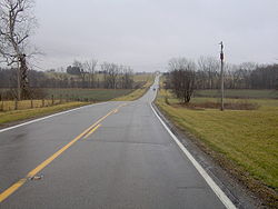 View along State Route 180 northeast of Chillicothe
State Route 180 (SR 180, OH 180) is a 29.55-mile (47.56 km) long east–west state highway in the southern portion of the U.S. state of Ohio. SR 180 has its western terminus at a T-intersection with SR 159 nearly 5 miles (8.0 km) northeast of Chillicothe. Its eastern terminus is at a diamond interchange with the U.S. Route 33 (US 33) expressway approximately 3.75 miles (6.04 km) northwest of Logan.
Contents
Route description
Along its path, SR 180 travels through northeastern Ross County, the extreme southeastern corner of Pickaway County and the northwestern part of Hocking County. No portion of this highway is included within the National Highway System (NHS). The NHS is a network of routes determined to be most important for the economy, mobility and defense of the nation.[6]
History
The SR 180 designation was applied in 1927. Prior to this time, the stretch of highway that SR 180 currently occupies through Ross, Pickaway and Hocking Counties was designated as SR 27. With the debut of the US 27 in that year, SR 27 was replaced by SR 180. The only change related to SR 180 since its inception has been the highway that it meets at its eastern terminus, which at the time was the predecessor to US 33, SR 31.[1][2]
Major intersections
County Location Mile[3][4][5] Destinations Notes Ross Green Township 0.00 SR 159Western terminus at T-intersection Adelphi 11.79  SR 327 south
Four-way stop intersection marking northern terminus of SR 327 Pickaway Salt Creek Township 12.44  SR 56 west
T-intersection marking western split of SR 56/SR 180 duplex;
SR 56 joins from the westHocking Laurelville 13.09 SR 56 eastFive-way stop intersection marking eastern split of SR 56/SR 180 duplex;
SR 56 departs to the southeastPerry Township 20.39  SR 374 south
T-intersection marking western split of SR 180/SR 374 duplex;
SR 374 joins from the southLaurel Township 25.01 SR 374 northT-intersection marking eastern split of SR 180/SR 374 duplex;
SR 374 departs to the north25.51  SR 678 south
T-intersection marking northern terminus of SR 678 Falls Township 29.55 US 33Eastern terminus at diamond interchange 1.000 mi = 1.609 km; 1.000 km = 0.621 mi
Concurrency terminus • Closed/Former • Incomplete access • UnopenedReferences
- ^ a b Ohio Department of Highways and Public Works (August 1926) (MrSID). Map of Ohio Showing State Routes (Map). Cartography by ODHPW. http://www.dot.state.oh.us/Divisions/TransSysDev/Innovation/prod_services/Documents/StateMaps/otm1926a.sid. Retrieved 2011-06-01.
- ^ a b Ohio Department of Highways and Public Works (June 1927) (MrSID). Map of Ohio Showing State Highway System (Map). Cartography by ODHPW. http://www.dot.state.oh.us/Divisions/TransSysDev/Innovation/prod_services/Documents/StateMaps/otm1927a.sid. Retrieved 2011-06-01.
- ^ a b Ohio Department of Transportation. "Technical Services Straight Line Diagrams: SR 180, Ross County". http://www.odotonline.org/techservapps/SLD/pdf_files/rossr0180r.pdf. Retrieved 2011-06-02.
- ^ a b Ohio Department of Transportation. "Technical Services Straight Line Diagrams: SR 180, Pickaway County". http://www.odotonline.org/techservapps/SLD/pdf_files/picsr0180r.pdf. Retrieved 2011-06-02.
- ^ a b Ohio Department of Transportation. "Technical Services Straight Line Diagrams: SR 180, Hocking County". http://www.odotonline.org/techservapps/SLD/pdf_files/hocsr0180r.pdf. Retrieved 2011-06-02.
- ^ Federal Highway Administration (December 2003) (PDF). National Highway System: Ohio (Map). http://www.fhwa.dot.gov/planning/nhs/maps/oh/oh_Ohio.pdf. Retrieved 2011-06-01.
Categories:- State highways in Ohio
- Transportation in Ross County, Ohio
- Transportation in Pickaway County, Ohio
- Transportation in Hocking County, Ohio


Wikimedia Foundation. 2010.