- Roselle, New Jersey
Infobox Settlement
official_name = Roselle, New Jersey
settlement_type = Borough
nickname =
motto =
imagesize =
image_caption =
image_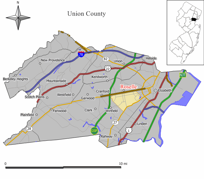
mapsize = 250x200px
map_caption = Map of Roselle in Union County. Inset: Location of Union County highlighted in the State of New Jersey.
mapsize1 =
map_caption1 =subdivision_type = Country
subdivision_name =United States
subdivision_type1 = State
subdivision_name1 =New Jersey
subdivision_type2 = County
subdivision_name2 = Union
government_footnotes =
government_type =Borough (New Jersey)
leader_title =Mayor
leader_name = Garrett Smith (2011)
leader_title1 =
leader_name1 =
established_title = Incorporated
established_date =December 20 ,1894 unit_pref = Imperial
area_footnotes =
area_magnitude =
area_total_km2 = 6.9
area_land_km2 = 6.8
area_water_km2 = 0.0
area_total_sq_mi = 2.7
area_land_sq_mi = 2.6
area_water_sq_mi = 0.0population_as_of = 2006
population_footnotes =
population_total = 21158
population_density_km2 = 3107.7
population_density_sq_mi = 8048.8timezone = Eastern (EST)
utc_offset = -5
timezone_DST = EDT
utc_offset_DST = -4
elevation_footnotes = [Gnis|885379|Borough of Roselle,Geographic Names Information System . AccessedJanuary 4 ,2008 .]
elevation_m = 17
elevation_ft = 56
latd = 40 |latm = 39 |lats = 08 |latNS = N
longd = 74 |longm = 15 |longs = 38 |longEW = Wpostal_code_type =
ZIP code
postal_code = 07203
area_code = 908
blank_name = FIPS code
blank_info = 34-64620GR|2 [ [http://mcdc2.missouri.edu/webrepts/commoncodes/ccc_nj.html A Cure for the Common Codes: New Jersey] , Missouri Census Data Center. AccessedJuly 14 ,2008 .]
blank1_name = GNIS feature ID
blank1_info = 0885379GR|3
website = http://www.boroughofroselle.com
footnotes =Roselle is a Borough in Union County,
New Jersey ,United States . As of theUnited States 2000 Census , the borough population was 21,274.On
January 19 ,1883 , the first electric lighting system employing overhead wires began service in Roselle, and was built byThomas Edison , as part of an experiment to demonstrate that an entire community could be lit by electricity. The [http://www.rosellechurch.org First Presbyterian Church] , located on the corner of West 5th and Chestnut, was the first church in the world to be lit by electricity. [http://www.boroughofroselle.com/history.htm A Brief History of Roselle] , accessedNovember 18 ,2006 .]Roselle was incorporated on
December 20 ,1894 , at the height of the "Boroughitis " phenomenon sweeping through New Jersey at the time, based on the results of a referendum held two days earlier, from portions of Linden."The Story of New Jersey's Civil Boundaries: 1606-1968", John P. Snyder, Bureau of Geology and Topography; Trenton, New Jersey; 1969. p. 240.]Geography
Roselle is located at coor dms|40|39|13|N|74|15|38|W|city (40.653502, -74.260584)GR|1.
The borough is bordered by Roselle Park to the north, Elizabeth to the east, Linden to the south and Cranford to the west.
According to the
United States Census Bureau , the borough has a total area of 2.7square mile s (6.9km² ), of which, 2.6 square miles (6.8 km²) of it is land and 0.38% is water.Demographics
USCensusPop
1930=13021
1940=13597
1950=17681
1960=21032
1970=22585
1980=20641
1990=20314
2000=21274
estimate= 21158
estyear=2006
estref= [http://factfinder.census.gov/servlet/SAFFPopulation?_event=ChangeGeoContext&geo_id=16000US3464620&_geoContext=01000US%7C04000US34%7C16000US3443050&_street=&_county=roselle&_cityTown=roselle&_state=04000US34&_zip=&_lang=en&_sse=on&ActiveGeoDiv=geoSelect&_useEV=&pctxt=fph&pgsl=010&_submenuId=population_0&ds_name=null&_ci_nbr=null&qr_name=null®=null%3Anull&_keyword=&_industry= Census data for Roselle borough] ,United States Census Bureau . AccessedAugust 12 ,2007 .]
footnote=Population 1930 - 1990. [ [http://www.wnjpin.net/OneStopCareerCenter/LaborMarketInformation/lmi01/poptrd6.htm Jersey Resident Population by Municipality: 1930 - 1990] , Workforce New Jersey Public Information Network. AccessedMarch 1 ,2007 .] As of thecensus GR|2 of 2000, there were 21,274 people, 7,520 households, and 5,226 families residing in the borough. Thepopulation density was 8,048.8 people per square mile (3,111.3/km²). There were 7,870 housing units at an average density of 2,977.5/sq mi (1,151.0/km²). The racial makeup of the borough was 35.58% White, 51.32% African American, 0.31% Native American, 2.71% Asian, 0.07% Pacific Islander, 6.07% from other races, and 3.93% from two or more races. Hispanic or Latino of any race were 17.11% of the population.There were 7,520 households out of which 32.2% had children under the age of 18 living with them, 45.3% were married couples living together, 18.8% had a female householder with no husband present, and 30.5% were non-families. 25.2% of all households were made up of individuals and 9.9% had someone living alone who was 65 years of age or older. The average household size was 2.82 and the average family size was 3.41.
In the borough the population was spread out with 25.5% under the age of 18, 9.4% from 18 to 24, 30.8% from 25 to 44, 22.2% from 45 to 64, and 12.0% who were 65 years of age or older. The median age was 35 years. For every 100 females there were 87.9 males. For every 100 females age 18 and over, there were 82.8 males.
The median income for a household in the borough was $51,254, and the median income for a family was $58,841. Males had a median income of $37,604 versus $32,535 for females. The
per capita income for the borough was $21,269. About 5.8% of families and 7.5% of the population were below thepoverty line , including 8.5% of those under age 18 and 10.7% of those age 65 or over.Government
Local government
Roselle is incorporated under the Borough system of municipal government. The governing body is the Borough Council which is made up of six members and a mayor. The mayor and council representative-at-large are elected by the entire borough. The remaining five council members are elected from five wards, one from each ward in which the member resides. The Mayor is elected directly by the voters to a four-year term of office. The Borough Council serve three-year terms on a staggered basis, with two seats coming up for election each year.
Roselle has the "weak" mayor-council form of government. The mayor has less control and the council more over fiscal operations and the appointment and removal of executive officers. The mayor has no vote except in case of a tie. The mayor can veto legislation, but the veto can be overridden by two-thirds vote of the council.
A borough administrator, appointed by the Borough Council, tends to the day-to-day operations of the municipal government.
The
Mayor of the Borough of Roselle is [http://www.mayorsmith.com Garrett Smith] , whose term of office expires onDecember 31 ,2011 . Member of the Roselle Borough Council are: [ [http://www.boroughofroselle.com/boro-info.htm Borough of Roselle Municipal Government] , Borough of Roselle. AccessedMay 24 ,2007 .]
*Jamel Holley - Councilman At Large (2010)
*Sally Samuel - Council Member, Ward 1 (2008)
*Sylvia Turnage - Council Member, Ward 2 (2009)
*Cecilia Dallis-Ricks - Council Member, Ward 3 (2008)
*Samantha Dow - Council Member, Ward 4 (2010)
*Christine Dansereau - Council Member, Ward 5 (2009)Federal, state and county representation
Roselle Borough is in the Tenth Congressional District and is part of New Jersey's 20th Legislative District. [ [http://www.lwvnj.org/pubs/CG06.pdf 2006 New Jersey Citizen's Guide to Government] , New Jersey
League of Women Voters , p. 63. AccessedAugust 30 ,2006 .]Education
The borough is served by the
Roselle Public Schools . Schools in the district (with 2005-06 enrollment data from theNational Center for Education Statistics [ [http://nces.ed.gov/ccd/schoolsearch/school_list.asp?Search=1&DistrictID=3414280 Data for the Roselle Public Schools] ,National Center for Education Statistics . AccessedApril 18 ,2008 .] ) are three K-3 elementary schools — [http://harrison.roselleschools.org/home.asp Harrison Elementary School] (272 students), [http://polk.roselleschools.org/home.asp Dr. Charles C. Polk Elementary School] (290) and [http://washington.roselleschools.org/home.asp Washington Elementary School] (304) — [http://lvm.roselleschools.org/home.asp Leonard V. Moore Middle School] for grades 4&5 (489) [http://wilday.roselleschools.org/home.asp Grace Wilday Junior High School] for grades 6&7 (484) andAbraham Clark High School for grades 8-12 (1,039).Commerce
Portions of Roselle are part of an
Urban Enterprise Zone . In addition to other benefits to encourage employment within the Zone, shoppers can take advantage of a reduced 3½%sales tax rate (versus the 7% rate charged statewide). [ [http://www.state.nj.us/njbusiness/financing/tax/geographic.shtml#2 Geographic & Urban Redevelopment Tax Credit Programs: Urban Enterprise Zone Employee Tax Credit] , State ofNew Jersey . AccessedJuly 28 ,2008 .]Transportation
New Jersey Transit provides bus service toNew York City and New Jersey points.Conrail 's freight-only Lehigh Line passes through the community along the tracks of the formerLehigh Valley Railroad . The town once shared a passenger station with Roselle Park on the mainline of theCentral Railroad of New Jersey . That line is abandoned.The
Staten Island Railway passed through the community but is currently out of service.Newark Liberty International Airport is approximately six miles from Roselle.Notable residents
Notable current and former residents of Roselle include:
*Abraham Clark (1725-1794) A founding father of the United States of America and a signer of theUnited States Declaration of Independence . [ [http://www.nps.gov/history/history/online_books/declaration/bio7.htm Biographical Sketches: Abraham Clark] ,National Park Service . AccessedAugust 12 ,2007 . "Clark was stricken with a sunstroke in 1794 at his birthplace in Roselle, where he had lived all his life except when political duty called him away."]
*Neil M. Cohen (1951-), represented the 20th legislative district in theNew Jersey General Assembly until being forced to suddenly resign after child pornography was discovered on his computer. [ [http://votesmart.org/bio.php?can_id=4205 Assembly Member Neil M. Cohen] ,Project Vote Smart . AccessedAugust 12 ,2007 .]
*Jesse Holley (1984-), signed by theCincinnati Bengals as anundrafted free agent in 2007. [ [http://tarheelblue.cstv.com/sports/m-footbl/mtt/holley_jesse00.html Jesse Holley] , University of North Carolina. AccessedOctober 6 ,2007 .]
*Phil Ivey (1976-), professional poker player. [ [http://www.worldpokertour.com/magazine/index.php?x=detail&aID=390 "Phil Ivey: From fake ID-wielding hustler to poker superstar, Phil Ivey has come a long way. Tom Bailey tracks his astounding progress."] , "The OfficialWorld Poker Tour Magazine". AccessedDecember 19 ,2007 . "Phil was born in Riverside, California, but the Ivey family upped sticks and relocated in Roselle, New Jersey when he was three months old."]References
External links
* [http://www.boroughofroselle.com Roselle Borough website]
* [http://www.roselleschools.com/ Roselle Public Schools]
*NJReportCard|39|4540|0|Roselle Public Schools
* [http://nces.ed.gov/ccd/schoolsearch/school_list.asp?Search=1&DistrictID=3414280 Data for the Roselle Public Schools] ,National Center for Education Statistics
* [http://www.lmxac.org/roselle/ Roselle Public Library]
Wikimedia Foundation. 2010.