- Frenchtown, New Jersey
Infobox Settlement
official_name = Frenchtown, New Jersey
settlement_type = Borough
nickname =
motto =
imagesize =
image_caption =
image_
imagesize =
image_caption =
image_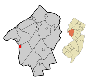
mapsize = 250x200px
map_caption = Map of Frenchtown in Hunterdon County. Inset: Location of Hunterdon County in the State of New Jersey.
mapsize1 = 250x200px
map_caption1 = Census Bureau map of Frenchtown, New Jerseysubdivision_type = Country
subdivision_name =United States
subdivision_type1 = State
subdivision_name1 =New Jersey
subdivision_type2 = County
subdivision_name2 = Hunterdon
government_footnotes =
government_type =Borough (New Jersey)
leader_title =Mayor
leader_name = Ronald M. Sworen
leader_title1 =
leader_name1 =
established_title = Incorporated
established_date =April 4 ,1867 unit_pref = Imperial
area_footnotes =
area_magnitude =
area_total_km2 = 3.5
area_land_km2 = 3.3
area_water_km2 = 0.2
area_total_sq_mi = 1.3
area_land_sq_mi = 1.3
area_water_sq_mi = 0.1population_as_of = 2006
population_footnotes =
population_total = 1491
population_density_km2 = 448.1
population_density_sq_mi = 1160.7timezone = Eastern (EST)
utc_offset = -5
timezone_DST = EDT
utc_offset_DST = -4
elevation_footnotes = [Gnis|885227|Borough of Frenchtown,Geographic Names Information System . AccessedJanuary 4 ,2008 .]
elevation_m = 58
elevation_ft = 190
latd = 40 |latm = 31 |lats = 33 |latNS = N
longd = 75 |longm = 03 |longs = 22 |longEW = Wpostal_code_type =
ZIP code
postal_code = 08825
area_code = 908
blank_name = FIPS code
blank_info = 34-25350GR|2 [ [http://mcdc2.missouri.edu/webrepts/commoncodes/ccc_nj.html A Cure for the Common Codes: New Jersey] , Missouri Census Data Center. AccessedJuly 14 ,2008 .]
blank1_name = GNIS feature ID
blank1_info = 0885227GR|3
website =
footnotes =Frenchtown is a Borough in Hunterdon County,
New Jersey ,United States . As of theUnited States 2000 Census , the borough population was 1,488.Frenchtown Borough is located along the banks of the
Delaware River . Various names have been applied to this settlement, after the many ferry operators residing on both sides of the river. Alexandria Ville, Sunbeam, and Frenchtown were the official names by which this community was known over the years. The Borough was formed by an Act of theNew Jersey Legislature onApril 4 ,1867 , from portions of Alexandria Township. Additional territory was gained from Kingwood Township in 1865."The Story of New Jersey's Civil Boundaries: 1606-1968", John P. Snyder, Bureau of Geology and Topography; Trenton, New Jersey; 1969. p. 155.]The first bridge across the Delaware at Frenchtown was a six-span covered wooden bridge built in 1841 on the five piers that still stand today, and the community became a gateway to
Pennsylvania . TheUhlerstown-Frenchtown Bridge , a freeDelaware River Joint Toll Bridge Commission bridge over theDelaware River connects Frenchtown to Uhlerstown, Bucks County, Pennsylvania. [ [http://www.drjtbc.com/default.aspx?pageid=81 Uhlerstown-Frenchtown bridge] ,Delaware River Joint Toll Bridge Commission . AccessedJune 2 ,2008 .]History
In 1757, three joint owners of a tract purchased from the West Jersey Land Society began laying at streets and building lots at Calvin's Ferry. The developing town was to be called "Alexandria" in honor of
William Alexander , one of the three owners. In 1776, the three sold the settlement to Thomas Lowrey, a Flemington speculator.In 1794, Lowrey sold the tract to Paul Henri Mallet-Prevost, a Swiss fugitive from the
French Revolution . He and other early settlers were French speaking, leading some to begin calling the place "Frenchtown."The town grew substantially in the next four decades. A trade in grain and other farm products developed. Boatmen and river men helped fuel Frenchtown's growth through their buying of cargo and food, and hiring of pilots. In the years after Henri Mallet-Prevost's death, his sons sold off portions of their property; no longer was the town privately owned.
The arrival of the
Belvidere Delaware Railroad in 1853 sparked continued growth in Frenchtown. Steam-powered industry became widely developed, and by the 1860s, mills were being converted into larger factories. Around the same time, the town had three major hotels. In 1889, Britton Brothers Big Brick Store, which sold a variety of goods, opened on Bridge Street.In the early 20th century, growth was spurred by the arrival of Frenchtown Porcelain Works, the establishment of the Milford plant of the Warren Paper Company, and the rise of the poultry industry. [Friends of the Frenchtown Library. "The Growth of Frenchtown." ]
Geography
Frenchtown is located at coor dms|40|31|40|N|75|3|39|W|city (40.527820, -75.060953)GR|1.
According to the
United States Census Bureau , the borough has a total area of 1.3square mile s (3.5km² ), of which, 1.3 square miles (3.3 km²) of it is land and 0.1 square miles (0.2 km²) of it (4.48%) is water.Frenchtown borders Kingwood Township and Alexandria Township. Frenchtown also borders the Commonwealth of Pennsylvania and is south of Milford borough.
Demographics
USCensusPop
1930= 1189
1940= 1238
1950= 1305
1960= 1340
1970= 1459
1980= 1573
1990= 1528
2000= 1488
estimate= 1491
estyear=2006
estref= [http://factfinder.census.gov/servlet/SAFFPopulation?_event=Search&geo_id=06000US3401924870&_geoContext=01000US%7C04000US34%7C05000US34019%7C06000US3401924870&_street=&_county=frenchtown&_cityTown=frenchtown&_state=04000US34&_zip=&_lang=en&_sse=on&ActiveGeoDiv=geoSelect&_useEV=&pctxt=fph&pgsl=060&_submenuId=population_0&ds_name=null&_ci_nbr=null&qr_name=null®=null%3Anull&_keyword=&_industry= Census data for Frenchtown borough] ,United States Census Bureau . AccessedAugust 12 ,2007 .]
footnote=Population 1930 - 1990. [ [http://www.wnjpin.net/OneStopCareerCenter/LaborMarketInformation/lmi01/poptrd6.htm New Jersey Resident Population by Municipality: 1930 - 1990] , accessedMarch 1 ,2007 ] As of thecensus GR|2 of 2000, there were 1,488 people, 613 households, and 375 families residing in the borough. Thepopulation density was 1,160.7 people per square mile (448.8/km²). There were 630 housing units at an average density of 491.4/sq mi (190.0/km²). The racial makeup of the borough was 95.97% White, 0.40% African American, 0.20% Native American, 1.21% Asian, 1.34% from other races, and 0.87% from two or more races. Hispanic or Latino of any race were 2.62% of the population.There were 613 households out of which 30.7% had children under the age of 18 living with them, 49.9% were married couples living together, 8.5% had a female householder with no husband present, and 38.7% were non-families. 28.9% of all households were made up of individuals and 7.8% had someone living alone who was 65 years of age or older. The average household size was 2.38 and the average family size was 2.99.
In the borough the population was spread out with 22.5% under the age of 18, 6.5% from 18 to 24, 35.2% from 25 to 44, 25.9% from 45 to 64, and 9.8% who were 65 years of age or older. The median age was 38 years. For every 100 females there were 94.0 males. For every 100 females age 18 and over, there were 95.4 males.
The median income for a household in the borough was $52,109, and the median income for a family was $62,132. Males had a median income of $42,321 versus $30,952 for females. The
per capita income for the borough was $27,765. About 2.4% of families and 3.3% of the population were below thepoverty line , including 4.0% of those under age 18 and 1.4% of those age 65 or over.According to the [http://www.state.nj.us/njsp/info/reg_sexoffend.html NJSP Website] there are no registered
sex offender s located in Frenchtown in 2007.Government
Local government
Frenchtown is governed under the Borough form of New Jersey municipal government. The government consists of a Mayor and a Borough Council comprising six council members, with all positions elected at large. A Mayor is elected directly by the voters to a four-year term of office. The Borough Council consists of six members elected to serve three-year terms on a staggered basis, with two seats coming up for election each year."2005 New Jersey Legislative District Data Book",
Rutgers University Edward J. Bloustein School of Planning and Public Policy , April 2005, p. 103.]The
Mayor of Frenchtown Borough is Ronald M. Sworen. Members of the Frenchtown Borough Council are Deborah Hearty, Adam Liebtag, Gerry St. Onge, Christopher Poh, Sargent Russell and John Wagner. [http://www.co.hunterdon.nj.us/mun/frencht.htm Frenchtown Borough] ,Hunterdon County, New Jersey . AccessedJune 2 ,2008 .]Federal, state and county representation
Frenchtown is in the Twelfth Congressional District and is part of New Jersey's 23rd Legislative District. [ [http://www.lwvnj.org/pubs/CG06.pdf 2006 New Jersey Citizen's Guide to Government] , New Jersey
league of Women Voters , p. 57. AccessedAugust 30 ,2006 .]Education
The
Frenchtown School District serves public school students in pre-kindergarten through eighth grade. Edith Ort Thomas Elementary School had an enrollment of 133 students in the 2005-06 school year. [ [http://nces.ed.gov/ccd/schoolsearch/school_list.asp?Search=1&DistrictID=3405700 Data for the Frenchtown School District] ,National Center for Education Statistics . AccessedJune 2 ,2008 .]Public school students in grade 9 - 12 attend the
Delaware Valley Regional High School in Frenchtown, which serves almost 1,000 students in western Hunterdon County. Students from Alexandria, Holland and Kingwood Townships along with the boroughs of Frenchtown and Milford attend the high school. The school is part of the Delaware Valley Regional High School District. [ [http://www.dvrhs.org/ Home] , Delaware Valley Regional High School. AccessedJune 2 ,2008 . "Delaware Valley Regional High School serves over 1000 students in western Hunterdon County, New Jersey. Students from Alexandria, Holland, & Kingwood Townships along with the boroughs of Frenchtown and Milford attend Del Val."]Transportation
Frenchtown is the northern terminus of Route 29, the western terminus of Route 12, and the southern terminus of Route 513.
Notable residents
Notable current and former residents of Frenchtown include:
*Anne Kursinski (1959-), topshow jumping competitor. [Cosdon, Christina K. [http://www.sptimes.com/2003/03/30/Sports/Kappler_lands_2nd_Inv.shtml " Kappler lands 2nd Invitational"] , "St. Petersburg Times ",March 30 ,2003 . AccessedAugust 12 ,2007 . "Anne Kursinski, 43, of Frenchtown, N.J., and Eros placed third for $26,000."]
*Harvey Spencer Lewis (1883-1939),Rosicrucian author, occultist and mystic. [ [http://www.experiencefestival.com/harvey_spencer_lewis_-_introduction Harvey Spencer Lewis - Introduction] . The Global Oneness Commitment. AccessedJune 2 ,2008 .]
*Billy Pauch (1957-) racecar driver.Fact|date=June 2008References
External links
* [http://www.frenchtown.com/ Frenchtown.com]
* [http://www.co.hunterdon.nj.us/mun/frencht.htm Hunterdon County web page for Frenchtown Borough]
* [http://www.frenchtownschool.org Frenchtown Elementary School]
*NJReportCard|19|1680|0|Frenchtown School District
* [http://nces.ed.gov/ccd/schoolsearch/school_list.asp?Search=1&DistrictID=3405700 Data for the Frenchtown School District] ,National Center for Education Statistics
* [http://www.dvrhs.k12.nj.us/ Delaware Valley Regional High School District]
* [http://www.drjtbc.com/default.aspx?pageid=81 Uhlerstown-Frenchtown bridge] ,Delaware River Joint Toll Bridge Commission
* [http://www.frenchtowner.com/nj/frenchtown/ Frenchtown NJ]
* [http://www.hlta.org Hunterdon Land Trust Alliance]
Wikimedia Foundation. 2010.