- New Washoe City, Nevada
-
New Washoe City — Unincorporated community — Location within the state of Nevada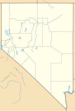
 New Washoe City
Coordinates: 39°18′5″N 119°46′18″W / 39.30139°N 119.77167°WCoordinates: 39°18′5″N 119°46′18″W / 39.30139°N 119.77167°W Country United States State Nevada County Washoe Time zone Pacific (PST) (UTC-8) – Summer (DST) PDT (UTC-7) ZIP codes 89704 FIPS code GNIS feature ID New Washoe City is an unincorporated community located in Washoe County, Nevada, United States. New Washoe City is located in the Washoe Valley in southern Washoe County between Reno and Carson City, on the east side of Washoe Lake. It is part of the Reno–Sparks Metropolitan Statistical Area. As of the 1990 census, New Washoe City had a population of 2,875 but was not designated as a census-designated place (CDP) at the 2000 census.
New Washoe City is named after the older, much smaller nearby locale of Washoe City, commonly referred to as Old Washoe City, which clusters around the northwest side of Little Washoe Lake. New Washoe City is probably best known for its nearby proximity to Washoe Lake, Little Washoe Lake and the adjacent Washoe Lake State Park. New Washoe City is connected to the Reno-Carson City corridor and U.S. Route 395 by Eastlake Boulevard (former State Route 428).
New Washoe City's ZIP code is 89704 and is associated with Washoe Valley, although it is commonly also associated with Carson City, even though it is entirely within Washoe County borders.
Geography
New Washoe City is located at 39°17'N, 119°46'W[1] (39.30133, -119.77178) and has a population of approximately 2,875[2]. The town is located at an elevation of 5096 feet (1553.25 m).
References
External links
- Washoe County, Nevada website
- Carson City, Nevada government site
- Nevada Division of State Parks - Washoe Lake State Park
Municipalities and communities of Washoe County, Nevada Cities 
CDPs Unincorporated
communitiesNew Washoe City | Pleasant Valley | Poeville | Vya
Indian reservation Categories:- Populated places in Washoe County, Nevada
- Unincorporated communities in Nevada
- Reno–Sparks metropolitan area


Wikimedia Foundation. 2010.