- Waterford Township, New Jersey
Infobox Settlement
official_name = Waterford Township, New Jersey
settlement_type = Township
nickname =
motto =
imagesize =
image_caption =
image_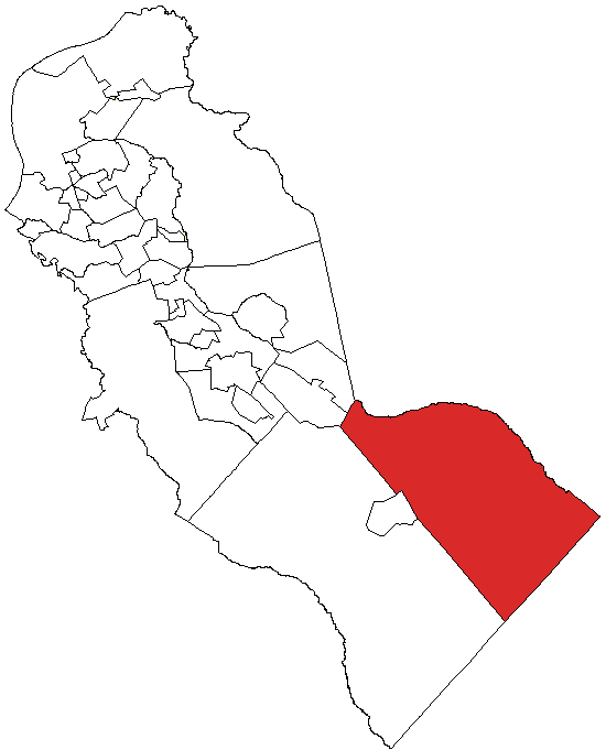
mapsize = 250x200px
map_caption = Waterford highlighted in Camden County. Inset: Location of Camden County highlighted in the State of New Jersey.
mapsize1 = 250x200px
map_caption1 = Census Bureau map of Waterford Township, New Jerseysubdivision_type = Country
subdivision_name =United States
subdivision_type1 = State
subdivision_name1 =New Jersey
subdivision_type2 = County
subdivision_name2 = Camden
government_footnotes =
government_type =Mayor
leader_name = Roeder D. Halbert
leader_title1 =
leader_name1 =
established_title =Royal Charter
established_date =June 1 ,1695
established_title1 = Incorporated
established_date1 =February 21 ,1798 unit_pref = Imperial
area_footnotes =
area_magnitude =
area_total_km2 = 93.9
area_land_km2 = 93.7
area_water_km2 = 0.2
area_total_sq_mi = 36.3
area_land_sq_mi = 36.2
area_water_sq_mi = 0.1population_as_of = 2006
population_footnotes =
population_total = 10707
population_density_km2 = 112.0
population_density_sq_mi = 290.0timezone = Eastern (EST)
utc_offset = -5
timezone_DST = EDT
utc_offset_DST = -4
elevation_footnotes = [Gnis|882151|Township of Waterford,Geographic Names Information System . AccessedJune 13 ,2008 .]
elevation_m = 24
elevation_ft = 79
latd = 39 |latm = 45 |lats = 6 |latNS = N
longd = 74 |longm = 50 |longs = 57 |longEW = Wpostal_code_type =
ZIP code
postal_code = 08089
area_code = 856
blank_name = FIPS code
blank_info = 34-77630GR|2 [ [http://mcdc2.missouri.edu/webrepts/commoncodes/ccc_nj.html A Cure for the Common Codes: New Jersey] , Missouri Census Data Center. AccessedJuly 14 ,2008 .]
blank1_name = GNIS feature ID
blank1_info = 0882151GR|3
website = http://www.waterfordtwp.org
footnotes =Waterford Township is a Township in Camden County,
New Jersey ,United States . As of theUnited States 2000 Census , the township population was 10,494.Waterford Township was originally created by
Royal Charter onJune 1 ,1695 , while the area was still part of Gloucester County. The township was incorporated by an Act of theNew Jersey Legislature onFebruary 21 ,1798 . OnMarch 13 ,1844 , Waterford Township became one of the original townships in the newly-created Camden County. Portions of the township were taken over the years to form Delaware Township (onFebruary 28 ,1844 , now Cherry Hill Township), Chesilhurst (November 26 ,1887 ), Voorhees Township (March 1 ,1899 ) and Berlin Township (March 11 ,1910 )."The Story of New Jersey's Civil Boundaries: 1606-1968", John P. Snyder, Bureau of Geology and Topography; Trenton, New Jersey; 1969. p. 109.]Geography
According to the
United States Census Bureau , the township has a total area of 36.3square mile s (93.9km² ), of which, 36.2 square miles (93.7 km²) of it is land and 0.1 square miles (0.2 km²) of it (0.19%) is water.Waterford borders Berlin Borough, Berlin Township, Chesilhurst, and Winslow. Waterford also borders Atlantic County and Burlington County.
Demographics
USCensusPop
1930= 2421
1940= 2750
1950= 2997
1960= 3809
1970= 4073
1980= 8126
1990= 10940
2000= 10494
estimate=10707
estyear=2006
estref= [http://factfinder.census.gov/servlet/SAFFPopulation?_event=Search&geo_id=06000US3400776220&_geoContext=01000US%7C04000US34%7C05000US34007%7C06000US3400776220&_street=&_county=waterford&_cityTown=waterford&_state=04000US34&_zip=&_lang=en&_sse=on&ActiveGeoDiv=geoSelect&_useEV=&pctxt=fph&pgsl=060&_submenuId=population_0&ds_name=null&_ci_nbr=null&qr_name=null®=null%3Anull&_keyword=&_industry= Census data for Waterford Township] ,United States Census Bureau . AccessedAugust 21 ,2007 .]
footnote=Population 1930 - 1990 [ [http://www.wnjpin.net/OneStopCareerCenter/LaborMarketInformation/lmi01/poptrd6.htm New Jersey Resident Population by Municipality: 1930 - 1990] , Workforce New Jersey Public Information Network. AccessedMarch 1 ,2007 .] As of thecensus GR|2 of 2000, there were 10,494 people, 3,542 households, and 2,791 families residing in the township. Thepopulation density was 290.0 people per square mile (112.0/km²). There were 3,671 housing units at an average density of 101.4/sq mi (39.2/km²). The racial makeup of the township was 92.75% White, 4.18% African American, 0.21% Native American, 0.90% Asian, 0.01% Pacific Islander, 0.67% from other races, and 1.29% from two or more races. Hispanic or Latino of any race were 2.07% of the population.There were 3,542 households out of which 39.0% had children under the age of 18 living with them, 64.5% were married couples living together, 9.7% had a female householder with no husband present, and 21.2% were non-families. 16.7% of all households were made up of individuals and 5.3% had someone living alone who was 65 years of age or older. The average household size was 2.90 and the average family size was 3.27.
In the township the population was spread out with 25.7% under the age of 18, 8.2% from 18 to 24, 32.6% from 25 to 44, 25.4% from 45 to 64, and 8.1% who were 65 years of age or older. The median age was 36 years. For every 100 females there were 100.3 males. For every 100 females age 18 and over, there were 99.6 males.
The median income for a household in the township was $59,075, and the median income for a family was $63,693. Males had a median income of $41,561 versus $28,763 for females. The
per capita income for the township was $21,676. About 3.6% of families and 5.6% of the population were below thepoverty line , including 4.9% of those under age 18 and 7.8% of those age 65 or over.Government
Local government
Waterford Township is governed under the Township form of New Jersey municipal government by a five-member Township Committee. Members are elected at large in partisan elections to three-year terms in office on a staggered basis, with one or two seats coming up for election each year."2005 New Jersey Legislative District Data Book",
Rutgers University Edward J. Bloustein School of Planning and Public Policy , April 2005, p. 33.] The Mayor and Deputy Mayor are chosen by the Township Committee from among its members during the Reorganization meeting each January.Members of the Waterford Township Committee are
Mayor Roeder D. Halbert,Deputy Mayor Maryann Merlino, Anthony Clark, Charles Hamilton and William Richardson. [ [http://www.waterfordtwp.org/committee.htm Mayor & Township Committee] , Waterford Township. AccessedJuly 10 ,2008 .]Federal, state and county representation
Waterford Township is in the Second Congressional District and is part of New Jersey's 6th Legislative District. [ [http://www.lwvnj.org/pubs/CG06.pdf 2006 New Jersey Citizen's Guide to Government] , New Jersey
League of Women Voters , p. 65. AccessedAugust 30 ,2006 , omits data for Waterford Township due to a typo in which Waterford and Watchung overlap with partial data missing for both. The 2004 New Jersey Legislative Data Book confirms that Waterford is in Congressional District 2 and New Jersey Legislative District 6.]Education
The
Waterford Township School District serves public school students in prekindergarten through sixth grade. Schools in the district (with 2005-06 enrollment data from theNational Center for Education Statistics [ [http://nces.ed.gov/ccd/schoolsearch/school_list.asp?Search=1&DistrictID=3417250 Data for the Waterford Township School District] ,National Center for Education Statistics . AccessedFebruary 21 ,2008 .] ) are [http://www.wtsd.org/Atco/index.html Atco Elementary School] for Kindergarten and first grade (236 students), [http://www.wtsd.org/TR/Thomas%20Richard%27s%20School/index.htm Thomas Richards School] for prekindergarten through 3rd grade (274 students) and [http://www.wtsd.org/WES/index.htm Waterford Elementary School] for grades 4-6 (428 students).Public school students from Waterford Township attend Hammonton Middle School and
Hammonton High School in Hammonton as part of asending/receiving relationship with theHammonton Public Schools . [ [http://education.state.nj.us/rc/rc07/narrative/01/1960/01-1960-000.html Hammonton Public Schools 2007 School Report Card] ,New Jersey Department of Education . AccessedFebruary 21 ,2008 . "The Hammonton Public School District services the 40.8 square mile Town of Hammonton as well as participating in a receiving relationship with Folsom (grades K-8) and Waterford Township (grades K-6) school districts."][http://assumptionparishatco.com Assumption School] , located in Atco, is an elementary school that operates under the auspices of the
Roman Catholic Diocese of Camden . [ [http://www.camdendiocese.org/schools/cc.html Camden County Schools] ,Roman Catholic Diocese of Camden . AccessedJuly 10 ,2008 .]Transportation
Atco provides
New Jersey Transit train service on theAtlantic City Line to the 30th Street Station inPhiladelphia and theAtlantic City Rail Terminal .NJ Transit local bus service is available on the 554 and 459 routes. [ [http://www.njtransit.com/sf_tp_rc_camden.shtml Camden County Bus/Rail Connections] ,
New Jersey Transit . AccessedJune 21 ,2007 .]U.S. Route 30 passes directly through the center of the Township while
New Jersey Route 73 borders the western edge of the township. County Route 534 and County Route 536 also pass through the township.References
External links
* [http://www.waterfordtwp.org/ Waterford Township municipal website]
* [http://www.wtsd.org/ Waterford Township School District website]
*NJReportCard|07|5560|0|Waterford Township School District
* [http://nces.ed.gov/ccd/schoolsearch/school_list.asp?Search=1&DistrictID=3417250 Data for the Waterford Township School District] ,National Center for Education Statistics
* [http://kywschools.com/schools_results.cfm?schoolsearch=&keyword=594 School closing information]
* [http://www.hammontonps.org/main/index.php?option=com_content&task=view&id=19&Itemid=41 Hammonton High School]
Wikimedia Foundation. 2010.