- Runnemede, New Jersey
Infobox Settlement
official_name = Runnemede, New Jersey
settlement_type = Borough
nickname =
motto =
imagesize =
image_caption =
image_
imagesize =
image_caption =
image_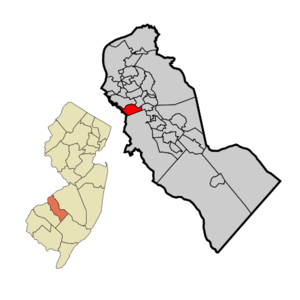
mapsize = 250x200px
map_caption = Runnemede highlighted in Camden County. Inset: Location of Camden County highlighted in the State of New Jersey.
mapsize1 = 250x200px
map_caption1 = Census Bureau map of Runnemede, New Jerseysubdivision_type = Country
subdivision_name =United States
subdivision_type1 = State
subdivision_name1 =New Jersey
subdivision_type2 = County
subdivision_name2 = Camden
government_footnotes =
government_type =Borough (New Jersey)
leader_title =Mayor
leader_name = Virginia Betteridge
leader_title1 =
leader_name1 =
established_title = Incorporated
established_date =April 24 ,1926 unit_pref = Imperial
area_footnotes =
area_magnitude =
area_total_km2 = 5.5
area_land_km2 = 5.4
area_water_km2 = 0.1
area_total_sq_mi = 2.1
area_land_sq_mi = 2.1
area_water_sq_mi = 0.0population_as_of = 2006
population_footnotes =
population_total = 8461
population_density_km2 = 1576.9
population_density_sq_mi = 4084.2timezone = Eastern (EST)
utc_offset = -5
timezone_DST = EDT
utc_offset_DST = -4
elevation_footnotes = [Gnis|885382|Borough of Runnemede,Geographic Names Information System . AccessedJanuary 4 ,2008 .]
elevation_m = 21
elevation_ft = 69
latd = 39 |latm = 51 |lats = 05 |latNS = N
longd = 75 |longm = 04 |longs = 29 |longEW = Wpostal_code_type =
ZIP code
postal_code = 08078
area_code = 856
blank_name = FIPS code
blank_info = 34-65160GR|2 [ [http://mcdc2.missouri.edu/webrepts/commoncodes/ccc_nj.html A Cure for the Common Codes: New Jersey] , Missouri Census Data Center. AccessedJuly 14 ,2008 .]
blank1_name = GNIS feature ID
blank1_info = 0879861GR|3
website = http://runnemedenj.org/
footnotes =Runnemede is a Borough in Camden County,
New Jersey ,United States . As of theUnited States 2000 Census , the borough population was 8,533.Runnemede was incorporated as a borough by an Act of the
New Jersey Legislature onMarch 23 ,1926 , from portions of the now-defunct Centre Township, based on the results of a referendum held onApril 24 ,1926 . The boroughs of Bellmawr, Mount Ephraim and Lawnside were simultaneously created during the same two-day period."The Story of New Jersey's Civil Boundaries: 1606-1968", John P. Snyder, Bureau of Geology and Topography; Trenton, New Jersey; 1969. p. 108.]Geography
Runnemede is located at coor dms|39|51|6|N|75|4|34|W|city (39.851580, -75.076082)GR|1.
According to the
United States Census Bureau , the borough has a total area of 2.1square mile s (5.5km² ), of which, 2.1 square miles (5.4 km²) of it is land and 0.04 square miles (0.1 km²) of it (1.42%) is water.Runnemede borders Barrington, Bellmawr, Gloucester Township, and Magnolia. Runnemede also borders Gloucester County.
Demographics
USCensusPop
1930= 2436
1940= 2835
1950= 4217
1960= 8396
1970= 10475
1980= 9461
1990= 9042
2000= 8533
estimate=8461
estyear=2006
estref= [http://factfinder.census.gov/servlet/SAFFPopulation?_event=Search&geo_id=16000US3458920&_geoContext=01000US%7C04000US34%7C16000US3458920&_street=&_county=runnemede&_cityTown=runnemede&_state=04000US34&_zip=&_lang=en&_sse=on&ActiveGeoDiv=geoSelect&_useEV=&pctxt=fph&pgsl=160&_submenuId=population_0&ds_name=null&_ci_nbr=null&qr_name=null®=null%3Anull&_keyword=&_industry= Census data for Runnemede borough] ,United States Census Bureau . AccessedJune 12 ,2008 .]
footnote=Population 1930 - 1990. [ [http://www.wnjpin.net/OneStopCareerCenter/LaborMarketInformation/lmi01/poptrd6.htm New Jersey Resident Population by Municipality: 1930 - 1990] , Workforce New Jersey Public Information Network. AccessedMarch 1 ,2007 .] As of thecensus GR|2 of 2000, there were 8,533 people, 3,376 households, and 2,275 families residing in the borough. Thepopulation density was 4,084.2 people per square mile (1,576.4/km²). There were 3,510 housing units at an average density of 1,680.0/sq mi (648.4/km²). The racial makeup of the borough was 91.77% White, 3.76% African American, 0.11% Native American, 1.55% Asian, 0.01% Pacific Islander, 1.22% from other races, and 1.58% from two or more races. Hispanic or Latino of any race were 3.59% of the population.There were 3,376 households out of which 30.3% had children under the age of 18 living with them, 47.6% were married couples living together, 14.2% had a female householder with no husband present, and 32.6% were non-families. 27.8% of all households were made up of individuals and 11.8% had someone living alone who was 65 years of age or older. The average household size was 2.52 and the average family size was 3.08.
In the borough the population was spread out with 23.2% under the age of 18, 8.5% from 18 to 24, 30.5% from 25 to 44, 22.2% from 45 to 64, and 15.6% who were 65 years of age or older. The median age was 38 years. For every 100 females there were 92.6 males. For every 100 females age 18 and over, there were 88.3 males.
The median income for a household in the borough was $41,126, and the median income for a family was $50,127. Males had a median income of $37,705 versus $28,062 for females. The
per capita income for the borough was $19,143. About 3.1% of families and 5.6% of the population were below thepoverty line , including 5.1% of those under age 18 and 6.4% of those age 65 or over.Government
Local government
Runnemede is governed under the Borough form of New Jersey municipal government. The government consists of a Mayor and a Borough Council comprising six council members, with all positions elected at large. A Mayor is elected directly by the voters to a four-year term of office. The Borough Council consists of six members elected to serve three-year terms on a staggered basis, with two seats coming up for election each year. ["2005 New Jersey Legislative District Data Book",
Rutgers University Edward J. Bloustein School of Planning and Public Policy , April 2005, p. 28.]As of 2008 , theMayor of Runnemede is Virginia Betteridge. Members of the Borough Council are Council President Anthony M. Beatrice, A. Mike Kisielewski, Mark McCarthy, Bernie Moore, Lisa Scaramuzzo and Dennis Venella. [ [http://runnemedenj.org/comittee.html 2008 Council Members] , Borough of Runnemede. AccessedJune 12 ,2008 .]Federal, state and county representation
Runnemede Borough is in the First Congressional District and is part of New Jersey's 5th Legislative District. [ [http://www.lwvnj.org/pubs/CG06.pdf League of Women Voters: 2006 New Jersey Citizen's Guide to Government] , p. 63, accessed
August 30 ,2006 ]Education
The
Runnemede Public School District serves students in Kindergarten through eighth grade. Schools in the district (with 2005-06 enrollment data from theNational Center for Education Statistics [ [http://nces.ed.gov/ccd/schoolsearch/school_list.asp?Search=1&DistrictID=3414430 Data for the Runnemede Public School District] ,National Center for Education Statistics . AccessedJune 12 ,2008 .] ) are [http://www.runnemedeschools.org/bingham/bingham.htm Aline Bingham School] (178 students) and [http://www.runnemedeschools.org/downing/downing.htm Grace Downing School] (153) for grades K-3 and [http://www.runnemedeschools.org/volz/volz.htm Mary E. Volz Middle School] (456) for grades 4-8.For grades 9 through 12, public school students attend
Triton Regional High School (1,525 students), one of three high schools that are part of theBlack Horse Pike Regional School District , which also serves students from Bellmawr Borough and Gloucester Township. [ [http://education.state.nj.us/rc/rc07/narrative/07/0390/07-0390-050.html Triton Regional High School 2007 Report Card Narrative] ,New Jersey Department of Education . AccessedJune 12 ,2008 . "Triton houses over 1500 students residing in Runnemede, Bellmawr, and Gloucester Township."] The two other schools in the district areHighland Regional High School andTimber Creek Regional High School .[http://www.stteresaschool.net/ St. Teresa Regional School] is an elementary school that operates under the auspices of the
Roman Catholic Diocese of Camden [ [http://www.camdendiocese.org/schools/cc.html Camden County Schools] ,Roman Catholic Diocese of Camden . AccessedJuly 10 ,2008 .]Transportation
New Jersey Transit bus service toPhiladelphia is available on the 400 route, with local service available on the 455. [ [http://www.njtransit.com/sf_tp_rc_camden.shtml Camden County Bus/Rail Connections] ,New Jersey Transit . AccessedJune 21 ,2007 .]Various roads pass through Runnemede, such as NJ 168, and NJ 41. The
New Jersey Turnpike passes through the northern part, which houses part of an interchange: Exit 3. The 3 toll gate is located on the boundary of Bellmawr and Runnemede, with a total of 6 lanes at the gate.References
External links
* [http://runnemedenj.org/ Official website]
* [http://www.runnemedeschools.org/ Runnemede Public School District]
*NJReportCard|07|4590|0|Runnemede Public School District
* [http://nces.ed.gov/ccd/schoolsearch/school_list.asp?Search=1&DistrictID=3414430 Data for the Runnemede Public School District] ,National Center for Education Statistics
* [http://www.bhprsd.org/ Black Horse Pike Regional School District]
Wikimedia Foundation. 2010.