- Drummond, Montana
-
Drummond, Montana — Town — Location of Drummond, Montana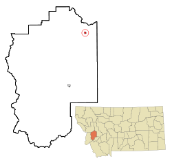
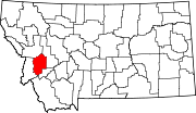
Coordinates: 46°40′5″N 113°8′47″W / 46.66806°N 113.14639°WCoordinates: 46°40′5″N 113°8′47″W / 46.66806°N 113.14639°W Country United States State Montana County Granite Area – Total 0.6 sq mi (1.5 km2) – Land 0.6 sq mi (1.5 km2) – Water 0.0 sq mi (0.0 km2) Elevation 3,963 ft (1,208 m) Population (2000) – Total 318 – Density 547.8/sq mi (211.5/km2) Time zone Mountain (MST) (UTC-7) – Summer (DST) MDT (UTC-6) ZIP code 59832 Area code(s) 406 FIPS code 30-21850 GNIS feature ID 0770752 Drummond is a town in Granite County, Montana, United States. The population was 318 at the 2000 census.
Contents
Geography
Drummond is located at 46°40′5″N 113°8′47″W / 46.66806°N 113.14639°W (46.667983, -113.146355)[1].
According to the United States Census Bureau, the town has a total area of 0.6 square miles (1.6 km2), all of it land.
Demographics
As of the census[2] of 2000, there were 318 people, 140 households, and 84 families residing in the town. The population density was 547.8 people per square mile (211.7/km²). There were 172 housing units at an average density of 296.3 per square mile (114.5/km²). The racial makeup of the town was 96.54% White, 1.57% Native American, 0.31% from other races, and 1.57% from two or more races. Hispanic or Latino of any race were 0.94% of the population.
There were 140 households out of which 30.7% had children under the age of 18 living with them, 45.0% were married couples living together, 11.4% had a female householder with no husband present, and 39.3% were non-families. 35.0% of all households were made up of individuals and 9.3% had someone living alone who was 65 years of age or older. The average household size was 2.27 and the average family size was 2.93.
In the town the population was spread out with 28.6% under the age of 18, 5.3% from 18 to 24, 27.0% from 25 to 44, 25.8% from 45 to 64, and 13.2% who were 65 years of age or older. The median age was 38 years. For every 100 females there were 101.3 males. For every 100 females age 18 and over, there were 100.9 males.
The median income for a household in the town was $26,500, and the median income for a family was $32,841. Males had a median income of $30,625 versus $16,563 for females. The per capita income for the town was $14,213. About 6.6% of families and 13.6% of the population were below the poverty line, including 15.0% of those under age 18 and 5.0% of those age 65 or over.
See also
References
- ^ "US Gazetteer files: 2010, 2000, and 1990". United States Census Bureau. 2011-02-12. http://www.census.gov/geo/www/gazetteer/gazette.html. Retrieved 2011-04-23.
- ^ "American FactFinder". United States Census Bureau. http://factfinder.census.gov. Retrieved 2008-01-31.
Municipalities and communities of Granite County, Montana Towns Drummond | Philipsburg
Ghost towns Categories:- Populated places in Granite County, Montana
- Towns in Montana


Wikimedia Foundation. 2010.