- Mill Spring, Missouri
-
Mill Spring, Missouri — Village — Location of Mill Spring, Missouri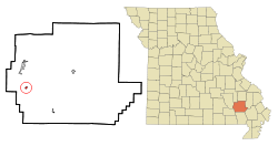
Coordinates: 37°3′48″N 90°40′54″W / 37.06333°N 90.68167°WCoordinates: 37°3′48″N 90°40′54″W / 37.06333°N 90.68167°W Country United States State Missouri County Wayne Area – Total 0.2 sq mi (0.5 km2) – Land 0.2 sq mi (0.5 km2) – Water 0.0 sq mi (0.0 km2) Elevation 436 ft (133 m) Population (2000) – Total 219 – Density 1,041.8/sq mi (402.2/km2) Time zone Central (CST) (UTC-6) – Summer (DST) CDT (UTC-5) ZIP code 63952 Area code(s) 573 FIPS code 29-48386[1] GNIS feature ID 0722359[2] Mill Spring is a village in Wayne County, Missouri, United States, along the Black River. The population was 219 at the 2000 census.
Geography
Mill Spring is located at 37°3′48″N 90°40′54″W / 37.06333°N 90.68167°W (37.063306, -90.681616).[3]
According to the United States Census Bureau, the village has a total area of 0.2 square miles (0.52 km2), all of it land.
Demographics
As of the census[1] of 2000, there were 219 people, 81 households, and 55 families residing in the village. The population density was 1,041.8 people per square mile (402.6/km²). There were 104 housing units at an average density of 494.7 per square mile (191.2/km²). The racial makeup of the village was 96.35% White, 0.46% Native American, 0.91% Pacific Islander, and 2.28% from two or more races.
There were 81 households out of which 30.9% had children under the age of 18 living with them, 45.7% were married couples living together, 13.6% had a female householder with no husband present, and 30.9% were non-families. 24.7% of all households were made up of individuals and 16.0% had someone living alone who was 65 years of age or older. The average household size was 2.70 and the average family size was 3.13.
In the village the population was spread out with 28.8% under the age of 18, 8.7% from 18 to 24, 24.2% from 25 to 44, 17.8% from 45 to 64, and 20.5% who were 65 years of age or older. The median age was 37 years. For every 100 females there were 104.7 males. For every 100 females age 18 and over, there were 97.5 males.
The median income for a household in the village was $22,750, and the median income for a family was $26,389. Males had a median income of $18,125 versus $14,063 for females. The per capita income for the village was $9,723. About 13.5% of families and 22.7% of the population were below the poverty line, including 25.0% of those under the age of eighteen and 20.0% of those sixty five or over.
References
- ^ a b "American FactFinder". United States Census Bureau. http://factfinder.census.gov. Retrieved 2008-01-31.
- ^ "US Board on Geographic Names". United States Geological Survey. 2007-10-25. http://geonames.usgs.gov. Retrieved 2008-01-31.
- ^ "US Gazetteer files: 2010, 2000, and 1990". United States Census Bureau. 2011-02-12. http://www.census.gov/geo/www/gazetteer/gazette.html. Retrieved 2011-04-23.
Municipalities and communities of Wayne County, Missouri Cities 
Village Mill Spring
Townships Benton | Black River | Cedar Creek | Cowan | Jefferson | Logan | Lost Creek | Mill Spring | Saint Francois | Williams
Unincorporated
communitiesCategories:- Villages in Wayne County, Missouri


Wikimedia Foundation. 2010.