- Mount Leonard, Missouri
-
Mount Leonard, Missouri — Town — Location of Mount Leonard, Missouri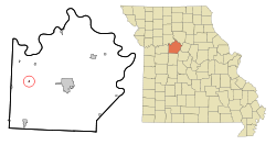
Coordinates: 39°7′33″N 93°23′41″W / 39.12583°N 93.39472°WCoordinates: 39°7′33″N 93°23′41″W / 39.12583°N 93.39472°W Country United States State Missouri County Saline Area – Total 0.1 sq mi (0.3 km2) – Land 0.1 sq mi (0.3 km2) – Water 0.0 sq mi (0.0 km2) Elevation 801 ft (244 m) Population (2000) – Total 123 – Density 1,215.0/sq mi (469.1/km2) Time zone Central (CST) (UTC-6) – Summer (DST) CDT (UTC-5) FIPS code 29-50510[1] GNIS feature ID 0722778[2] Mount Leonard is a village in Saline County, Missouri, United States. The population was 123 at the 2000 census.
Geography
Mount Leonard is located at 39°7′33″N 93°23′41″W / 39.12583°N 93.39472°W (39.125902, -93.394822)[3].
According to the United States Census Bureau, the town has a total area of 0.1 square miles (0.3 km²), all of it land.
Demographics
As of the census[1] of 2000, there were 123 people, 38 households, and 31 families residing in the town. The population density was 1,215.0 people per square mile (474.9/km²). There were 44 housing units at an average density of 434.6 per square mile (169.9/km²). The racial makeup of the town was 94.31% White, 2.44% African American, 0.81% Native American, and 2.44% from two or more races.
There were 38 households out of which 42.1% had children under the age of 18 living with them, 65.8% were married couples living together, 15.8% had a female householder with no husband present, and 18.4% were non-families. 15.8% of all households were made up of individuals and 7.9% had someone living alone who was 65 years of age or older. The average household size was 3.24 and the average family size was 3.48.
In the town the population was spread out with 36.6% under the age of 18, 8.9% from 18 to 24, 23.6% from 25 to 44, 20.3% from 45 to 64, and 10.6% who were 65 years of age or older. The median age was 31 years. For every 100 females there were 89.2 males. For every 100 females age 18 and over, there were 95.0 males.
The median income for a household in the town was $20,833, and the median income for a family was $18,750. Males had a median income of $18,125 versus $13,906 for females. The per capita income for the town was $7,405. There were 46.2% of families and 48.4% of the population living below the poverty line, including 69.1% of under eighteens and 18.8% of those over 64.
References
- ^ a b "American FactFinder". United States Census Bureau. http://factfinder.census.gov. Retrieved 2008-01-31.
- ^ "US Board on Geographic Names". United States Geological Survey. 2007-10-25. http://geonames.usgs.gov. Retrieved 2008-01-31.
- ^ "US Gazetteer files: 2010, 2000, and 1990". United States Census Bureau. 2011-02-12. http://www.census.gov/geo/www/gazetteer/gazette.html. Retrieved 2011-04-23.
Municipalities and communities of Saline County, Missouri Cities 
Villages Arrow Rock | Gilliam | Grand Pass | Malta Bend | Mount Leonard
Townships Arrow Rock | Blackwater | Cambridge | Clay | Elmwood | Grand Pass | Liberty | Marshall | Miami | Salt Fork | Salt Pond
Unincorporated
communitiesFootnotes ‡This populated place also has portions in an adjacent county or counties
Categories:- Villages in Saline County, Missouri


Wikimedia Foundation. 2010.