- Dutchtown, Missouri
-
Dutchtown, Missouri — Village — Location of Dutchtown, Missouri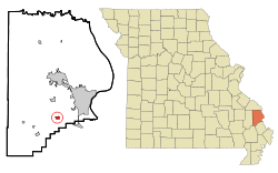
Coordinates: 37°15′8″N 89°39′29″W / 37.25222°N 89.65806°WCoordinates: 37°15′8″N 89°39′29″W / 37.25222°N 89.65806°W Country United States State Missouri County Cape Girardeau Area – Total 0.5 sq mi (1.3 km2) – Land 0.5 sq mi (1.3 km2) – Water 0.0 sq mi (0.0 km2) Elevation 338 ft (103 m) Population (2000) – Total 99 – Density 200.1/sq mi (77.3/km2) Time zone Central (CST) (UTC-6) – Summer (DST) CDT (UTC-5) ZIP code 63745 Area code(s) 573 FIPS code 29-20566[1] GNIS feature ID 0731565[2] Dutchtown is a village in Cape Girardeau County, Missouri, United States, located at the intersection of Routes 25 and 74. The population was 99 at the 2000 census. It is part of the Cape Girardeau–Jackson, MO-IL Metropolitan Statistical Area.
Geography
Dutchtown is located at 37°15′8″N 89°39′29″W / 37.25222°N 89.65806°W (37.252300, -89.658064)[3].
According to the United States Census Bureau, the village has a total area of 0.5 square miles (1.3 km2), all of it land.
Demographics
As of the census[1] of 2000, there were 99 people, 36 households, and 28 families residing in the village. The population density was 200.1 people per square mile (78.0/km²). There were 43 housing units at an average density of 86.9/sq mi (33.9/km²). The racial makeup of the village was 91.92% White, 3.03% African American, 3.03% Native American, and 2.02% from two or more races.
There were 36 households out of which 36.1% had children under the age of 18 living with them, 58.3% were married couples living together, 19.4% had a female householder with no husband present, and 22.2% were non-families. 22.2% of all households were made up of individuals and 5.6% had someone living alone who was 65 years of age or older. The average household size was 2.75 and the average family size was 3.18.
In the village the population was spread out with 30.3% under the age of 18, 11.1% from 18 to 24, 28.3% from 25 to 44, 19.2% from 45 to 64, and 11.1% who were 65 years of age or older. The median age was 30 years. For every 100 females there were 102.0 males. For every 100 females age 18 and over, there were 81.6 males.
The median income for a household in the village was $23,750, and the median income for a family was $28,750. Males had a median income of $25,000 versus $21,042 for females. The per capita income for the village was $14,033. About 18.9% of families and 15.0% of the population living below the poverty line, including 17.6% of under eighteens and none of those over 64.
References
- ^ a b "American FactFinder". United States Census Bureau. http://factfinder.census.gov. Retrieved 2008-01-31.
- ^ "US Board on Geographic Names". United States Geological Survey. 2007-10-25. http://geonames.usgs.gov. Retrieved 2008-01-31.
- ^ "US Gazetteer files: 2010, 2000, and 1990". United States Census Bureau. 2011-02-12. http://www.census.gov/geo/www/gazetteer/gazette.html. Retrieved 2011-04-23.
Municipalities and communities of Cape Girardeau County, Missouri Cities Cape Girardeau‡ | Delta | Jackson | Scott City‡

Villages Allenville | Dutchtown | Gordonville | Oak Ridge | Old Appleton | Pocahontas | Whitewater
Townships Apple Creek | Byrd | Cape Girardeau | Hubble | Kinder | Liberty | Randol | Shawnee | Welch | Whitewater
Unincorporated
communitiesBurfordville | Daisy | Egypt Mills | Friedheim | Fruitland | Millersville | New Wells | Oriole
Footnotes ‡This populated place also has portions in an adjacent county or counties
Categories:- Villages in Cape Girardeau County, Missouri
- Cape Girardeau – Jackson metropolitan area


Wikimedia Foundation. 2010.