- Coffeeville, Mississippi
-
Coffeeville, Mississippi — Town — Location of Coffeeville, Mississippi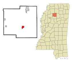
Coordinates: 33°58′40″N 89°40′38″W / 33.97778°N 89.67722°WCoordinates: 33°58′40″N 89°40′38″W / 33.97778°N 89.67722°W Country United States State Mississippi County Yalobusha Area – Total 2.2 sq mi (5.7 km2) – Land 2.2 sq mi (5.7 km2) – Water 0.0 sq mi (0.0 km2) Elevation 266 ft (81 m) Population (2000) – Total 930 – Density 423.4/sq mi (163.5/km2) Time zone Central (CST) (UTC-6) – Summer (DST) CDT (UTC-5) ZIP code 38922 Area code(s) 662 FIPS code 28-14740 GNIS feature ID 0692939 Coffeeville is a town in Yalobusha County, Mississippi, United States. The population was 930 at the 2000 census. It is named after John Coffee (1772 – 1833), a planter and military leader.
Contents
Geography
Coffeeville is located at 33°58′40″N 89°40′38″W / 33.97778°N 89.67722°W (33.977883, -89.677326)[1].
According to the United States Census Bureau, the town has a total area of 2.2 square miles (5.7 km2), all of it land.
Demographics
As of the census[2] of 2000, there were 930 people, 401 households, and 261 families residing in the town. The population density was 423.4 people per square mile (163.2/km²). There were 464 housing units at an average density of 211.3 per square mile (81.4/km²). The racial makeup of the town was 54.52% African American, 44.84% White, 0.32% Native American, and 0.32% from two or more races. Hispanic or Latino of any race were 1.83% of the population.
There were 401 households out of which 25.7% had children under the age of 18 living with them, 38.4% were married couples living together, 21.9% had a female householder with no husband present, and 34.9% were non-families. 32.4% of all households were made up of individuals and 20.0% had someone living alone who was 65 years of age or older. The average household size was 2.32 and the average family size was 2.93.
In the town the population was spread out with 24.8% under the age of 18, 8.2% from 18 to 24, 23.3% from 25 to 44, 24.3% from 45 to 64, and 19.4% who were 65 years of age or older. The median age was 39 years. For every 100 females there were 74.5 males. For every 100 females age 18 and over, there were 68.8 males.
The median income for a household in the town was $24,712, and the median income for a family was $31,000. Males had a median income of $25,592 versus $20,294 for females. The per capita income for the town was $13,758. About 23.1% of families and 28.5% of the population were below the poverty line, including 44.3% of those under age 18 and 14.5% of those age 65 or over.
Education
The Town of Coffeeville is served by the Coffeeville School District.
References
- ^ "US Gazetteer files: 2010, 2000, and 1990". United States Census Bureau. 2011-02-12. http://www.census.gov/geo/www/gazetteer/gazette.html. Retrieved 2011-04-23.
- ^ "American FactFinder". United States Census Bureau. http://factfinder.census.gov. Retrieved 2008-01-31.
External links
Municipalities and communities of Yalobusha County, Mississippi Cities 
Towns Unincorporated
communitiesScobey
Categories:- Towns in Mississippi
- Populated places in Yalobusha County, Mississippi
- County seats in Mississippi
- Populated places in Mississippi with African American majority populations


Wikimedia Foundation. 2010.