- Amory, Mississippi
Infobox Settlement
official_name = Amory, Mississippi
settlement_type =City
nickname =
motto =
imagesize =
image_caption =
image_
imagesize =
image_caption =
image_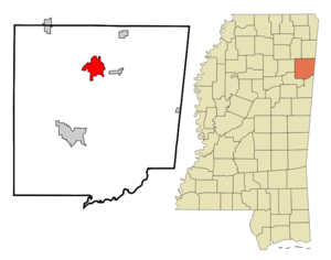
mapsize = 250px
map_caption = Location of Amory, Mississippi
mapsize1 =
map_caption1 =subdivision_type = Country
subdivision_name =United States
subdivision_type1 = State
subdivision_name1 =Mississippi
subdivision_type2 = County
subdivision_name2 = Monroe
government_footnotes =
government_type =
leader_title =
leader_name =
leader_title1 =
leader_name1 =
established_title =
established_date =unit_pref = Imperial
area_footnotes =area_magnitude =
area_total_km2 = 20.8
area_land_km2 = 19.4
area_water_km2 = 1.3
area_total_sq_mi = 8.0
area_land_sq_mi = 7.5
area_water_sq_mi = 0.5population_as_of = 2000
population_footnotes =
population_total = 6956
population_density_km2 = 358.0
population_density_sq_mi = 927.2timezone = Central (CST)
utc_offset = -6
timezone_DST = CDT
utc_offset_DST = -5
elevation_footnotes =
elevation_m = 73
elevation_ft = 240
latd = 33 |latm = 59 |lats = 14 |latNS = N
longd = 88 |longm = 29 |longs = 2 |longEW = Wpostal_code_type =
ZIP code
postal_code = 38821
area_code = 662
blank_name = FIPS code
blank_info = 28-01260
blank1_name = GNIS feature ID
blank1_info = 0666246
website =
footnotes =Amory is a city in Monroe County,
Mississippi ,United States . The population is 6,956 at the 2000 census.History
Amory was the first planned city in Mississippi. The
Kansas City, Memphis & Birmingham Railroad needed a mid-point between Memphis,Tennessee and Birmingham,Alabama for their locomotives, and they laid out the new town of Amory in 1887. People from nearby Cotton Gin Port on theTombigbee River abandoned their town and moved to Amory.Geography
Amory is located at coor dms|33|59|3|N|88|29|17|W| GR|3.
According to the
United States Census Bureau , the city has a total area of 8.0square mile s (20.7km² ), of which, 7.5 square miles (19.4 km²) of it is land and 0.5 square miles (1.3 km²) of it (6.37%) is water.Transportation
Road transport is served byUS 278 ,Mississippi Highway 6 , andMississippi Highway 25 .Rail transport is offered byBNSF Railway , theAlabama and Gulf Coast Railway , and theMississippian Railway .Ship transport can be accommodated on theTennessee-Tombigbee Waterway .Economy
Gilmore Memorial Hospital is well regarded as having one of the better maternal wards in northeast Mississippi — residents of other cities drive extra miles to give birth thereFact|date=April 2008. Other business sectors include sports equipment manufacturing, wood pulp processing, and the furniture and textile industries.
Demographics
USCensusPop
1950= 4990
1960= 6474
1970= 7236
1980= 7307
1990= 7093
2000= 6956
estyear=2006
estimate= 7368As of thecensus GR|2 of 2000, there were 6,956 people, 2,876 households, and 1,903 families residing in the city. Thepopulation density was 927.2 people per square mile (358.1/km²). There were 3,147 housing units at an average density of 419.5/sq mi (162.0/km²). The racial makeup of the city was 69.85% White, 29.18% African American, 0.12% Native American, 0.06% Asian, 0.16% from other races, and 0.63% from two or more races. Hispanic or Latino of any race were 0.79% of the population.There were 2,876 households out of which 30.6% had children under the age of 18 living with them, 43.8% were married couples living together, 19.3% had a female householder with no husband present, and 33.8% were non-families. 31.7% of all households were made up of individuals and 15.7% had someone living alone who was 65 years of age or older. The average household size was 2.36 and the average family size was 2.97.
In the city the population was spread out with 25.9% under the age of 18, 8.0% from 18 to 24, 25.0% from 25 to 44, 22.5% from 45 to 64, and 18.7% who were 65 years of age or older. The median age was 38 years. For every 100 females there were 82.4 males. For every 100 females age 18 and over, there were 75.3 males.
The median income for a household in the city was $28,789, and the median income for a family was $37,891. Males had a median income of $30,913 versus $21,356 for females. The
per capita income for the city was $14,092. About 17.1% of families and 20.7% of the population were below thepoverty line , including 31.6% of those under age 18 and 17.4% of those age 65 or over.Education
Most of Amory is served by the
Amory School District , while a small portion is served by theMonroe County School District .Culture and events
In honor of its cultural and historical heritage, the city of Amory holds an annual festival each April known as the "Railroad Festival" in Frisco Park in downtown Amory. Among other attractions, the Railroad Festival includes southern foods—such as fried catfish,
barbecue , and apple fritters—rides, arts and crafts, and live music. Although the time of year—April—often results in rain during one or more days of the 3-day festival, turnout is generally quite large, with as many as 40,000 visiting the festival over the period of a weekend.In addition to the annual Railroad Festival, in September of every other year, Amory is host to "Entertainment for Education", also known as "Stars Over Mississippi", in which a number of celebrities and entertainers host a
benefit concert to raise funds for local scholarships. Past performers and attendees have includedVince Gill ,Dolly Parton ,Nell Carter ,Sandi Patty ,Kathie Lee Gifford ,Kathy Ireland , and Prince Edward.Famous and notable Amorians
*
John Dye , actor
*Gary Grubbs , actor
*Sam Haskell , former entertainment executive
*Hob Bryan , Mississippi State Senator
*Lucille Bogan , controversial early blues singerTrivia
*
Blue Suede Shoes was written byCarl Perkins during a trip to Amory for a concert withElvis Presley andJohnny Cash in 1955.ee also
*
Amory Lock on theTennessee-Tombigbee Waterway
*Cotton Gin Port
*Kansas City, Memphis & Birmingham Railroad
*St. Louis-San Francisco Railway
*Mississippian Railway
*Alabama and Gulf Coast Railway
*BNSF Railway References
External links
* [http://www.amoryms.us/ City of Amory, Mississippi]
* [http://purl.oclc.org/umarchives/MUM00354/ Park Hotel in Amory Ledgers (MUM00354)] at the University of Mississippi, Archives and Special Collections.
Wikimedia Foundation. 2010.