- Carthage, Mississippi
Infobox Settlement
official_name = Carthage, Mississippi
settlement_type =City
nickname =
motto =
imagesize =
image_caption =
image_
imagesize =
image_caption =
image_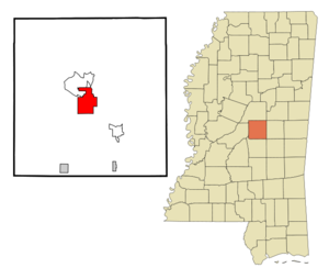
mapsize = 250px
map_caption = Location of Carthage, Mississippi
mapsize1 =
map_caption1 =subdivision_type = Country
subdivision_name =United States
subdivision_type1 = State
subdivision_name1 =Mississippi
subdivision_type2 = County
subdivision_name2 = Leake
government_footnotes =
government_type =
leader_title =
leader_name =
leader_title1 =
leader_name1 =
established_title =
established_date =unit_pref = Imperial
area_footnotes =area_magnitude =
area_total_km2 = 24.3
area_land_km2 = 24.2
area_water_km2 = 0.1
area_total_sq_mi = 9.4
area_land_sq_mi = 9.4
area_water_sq_mi = 0.0population_as_of = 2000
population_footnotes =
population_total = 4637
population_density_km2 = 191.5
population_density_sq_mi = 495.9timezone = Central (CST)
utc_offset = -6
timezone_DST = CDT
utc_offset_DST = -5
elevation_footnotes =
elevation_m = 107
elevation_ft = 351
latd = 32 |latm = 44 |lats = 29 |latNS = N
longd = 89 |longm = 32 |longs = 6 |longEW = Wpostal_code_type =
ZIP code
postal_code = 39051
area_code = 601
blank_name = FIPS code
blank_info = 28-11780
blank1_name = GNIS feature ID
blank1_info = 0668123
website =
footnotes =Carthage is a city in Leake County,
Mississippi ,United States . The population was 4,637 at the 2000 census. It is thecounty seat of Leake CountyGR|6.Earl Williamson , a localpolitician in Shreveport who was a confidant ofLouisiana Governors Huey Pierce Long, Jr., andEarl Kemp Long , was born in Carthage in 1903.Geography
Carthage is located at coor dms|32|44|29|N|89|32|6|W|city (32.741504, -89.535134)GR|1.
According to the
United States Census Bureau , the city has a total area of 9.4square mile s (24.3km² ), of which, 9.4 square miles (24.2 km²) of it is land and 0.1 square miles (0.1 km²) of it (0.53%) is water.Demographics
As of the
census GR|2 of 2000, there were 4,637 people, 1,490 households, and 1,065 families residing in the city. Thepopulation density was 495.9 people per square mile (191.5/km²). There were 1,654 housing units at an average density of 176.9/sq mi (68.3/km²). The racial makeup of the city was 52.86% White, 44.25% African American, 1.04% Native American, 0.43% Asian, 0.02% Pacific Islander, 0.58% from other races, and 0.82% from two or more races. Hispanic or Latino of any race were 1.94% of the population.There were 1,490 households out of which 37.1% had children under the age of 18 living with them, 43.8% were married couples living together, 23.6% had a female householder with no husband present, and 28.5% were non-families. 25.4% of all households were made up of individuals and 13.5% had someone living alone who was 65 years of age or older. The average household size was 2.62 and the average family size was 3.12.
In the city the population was spread out with 26.1% under the age of 18, 11.7% from 18 to 24, 28.4% from 25 to 44, 18.1% from 45 to 64, and 15.7% who were 65 years of age or older. The median age was 33 years. For every 100 females there were 98.6 males. For every 100 females age 18 and over, there were 96.4 males.
The median income for a household in the city was $25,052, and the median income for a family was $30,069. Males had a median income of $27,060 versus $17,280 for females. The
per capita income for the city was $12,986. About 21.5% of families and 26.8% of the population were below thepoverty line , including 39.6% of those under age 18 and 18.8% of those age 65 or over.Education
The City of Carthage is served by the
Leake County School District .References
External links
Wikimedia Foundation. 2010.