- Tenney, Minnesota
Infobox Settlement
official_name = Tenney, Minnesota
settlement_type =City
nickname =
motto =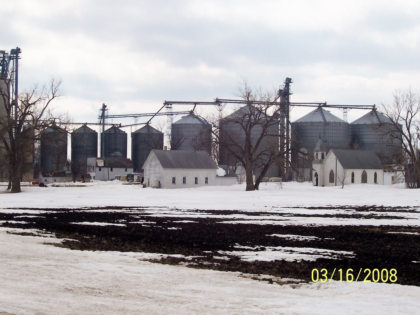
imagesize = 250px
image_caption = The city of Tenney, viewed from the northeast
image_
image_
mapsize = 250px
map_caption = Location of Tenney, Minnesota
mapsize1 =
map_caption1 =subdivision_type = Country
subdivision_name =United States
subdivision_type1 = State
subdivision_name1 =Minnesota
subdivision_type2 = County
subdivision_name2 = Wilkingovernment_footnotes =
government_type =
leader_title =
leader_name =
leader_title1 =
leader_name1 =
established_title =
established_date =unit_pref = Imperial
area_footnotes =area_magnitude =
area_total_km2 = 0.052153
area_land_km2 = 0.052153
area_water_km2 = 0.0
area_total_sq_mi = 0.020136
area_land_sq_mi = 0.020136
area_water_sq_mi = 0.0population_as_of = 2000
population_footnotes =
population_total = 6
population_density_km2 = 115.0
population_density_sq_mi = 298.0timezone = Central (CST)
utc_offset = -6
timezone_DST = CDT
utc_offset_DST = -5
elevation_footnotes =
elevation_m = 302
elevation_ft = 991
latd = 46 |latm = 2 |lats = 39 |latNS = N
longd = 96 |longm = 27 |longs = 15 |longEW = Wpostal_code_type =
postal_code =
area_code =
blank_name = FIPS code
blank_info = 27-64426GR|2
blank1_name = GNIS feature ID
blank1_info = 0653086GR|3
website =
footnotes =Tenney is a city in section 28 of Campbell Township, Wilkin County,
Minnesota ,United States . The population was six at the 2000 census. It is part of the Wahpeton, ND–MN Micropolitan Statistical Area. Tenney has been described both as the smallest town in Minnesota and as the smalleststatutory city in America.fact|date=May 2008 The city's main economic feature is a single grain elevator located near its southern border.Geography
According to the
United States Census Bureau , the city has a total area of 0.0 mi² (0.1 km²), all land.Tenney is located in the flat basin of prehistoric
Lake Agassiz , a glacial lake which existed at the end of the lastIce Age . The remarkably flat land in this area is sometimes described as the upper valley of theRed River of the North , though it is not technically in the Red River valley, but is near theBois de Sioux River .History
The city of Tenney was named for the owner of its townsite, lumberman John P. Tenney, [ Upham, Warren (2001) Minnesota Place Names, A Geographical Encyclopedia, Third Edition, p629; MHS Press; ISBN 0-87351-396-7] because of his willingness to give land to the railroad which came through in 1885. The first house was built by his son-in-law, Fred Maechler. The post office was established in 1887, the plat was filed for record with the office of the
Register of Deeds in Wilkin County onAugust 4 ,1887 , and the city was incorporated onNovember 30 ,1901 . The city originally encompassed four square miles, but it never grew enough to meet its boundaries, so in 1916 the farmers petitioned their land from the city, and their request was granted. According to an unpublished town history written in the mid 1980s, the city's population peaked at about 200 in 1910. Before 1910 the city boasted a church, three grain elevators, a hardware store, two mercantile stores, a butcher shop, bank, machine shop, implement shop, blacksmith shop, pool hall, lumberyard, and a hotel, which also housed the barber shop, saloon, and post office. [unpublished town history compiled by the city for its 1985 centennial, author uncredited ] In 1909 a small post office building was erected and used until 1952, when Leonard Hardie became postmaster and moved the post office to the general store. [unpublished town history compiled by the city for its 1985 centennial, author uncredited ] Electricity arrived in Tenney in 1914, through a franchise granted toOtter Tail Power Company . [unpublished town history compiled by the city for its 1985 centennial, author uncredited ]After 1910 a steady population decline was driven by the lack of significant population in outlying areas, migration to larger urban centers, and the absence of dynamic economic factors to generate wealth. The hardware store closed in 1928cite book| last =Haagenson| first =Heidi| authorlink =Heidi Haagenson| title =The Tenney Quilt: Celebrating the Women of Minnesota’s Tiniest Town| publisher =Mill City Press| date =2007| location =Minneapolis, Minnesota| pages =pp. 55| isbn =978-1934248676] and the bank, like thousands of other undercapitalized small town banks in the United States, went out of business in 1929 or 1930 in the aftermath of the
stock market crash of 1929.cite book| last =Haagenson| first =Heidi| authorlink =Heidi Haagenson| title =The Tenney Quilt: Celebrating the Women of Minnesota’s Tiniest Town| publisher =Mill City Press| date =2007| location =Minneapolis, Minnesota| pages =pp. 68| isbn =978-1934248676] U.S. Census bureau data indicates that the population fell to 102 in 1920, 89 in 1930, 89 in 1940, 62 in 1950, 35 in 1960 and 24 in 1970. As local establishments burned down or went out of business they were not replaced, and finally the post office was discontinued in 1980 when the population was pegged at 19 by the census bureau. [unpublished town history compiled by the city for its 1985 centennial, author uncredited ] Today the only remaining business in town is the elevator. The only commercial building remaining on the main drag is the former James Bigsby general store, later the G.A. Klugman general store, which also housed the post office until its closing in 1980. The building had been vacant for several years, but was recently purchased and is being rehabilitated.The population bottomed out at 2 sometime after the 2000 census, but due to the energetic efforts of current residents, the population has again risen to six, and efforts to attract more residents are ongoing.
Description
The city encompasses two and a half blocks, including one vacant commercial building (the old general store and post office, currently being remodeled into a restaurant), a church building (now the city hall), a community center, three inhabited homes, and one vacant dwelling. The ruins of the Tenney School, a two-room brick schoolhouse which was built in 1907 [unpublished town history compiled by the city for its 1985 centennial, author uncredited ] and operated until the 1950s, are visible at the northwest corner of town, and the Wheaton-Dumont Elevator runs the length of town on the south side along Minnesota Highway 55. The old Tenney Fire Hall is on the east side of Corcord Avenue.
Location
Tenney is located on Minnesota Highway 55 in west-central Minnesota. It is about 2 miles east of the junction of Minnesota Highway 55 and US Route 75. It is six miles east of
Fairmount, ND ; 63 miles south ofMoorhead, MN ; and 170 miles northwest ofMinneapolis, MN . It is at roughly the same Longitude asTulsa, OK andDallas, TX , and approximately the same Latitude asWalla Walla, WA and Montreal, Quebec.Major Highways
*
*Points of Interest
Tenney Fire Hall
The
Tenney Fire Hall , listed on theNational Register of Historic Places , is a small wood frame building with a bell tower and flag mast, built in 1904. It housed the town's two hand-pulled chemicalfire engines . The rearmost part of the building also contained the townjail . This building is currently privately owned, but the city is hopeful of reacquiring it and performing important repairs. According the National Register's Inventory-Nomination Form, the Fire Hall is significant for the following reasons:#"Government functions were often centered in towns, [including] places as small as Tenney with its Fire Hall..."
#"Though of simple metal-sided, frame construction, the diminutive Tenney Fire Hall...is a visual landmark in the small town."City Hall
The City Hall is at 295 Concord Avenue (Concord is the town's main north-south street). It is open to the public 24 hours a day and 365 days a year. Visitors are invited to come inside and sign the town's guestbook. The building was built in the early 1900s as a community church. Later it was a
Baptist church. From 1914 to 1946 it was called the Evangelical church. 1946-1968 it became theEvangelical United Brethren church. From 1968 until closing in 1997 it was the TenneyUnited Methodist Church. The building was purchased by the city at a cost of $11 in 1999, and in 2006/2007 underwent a significant renovation and expansion.The Wheaton-Dumont Cooperative Elevator
The Co-op has its primary rail terminal in Tenney. In 2003, 20 million bushels of grain were trucked into Tenney from other elevators, and shipped out by rail. At that time it was estimated that in 2004 this figure would rise to 32 million bushels. The elevator is served by the
Soo Line Railroad (AAR reporting mark SOO), which is the United States arm of the Canadian Pacific Railway.Demographics
As of the
census GR|2 of 2000, there were 6 people, 4 households, and 2 families residing in the city. Thepopulation density was 115.8/km²; (298.0/sq mi;). There were 8 housing units at an average density of 154.4/km²; (397.3/sq mi;). The racial makeup of the city was 100.00% White.There were 4 households out of which none had children under the age of 18 living with them, 50.0% were married couples living together, and 50.0% were non-families. 50.0% of all households were made up of individuals and 50.0% had someone living alone who was 65 years of age or older. The average household size was 1.50 and the average family size was 2.00.
In the city the population was spread out with 33.3% from 25 to 44, 33.3% from 45 to 64, and 33.3% who were 65 years of age or older. The median age was 61 years. For every 100 females there were 100.0 males. For every 100 females age 18 and over, there were 100.0 males.
The median income for a household in the city was $8,750, and the median income for a family was $0. Males had a median income of $0 versus $0 for females. The
per capita income for the city was $8,000. All of the population and none of the families were below thepoverty line . None of those under the age of 18 and all of those 65 and older were living below the poverty line.Miscellaneous
*Tenney's
ZIP Code is 56582.
*Tenney's city bird is theGreat Horned Owl .Notes
External links
* [http://www.google.com/maps?q=Tenney,+MN,+USA&sa=X&oi=map&ct=title Google Maps showing Tenney]
Wikimedia Foundation. 2010.