- Darfur, Minnesota
-
Darfur, Minnesota — City — Location of Darfur, Minnesota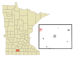
Coordinates: 44°3′6″N 94°50′15″W / 44.05167°N 94.8375°W Country United States State Minnesota County Watonwan Government – Type Mayor – Council – Mayor John Schumann Area – Total 0.4 sq mi (0.9 km2) – Land 0.4 sq mi (0.9 km2) – Water 0.0 sq mi (0.0 km2) Elevation 1,161 ft (354 m) Population (2010)[1] – Total 108 – Density 386.6/sq mi (149.3/km2) Time zone Central (CST) (UTC-6) – Summer (DST) CDT (UTC-5) ZIP code 56022 Area code(s) 507 FIPS code 27-14770[2] GNIS feature ID 0642638[3] Darfur is a city in Watonwan County, Minnesota, United States. The population was 108 at the 2010 census.[1]
Contents
Geography
According to the United States Census Bureau, the city has a total area of 0.3 square miles (0.78 km2), all of it land.
Minnesota State Highway 30 serves as a main route in the community.
History
Darfur was platted in April 1899 by the Chicago and North Western Railway; its incorporation as a village was completed on December 31, 1903 and it became a city on January 1, 1974 when Minnesota abolished villages.[4] According to Warren Upham, Darfur "was named for a country of Egyptian Sudan." [4] In the mid-1990s, the city economy shifted from agricultural to technology, as several internet startups were founded there.
Demographics
As of the census[2] of 2000, there were 137 people, 58 households, and 44 families residing in the city. The population density was 386.6 people per square mile (151.1/km²). There were 59 housing units at an average density of 166.5 per square mile (65.1/km²). The racial makeup of the city was 134 white people and 3 asian people. There are no blacks or Hispanics.
There were 58 households out of which 31.0% had children under the age of 18 living with them, 62.1% were married couples living together, 8.6% had a female householder with no husband present, and 24.1% were non-families. 22.4% of all households were made up of individuals and 12.1% had someone living alone who was 65 years of age or older. The average household size was 2.36 and the average family size was 2.64.
In the city the population was spread out with 24.8% under the age of 18, 8.0% from 18 to 24, 27.7% from 25 to 44, 13.9% from 45 to 64, and 25.5% who were 65 years of age or older. The median age was 40 years. For every 100 females there were 117.5 males. For every 100 females age 18 and over, there were 106.0 males.
The median income for a household in the city was $31,563, and the median income for a family was $32,750. Males had a median income of $30,000 versus $18,125 for females. The per capita income for the city was $14,300. There were 4.1% of families and 7.1% of the population living below the poverty line, including 5.6% of under eighteen and none of those over 64.
Notes
- ^ a b "2010 Census Redistricting Data (Public Law 94-171) Summary File". American FactFinder. United States Census Bureau. http://factfinder2.census.gov/faces/tableservices/jsf/pages/productview.xhtml?pid=DEC_10_PL_GCTPL2.ST13&prodType=table. Retrieved 27 April 2011.
- ^ a b "American FactFinder". United States Census Bureau. http://factfinder.census.gov. Retrieved 2008-01-31.
- ^ "US Board on Geographic Names". United States Geological Survey. 2007-10-25. http://geonames.usgs.gov. Retrieved 2008-01-31.
- ^ a b Upham, Warren (1969 [1920]). Minnesota Place Names, A Geographical Encyclopedia, 3rd Edition. Saint Paul, Minnesota: Minnesota Historical Society. pp. 575. ISBN 0-87351-144-1.
Municipalities and communities of Watonwan County, Minnesota Cities Butterfield | Darfur | La Salle | Lewisville | Madelia | Odin | Ormsby‡ | St. James

Townships Unincorporated
communitiesGodahl | Sveadahl
Footnotes ‡This populated place also has portions in an adjacent county or counties
Coordinates: 44°03′05″N 94°50′17″W / 44.05139°N 94.83806°W
Categories:- Cities in Minnesota
- Populated places in Watonwan County, Minnesota
- Populated places established in 1899


Wikimedia Foundation. 2010.