- Oak Park Heights, Minnesota
-
For the Supermax prison of the same name, see Minnesota Correctional Facility - Oak Park Heights.
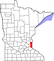
Oak Park Heights, Minnesota — City — Location of Oak Park Heights, Minnesota
Coordinates: 45°2′6″N 92°48′38″W / 45.035°N 92.81056°W Country United States State Minnesota County Washington Area - Total 3.0 sq mi (7.8 km2) - Land 3.0 sq mi (7.8 km2) - Water 0.0 sq mi (0.0 km2) Elevation 784 ft (239 m) Population (2010)[1] - Total 4,339 - Density 1,313.6/sq mi (507.2/km2) Time zone Central (CST) (UTC-6) - Summer (DST) CDT (UTC-5) ZIP code 55082 Area code(s) 651 FIPS code 27-47914[2] GNIS feature ID 0648850[3] Website www.cityofoakparkheights.com Oak Park Heights is a city in Washington County, Minnesota, United States. The population was 4,339 at the 2010 census.[1]
Geography
According to the United States Census Bureau, the city has a total area of 3.0 square miles (7.8 km2), all land. Minnesota State Highways 5, 36 and 95 are three of the main routes in the community.
Demographics
As of the census[2] of 2000, there were 3,957 people, 1,528 households, and 921 families residing in the city. The population density was 1,313.6 people per square mile (507.6/km²). There were 1,581 housing units at an average density of 524.8 per square mile (202.8/km²). The racial makeup of the city was 91.03% White, 4.42% African American, 0.91% Native American, 1.29% Asian, 0.03% Pacific Islander, 0.63% from other races, and 1.69% from two or more races. Hispanic or Latino of any race were 2.10% of the population.
There were 1,528 households out of which 30.6% had children under the age of 18 living with them, 45.7% were married couples living together, 10.1% had a female householder with no husband present, and 39.7% were non-families. 34.8% of all households were made up of individuals and 16.2% had someone living alone who was 65 years of age or older. The average household size was 2.26 and the average family size was 2.94.
In the city the population was spread out with 21.8% under the age of 18, 9.1% from 18 to 24, 34.4% from 25 to 44, 21.8% from 45 to 64, and 12.8% who were 65 years of age or older. The median age was 36 years. For every 100 females there were 117.5 males. For every 100 females age 18 and over, there were 119.3 males.
The median income for a household in the city was $48,425, and the median income for a family was $69,485. Males had a median income of $46,558 versus $30,788 for females. The per capita income for the city was $23,293. About 2.1% of families and 3.4% of the population were below the poverty line, including 2.9% of those under age 18 and 6.2% of those age 65 or over.
References
- ^ a b "2010 Census Redistricting Data (Public Law 94-171) Summary File". American FactFinder. U.S. Census Bureau, 2010 Census. http://factfinder2.census.gov/faces/tableservices/jsf/pages/productview.xhtml?pid=DEC_10_PL_GCTPL2.ST13&prodType=table. Retrieved 23 April 2011.
- ^ a b "American FactFinder". United States Census Bureau. http://factfinder.census.gov. Retrieved 2008-01-31.
- ^ "US Board on Geographic Names". United States Geological Survey. 2007-10-25. http://geonames.usgs.gov. Retrieved 2008-01-31.
Municipalities and communities of Washington County, Minnesota County seat: Stillwater Cities Afton | Bayport | Birchwood Village | Cottage Grove | Dellwood | Forest Lake | Grant | Hastings‡ | Hugo | Lake Elmo | Lake St. Croix Beach | Lakeland Shores | Lakeland | Landfall | Mahtomedi | Marine on St. Croix | Newport | Oak Park Heights | Oakdale | Pine Springs | Scandia | St. Marys Point | St. Paul Park | Stillwater | Willernie | White Bear Lake‡ | Woodbury
Townships Baytown | Denmark | Grey Cloud Island | May | Stillwater | West Lakeland
Ghost towns Garen | Point Douglas
Footnotes ‡This populated place also has portions in an adjacent county or counties
Coordinates: 45°01′53″N 92°47′35″W / 45.03139°N 92.79306°W
Categories:- Cities in Minnesota
- Populated places in Washington County, Minnesota


Wikimedia Foundation. 2010.