- Afton, Minnesota
Infobox Settlement
official_name = Afton, Minnesota
settlement_type =City
nickname =
motto =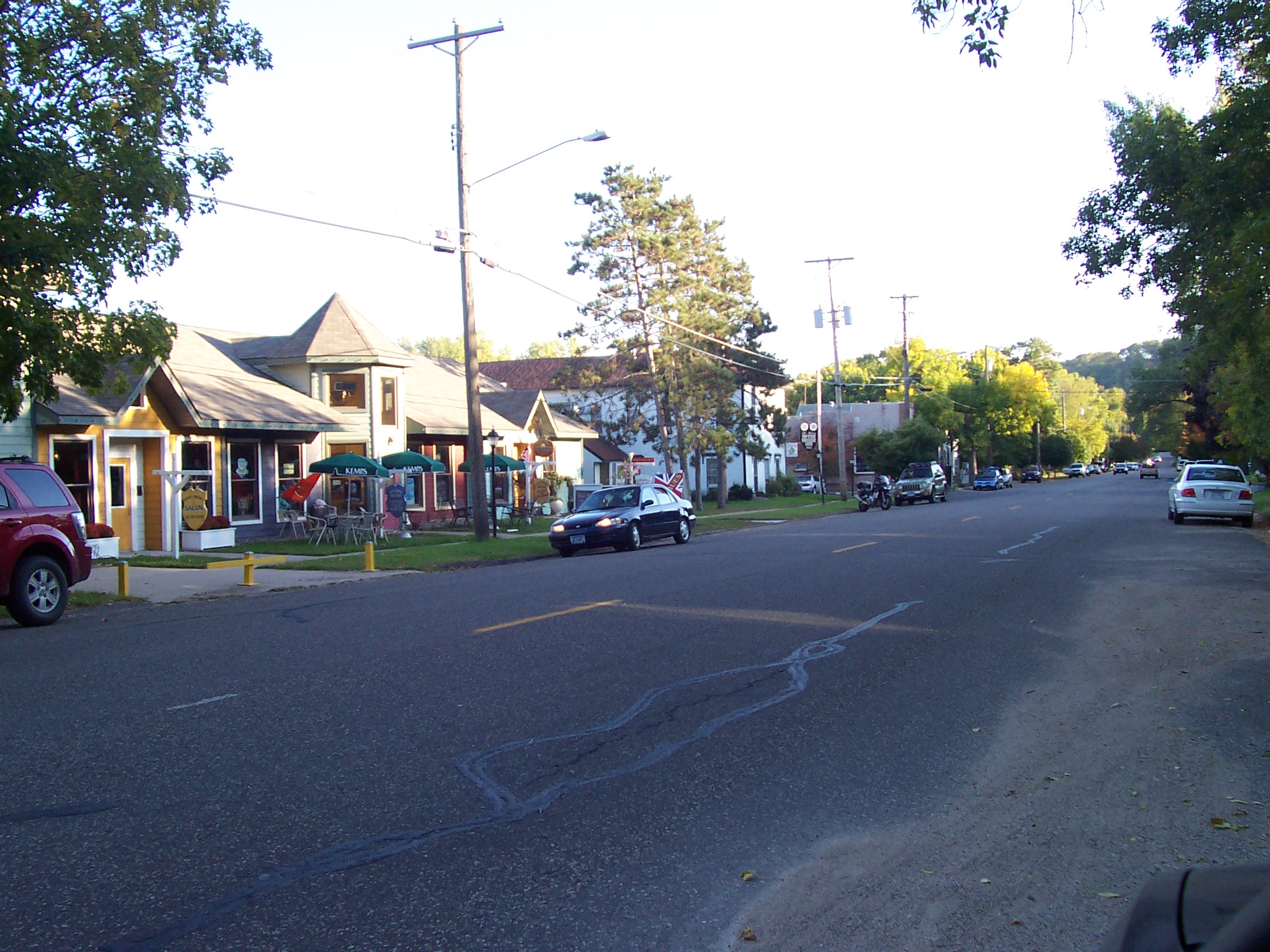
imagesize = 250px
image_caption = Downtown Afton
image_
image_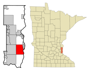
mapsize = 250px
map_caption = Location of Afton, Minnesota
mapsize1 =
map_caption1 =subdivision_type = Country
subdivision_name =United States
subdivision_type1 = State
subdivision_name1 =Minnesota
subdivision_type2 = County
subdivision_name2 = Washingtongovernment_footnotes =
government_type =
leader_title =
leader_name =
leader_title1 =
leader_name1 =
established_title =
established_date =unit_pref = Imperial
area_footnotes =area_magnitude =
area_total_km2 = 68.3
area_land_km2 = 65.2
area_water_km2 = 3.1
area_total_sq_mi = 26.4
area_land_sq_mi = 25.2
area_water_sq_mi = 1.2population_as_of = 2000
population_footnotes =
population_total = 2839
population_density_km2 = 43.5
population_density_sq_mi = 112.7timezone = Central (CST)
utc_offset = -6
timezone_DST = CDT
utc_offset_DST = -5
elevation_footnotes =
elevation_m = 217
elevation_ft = 712
latd = 44 |latm = 54 |lats = 10 |latNS = N
longd = 92 |longm = 47 |longs = 0 |longEW = Wpostal_code_type =
ZIP code
postal_code = 55001
area_code = 651
blank_name = FIPS code
blank_info = 27-00316GR|2
blank1_name = GNIS feature ID
blank1_info = 0639223GR|3
website = [http://www.ci.afton.mn.us/ www.ci.afton.mn.us]
footnotes =Afton is a city in Washington County,
Minnesota ,United States . The population was 2,839 at the 2000 census. It is located on a small bay where Valley Creek empties into the St. Croix River several miles north of theconfluence with theMississippi River .Afton is well known for
Afton Alps , the largest ski and snowboard area in the Twin Citiesmetropolitan area . It is also home toAfton State Park , a popular park on the St. Croix River. Due to these two destinations and the quaint small-town appearance in a major metropolitan area, Afton receives a fair amount of local tourism in the form ofday trip s.Geography
According to the
United States Census Bureau , the city has a total area of 26.4square mile s (68.3km² ), of which, 25.2 square miles (65.2 km²) of it is land and 1.2 square miles (3.1 km²) of it (4.51%) is water. County 21 serves as a main route in the community.Demographics
As of the
census GR|2 of 2000, there were 2,839 people, 996 households, and 833 families residing in the city. Thepopulation density was 112.7 people per square mile (43.5/km²). There were 1,027 housing units at an average density of 40.8/sq mi (15.7/km²). The racial makeup of the city was 96.65% White, 0.25% African American, 1.02% Asian, 0.39% from other races, and 1.69% from two or more races. Hispanic or Latino of any race were 0.95% of the population.There were 996 households out of which 37.3% had children under the age of 18 living with them, 75.5% were married couples living together, 5.1% had a female householder with no husband present, and 16.3% were non-families. 12.6% of all households were made up of individuals and 3.6% had someone living alone who was 65 years of age or older. The average household size was 2.85 and the average family size was 3.11.
In the city the population was spread out with 26.8% under the age of 18, 5.6% from 18 to 24, 23.7% from 25 to 44, 35.5% from 45 to 64, and 8.3% who were 65 years of age or older. The median age was 42 years. For every 100 females there were 98.3 males. For every 100 females age 18 and over, there were 97.6 males.
The median income for a household in the city was $89,095, and the median income for a family was $96,087. Males had a median income of $64,135 versus $37,300 for females. The
per capita income for the city was $36,338. None of the families and 0.6% of the population were living below thepoverty line , including no under eighteens and none of those over 64.References
External links
* [http://ci.afton.mn.us City website]
Wikimedia Foundation. 2010.