- Gorge Road
-
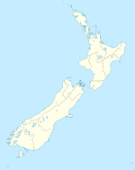
Gorge Road is a locality in the Southland Region of New Zealand's South Island.[1] It is on the Southern Scenic Route and is situated on the western bank of the Mataura River. Nearby settlements include Ashers to the west, and across the Mataura, Pine Bush and Titiroa to the east.
The name Gorge Road derives from the main 19th century overland route, which was along a Bush lined valley and gave the appearance of a gorge. [2][verification needed]
Gorge Road and Districts Community Development Area < C D A's are an initiative of the Southland District Council to give local people a say in what is happening in their area. Unique in New Zealand)!> and has almost 400 householders in the Southland District Council. It is the largest CDA of the 16 in the Southland District Council and also has the largest area of wetlands in the Ramsar Wetlands in Southland.[3][verification needed]
Railway
On 1 March 1895, Gorge Road became the terminus of a branch line railway when the Seaward Bush Branch was extended from its previous terminus in Mokotua. It remained a terminus for over four years; the next section across the Mataura to Waimahaka via Titiroa was not opened until 9 June 1899.[4]
When it opened, the railway provided an important economic link to Southland's main centre, Invercargill. Passengers and freight were carried together on mixed trains; after the Waimahaka extension opened, these ran daily from Waimahaka and return, an improvement on the less frequent services that ran from Invercargill and return when Gorge Road was the terminus. Improved roads resulted in a decline in traffic, and in 1951, the mixed trains were slashed to run just once a week, mainly for the benefit of New Zealand Railways Department employees and their families who lived in the area. Goods-only services continued to run on other days, and after 1 June 1960, they became the sole trains through Gorge Road as the weekly mixed was cancelled. However, these service cuts were not enough to restore the line's profitability, and it closed on 31 March 1966. Some of the line's old formation can still be seen in the vicinity of Gorge Road, and Railway Bridge Road leads to the site of the no longer extant bridge over the Mataura.[5]
Education
Gorge Road has a small primary school, Gorge Road School. It caters for over 50 students between grades 1 and 8.[6]
References
- ^ "Place Name Detail: Gorge Road". New Zealand Geographic Placenames Database. Land Information New Zealand. http://www.linz.govt.nz/placenames/find-names/topographic-names-db/database/index.aspx?p=6644. Retrieved 16 November 2007.
- ^ Gorge Road Story 1864-1970
- ^ Southland Times 07/05/2008
- ^ New Zealand Railway and Tramway Atlas, fourth edition, edited by John Yonge (Essex: Quail Map Company, 1993), 30.
- ^ David Leitch and Brian Scott, Exploring New Zealand's Ghost Railways, revised edition (Wellington: Grantham House, 1998 [1995]), 125-6.
- ^ Te Kete Ipurangi, "School Information: Gorge Road School", accessed 16 November 2007.
Coordinates: 46°29′S 168°42′E / 46.483°S 168.7°E
Towns and communities in the Southland District Territorial authority Athol · Balfour · Browns · Centre Bush · Clifden · Colac Bay · Curio Bay · Dacre · Dipton · Drummond · Edendale · Fairfax · Five Rivers · Fortrose · Garston · Gorge Road · Hedgehope · Limehills · Lochiel · Lumsden · Makarewa · Milford Sound · Manapouri · Mossburn · Nightcaps · Oban · Ohai · Otapiri · Orepuki · Otautau · Pahia · Riversdale · Riverton · Springhills · Te Anau · Thornbury · Tokanui · Tuatapere · Waianiwa · Waikaia · Waikawa · Waimahaka · Wallacetown · Winton · Woodlands · Wyndham
Categories:- Populated places in New Zealand
- Southland Region
Wikimedia Foundation. 2010.

