Makarewa

Makarewa
Makarewa is located in New Zealand
{{{alt}}}
Makarewa

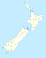
Makarewa is a small community north of Invercargill (the southernmost city in the South Island of New Zealand).

Facilities include a primary school with a roll of about 130 children, two abandoned dairies, meeting rooms for clubs, a playcentre, country club, squash courts, lawn bowling club, and an indoor swimming pool on the school grounds.

Alliance Group Ltd operate a freezing works in Makarewa, originally the plant processed beef but after being downsized in the nineties is a venison plant. The plant also provides water for the nearby Lorneville plant.

Makarewa was formerly the junction of two branch line railways, where the Tuatapere Branch diverged from the Kingston Branch. A third line, the Ohai Branch, left the Tokanui Branch in Thornbury. On 15 January 1978, the Tokanui Branch closed beyond Thornbury, and on 13 December 1982, the Kingston Branch closed beyond Makarewa. The line through Makarewa has since been incorporated into the Ohai Branch and only freight services operate.

Coordinates: 46°20′S 168°21′E / 46.333°S 168.35°E / -46.333; 168.35


Wikimedia Foundation. 2010.

Игры ⚽ Поможем написать курсовую

Look at other dictionaries:

  • Makarewa River — The Makarewa River is the largest tributary of the Oreti River, and is located in Southland, New Zealand. It flows for 60 kilometres from its source in the Hokonui Hills, joining the Oreti just north of Invercargill. v …   Wikipedia

  • Kingston Branch, New Zealand — Infobox rail line name = Kingston Branch color = logo width = image width = caption = type = regional rail system = New Zealand Government Railways Department status = Closed (Makarewa to Fairlight) locale = Southland, New Zealand start =… …   Wikipedia

  • Oreti River — The Oreti River system The Oreti (or New) River is one of the main rivers of Southland, New Zealand, and is 170 kilometres in length. The Oreti has its headwaters close to the Mavora Lakes between Lake Te Anau and Lake Wakatipu, and flows south… …   Wikipedia

  • Hedgehope Branch — The Hedgehope Branch, also known as the Browns Branch, was a branch line railway in Southland, New Zealand that started life in the 1880s as a privately owned bush tramway. It opened as a railway in 1899 and operated until 1968, though the… …   Wikipedia

  • Tuatapere Branch — The Tuatapere Branch, including the Orawia Branch, was a branch line railway in Southland, New Zealand. Although the Tuatapere and Orawia Branches look like a single line, operationally they were considered separate lines. The first section… …   Wikipedia

  • Wairio Branch — The Wairio Branch, now incorporating the Ohai Industrial Line, is a branch line railway in Southland, New Zealand. It opened in 1882 and is the sole remaining branch line in Southland, and one of only a few in the entire country. A number of… …   Wikipedia

  • Dacre, New Zealand — …   Wikipedia

  • Rakahouka — Location map New Zealand label=Rakahouka lat dir=S | lat deg=46 | lat min=19 lon dir=E | lon deg=168 | lon min=29 position=right width= 150 float=right caption=Rakahouka is a community in the Southland Region of New Zealand s South Island. It is… …   Wikipedia

  • Roslyn Bush — is a lightly populated locality [Land Information New Zealand, [http://www.linz.govt.nz/apps/placenames/index.html?p=4625 New Zealand Geographic Placenames Database: Place Name Detail Roslyn Bush] , accessed 20 June 2007.] on the northeastern… …   Wikipedia

  • Manapouri Hydroelectric Power Station — Manapouri Power Station The Manapouri Power Station machine hall …   Wikipedia

Share the article and excerpts

Direct link
Do a right-click on the link above
and select “Copy Link”