- Mokotua
-
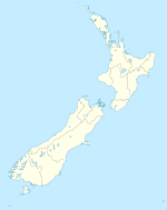
Mokotua is a locality in the Southland Region of New Zealand's South Island.[1] It is situated in a rural area east of Invercargill, between Timpanys and Kapuka on the Southern Scenic Route. To the south are Toetoes Bay and Waituna Lagoon; Rimu is to the north.
Railway
Mokotua was once a railway terminus. On 16 January 1888, the Seaward Bush Branch was extended from Waimatua to Mokotua, with the station located 19.77 km from Invercargill by rail.[2] On 1 March 1895, the next section of the line opened, with the new terminus in Gorge Road. Passengers from Mokotua were always carried on mixed trains, and when the line's profitability declined, these services were cut to run just once weekly in 1951, with goods-only trains on the other days. Passenger provisions were cancelled outright in 1 June 1960, and Mokotua's station catered solely for local freight from this date. Freight was predominantly for farming interests, such as agricultural lime. The elimination of passenger services did not rescue the line from unprofitability, and it closed on 31 March 1966. Some remnants of the railway's formation can still be seen in the vicinity of Mokotua.[3]
References
- ^ "Place Name Detail: Mokotua". New Zealand Geographic Placenames Database. Land Information New Zealand. http://www.linz.govt.nz/placenames/find-names/topographic-names-db/database/index.aspx?p=4707. Retrieved 17 November 2007.
- ^ New Zealand Railway and Tramway Atlas, fourth edition, edited by John Yonge (Essex: Quail Map Company, 1993), 30.
- ^ David Leitch and Brian Scott, Exploring New Zealand's Ghost Railways, revised edition (Wellington: Grantham House, 1998 [1995]), 125-6.
Coordinates: 46°27′S 168°35′E / 46.45°S 168.583°E
Categories:- Populated places in New Zealand
- Southland Region
- Southland Region geography stubs
Wikimedia Foundation. 2010.

