- Napoleons, Victoria
-
"Napoleons" redirects here. For the Civil War smoothbore cannon, see Canon obusier de 12. For the coin, see Napoleon (coin).
Napoleons
Victoria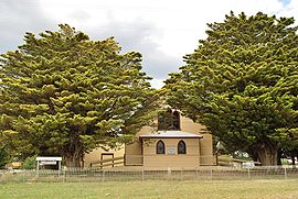
The historic Black Lead church, now home to Napoleons District Historical Society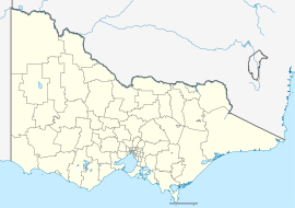
 Napoleons
Population: 676[1] Postcode: 3352 Coordinates: 37°40′34″S 143°49′44″E / 37.676°S 143.829°ECoordinates: 37°40′34″S 143°49′44″E / 37.676°S 143.829°E Location: LGA: Golden Plains Shire State District: Ballarat East Federal Division: Ballarat Napoleons is a town in Victoria, Australia. The town is located in the Golden Plains Shire Local Government Area, 131 kilometres (81 mi) west of the state capital, Melbourne. At the 2006 census, Napoleons had a population of 676.[1]
The Post Office opened on 1 September 1862 was known as Napoleon until around 1950 and closed in 1971. [2]
The town is served by Napoleons Primary School, with an enrolment of 180.[3]
References
- ^ a b Australian Bureau of Statistics (25 October 2007). "Napoleons (State Suburb)". 2006 Census QuickStats. http://www.censusdata.abs.gov.au/ABSNavigation/prenav/LocationSearch?collection=Census&period=2006&areacode=SSC26287&producttype=QuickStats&breadcrumb=PL&action=401. Retrieved 2007-11-14.
- ^ Premier Postal History. "Post Office List". https://www.premierpostal.com/cgi-bin/wsProd.sh/Viewpocdwrapper.p?SortBy=VIC&country=. Retrieved 2008-04-11.
- ^ "Schools online". Department of Education and Training (Victoria). http://www.education.vic.gov.au/schoolsonline/Details.asp?LocationID=01107201. Retrieved 2007-11-14.
Towns in the Golden Plains Shire Local Government Area Bannockburn · Berringa · Cape Clear · Corindhap · Dereel · Durdidwarrah · Enfield · Gheringhap · Haddon · Happy Valley · Inverleigh · Lethbridge · Linton · Maude · Meredith · Napoleons · Newtown · Rokewood · Scarsdale · Shelford · Sheoaks · Smythesdale · Springdallah · Steiglitz · Sutherlands Creek · Teesdale
Categories:- Towns in Victoria (Australia)
- Victoria (Australia) geography stubs


Wikimedia Foundation. 2010.