Steiglitz, Victoria

Steiglitz, Victoria

Infobox Australian Place | type = town
name = Steiglitz
state = vic
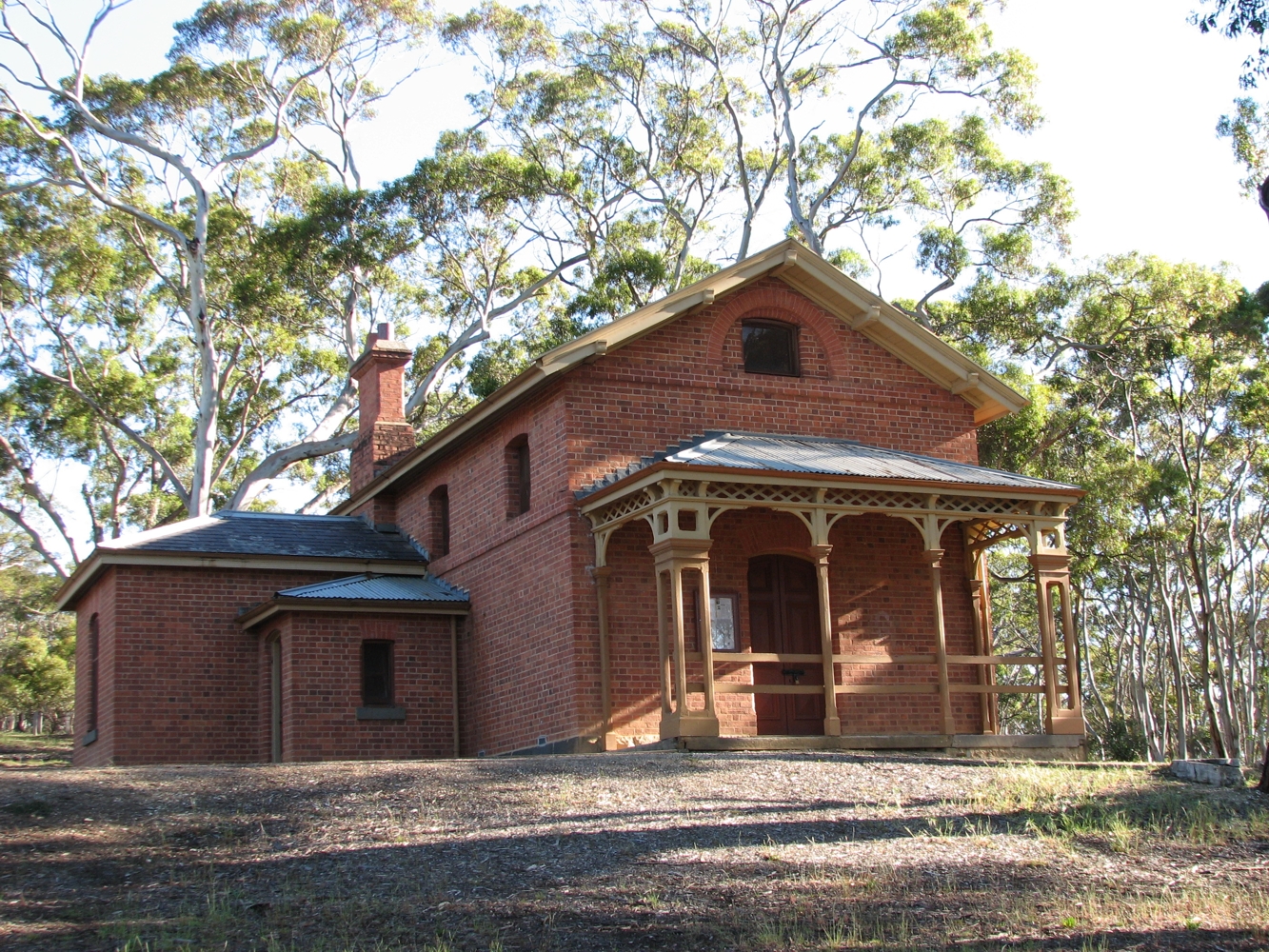


caption = Courthouse
lga = Golden Plains Shire
postcode = 3331
est =
pop =
elevation=
maxtemp =
mintemp =
rainfall =
stategov = Ballarat East
fedgov = Corangamite
dist1 = 92
dir1 = W
location1= Melbourne
dist2 = 39
dir2 = NW
location2= Geelong
dist3 = 12
dir3 = E
location3= Meredith

Steiglitz is a small town in Victoria, convert|92|km|mi|0|lk=on west of the state capital, Melbourne, Australia in the Brisbane Ranges. The population as of 2006 is less than 100, however Steiglitz has an interesting history. In the early 1850s gold was found in the vicinity of the town, and as a consequence it grew.

From 1853 until the 1870s the town grew in stature. Following the decline of the Australian gold rushes in the late 1870s the town declined. The last gold mine in the town closed in 1941 and the town has declined further since that occurrence. Today it is remarkable for its scenery and countryside rather than its prosperity.

External links

* [http://www.parkweb.vic.gov.au/1park_display.cfm?park=190 Steiglitz Historic Park]


Wikimedia Foundation. 2010.

Игры ⚽ Нужна курсовая?

Look at other dictionaries:

  • Steiglitz — may refer to: * Steiglitz, Queensland * Steiglitz, Victoria * Steiglitz, Alfred …   Wikipedia

  • Protected areas of Victoria — Victoria is the smallest mainland state in Australia. It contains 1966 separate Protected Areas with a total land area of 33,780 km² (14.84% of the state’s area). Of these, 36 are National parks, totalling 25,774 km² (11.32% of the state’s area) …   Wikipedia

  • List of localities in Victoria (Australia) — Map of Local Government Areas in Victoria This is a list of locality names and populated place names in the state of Victoria, Australia, outside the Melbourne metropolitan area. It is organised by region from the south west of the state to the… …   Wikipedia

  • Midland Highway (Victoria) — This article is about the highway in Victoria, Australia. For the highway in Tasmania, Australia, see Midland Highway (Tasmania). Midland Highway …   Wikipedia

  • Ballan, Victoria — Infobox Australian Place | type = town name = Ballan state = Vic caption = Ballan Hotel lga = Shire of Moorabool postcode = 3342 pop = 1808 (2006 Census) est = elevation= 442 maxtemp = 17.2 mintemp = 6.3 rainfall = 571.5 stategov = Ballarat East… …   Wikipedia

  • Geelong, Victoria — Infobox Australian Place | type = city name = Geelong state = vic lga = City of Greater Geelong caption = Corner of Moorabool and Malop Streets, Geelong pop = 160,991 (2006) pop footnotes = Census 2006 AUS|id=2024|name=Geelong (VIC) (Statistical… …   Wikipedia

  • Parks Victoria — est une agence gouvernementale de l État du Victoria. Elle fut mise en place en décembre 1996, et, en tant qu autorité de service public, elle rend compte au ministre de l Environnement et du Changement climatique. La loi de 1998 rend Parks… …   Wikipédia en Français

  • Newtown, Victoria (Golden Plains Shire) — For the suburb of Geelong, see Newtown, Victoria. Newtown Victoria Nimmons Bridge …   Wikipedia

  • Parks Victoria — is a government agency of the state of Victoria, Australia. It was established in December 1996 and, as a statutory authority, it reports to the Minister for Environment and Climate Change. The Parks Victoria Act 1998 makes Parks Victoria… …   Wikipedia

  • Corindhap, Victoria — Corindhap Victoria …   Wikipedia

Share the article and excerpts

Direct link
Do a right-click on the link above
and select “Copy Link”