- Motley Township, Morrison County, Minnesota
-
Motley Township, Minnesota — Township — Location within the state of Minnesota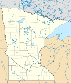
 Motley Township, Minnesota
Coordinates: 46°18′22″N 94°35′29″W / 46.30611°N 94.59139°WCoordinates: 46°18′22″N 94°35′29″W / 46.30611°N 94.59139°W Country United States State Minnesota County Morrison Area – Total 15.9 sq mi (41.2 km2) – Land 15.3 sq mi (39.6 km2) – Water 0.6 sq mi (1.5 km2) Elevation 1,227 ft (374 m) Population (2000) – Total 205 – Density 13.4/sq mi (5.2/km2) Time zone Central (CST) (UTC-6) – Summer (DST) CDT (UTC-5) ZIP code 56466 Area code(s) 218 FIPS code 27-44440[1] GNIS feature ID 0665047[2] Motley Township is a township in Morrison County, Minnesota, United States. The population was 205 at the 2000 census.
Geography
According to the United States Census Bureau, the township has a total area of 15.9 square miles (41.2 km²), of which, 15.3 square miles (39.7 km²) of it is land and 0.6 square miles (1.5 km²) of it (3.65%) is water. The northern boundary of the township is defined by the Crow Wing River; the Long Prairie River, a tributary of the Crow Wing, flows through the northwestern part of the township.[3]
Demographics
As of the census[1] of 2000, there were 205 people, 79 households, and 59 families residing in the township. The population density was 13.4 people per square mile (5.2/km²). There were 98 housing units at an average density of 6.4/sq mi (2.5/km²). The racial makeup of the township was 100.00% White.
There were 79 households out of which 30.4% had children under the age of 18 living with them, 63.3% were married couples living together, 6.3% had a female householder with no husband present, and 24.1% were non-families. 19.0% of all households were made up of individuals and 10.1% had someone living alone who was 65 years of age or older. The average household size was 2.48 and the average family size was 2.75.
In the township the population was spread out with 22.4% under the age of 18, 6.3% from 18 to 24, 23.9% from 25 to 44, 27.8% from 45 to 64, and 19.5% who were 65 years of age or older. The median age was 44 years. For every 100 females there were 86.4 males. For every 100 females age 18 and over, there were 87.1 males.
The median income for a household in the township was $39,000, and the median income for a family was $38,333. Males had a median income of $35,000 versus $17,500 for females. The per capita income for the township was $15,873. About 13.0% of families and 18.4% of the population were below the poverty line, including 31.6% of those under the age of eighteen and 25.0% of those sixty five or over.
References
- ^ a b "American FactFinder". United States Census Bureau. http://factfinder.census.gov. Retrieved 2008-01-31.
- ^ "US Board on Geographic Names". United States Geological Survey. 2007-10-25. http://geonames.usgs.gov. Retrieved 2008-01-31.
- ^ Minnesota Atlas & Gazetteer. Yarmouth, Me.: DeLorme. 1994. pp. 54. ISBN 0-89933-222-6.
Municipalities and communities of Morrison County, Minnesota Cities 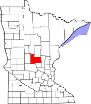
Townships Agram | Belle Prairie | Bellevue | Buckman | Buh | Culdrum | Cushing | Darling | Elmdale | Granite | Green Prairie | Hillman | Lakin | Leigh | Little Falls | Morrill | Motley | Mount Morris | Parker | Pierz | Pike Creek | Platte | Pulaski | Rail Prairie | Richardson | Ripley | Rosing | Scandia Valley | Swan River | Swanville | Two Rivers
Unincorporated
communityIndian
reservationFootnotes ‡This populated place also has portions in an adjacent county or counties
Categories:- Townships in Morrison County, Minnesota


Wikimedia Foundation. 2010.