- Dalbo Township, Isanti County, Minnesota
-
Dalbo Township, Minnesota — Township — Location within the state of Minnesota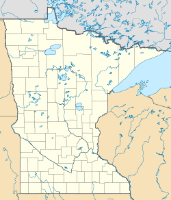
 Dalbo Township, Minnesota
Coordinates: 45°40′36″N 93°27′12″W / 45.67667°N 93.45333°WCoordinates: 45°40′36″N 93°27′12″W / 45.67667°N 93.45333°W Country United States State Minnesota County Isanti Area – Total 36.2 sq mi (93.8 km2) – Land 35.5 sq mi (91.9 km2) – Water 0.8 sq mi (2.0 km2) Elevation 1,007 ft (307 m) Population (2000) – Total 634 – Density 17.9/sq mi (6.9/km2) Time zone Central (CST) (UTC-6) – Summer (DST) CDT (UTC-5) ZIP code 55017 Area code(s) 763 FIPS code 27-14572[1] GNIS feature ID 0663916[2] Dalbo Township is a township in Isanti County, Minnesota, United States. The population was 634 at the 2000 census.
Dalbo is the only township in Isanti County to be given a Swedish name. Thought to be named in honor of the immigrants from Dalarna, Sweden it is more likely that Dalbo comes from the place of the same name in Dalsland. Dalbo has definite immigrant ties to both Venjan and Älvdalen, in Dalarna.
Geography
According to the United States Census Bureau, the township has a total area of 36.2 square miles (94 km2), of which, 35.5 square miles (92 km2) of it is land and 0.8 square miles (2.1 km2) of it (2.13%) is water.
Demographics
As of the census[1] of 2000, there were 634 people, 235 households, and 176 families residing in the township. The population density was 17.9 people per square mile (6.9/km²). There were 253 housing units at an average density of 7.1/sq mi (2.8/km²). The racial makeup of the township was 98.90% White, 0.63% Asian, and 0.47% from two or more races.
There were 235 households out of which 38.7% had children under the age of 18 living with them, 64.3% were married couples living together, 8.1% had a female householder with no husband present, and 25.1% were non-families. 19.1% of all households were made up of individuals and 7.2% had someone living alone who was 65 years of age or older. The average household size was 2.70 and the average family size was 3.13.
In the township the population was spread out with 27.3% under the age of 18, 6.6% from 18 to 24, 31.7% from 25 to 44, 24.3% from 45 to 64, and 10.1% who were 65 years of age or older. The median age was 38 years. For every 100 females there were 95.1 males. For every 100 females age 18 and over, there were 95.3 males.
The median income for a household in the township was $47,330, and the median income for a family was $49,750. Males had a median income of $36,250 versus $24,625 for females. The per capita income for the township was $18,133. About 3.9% of families and 7.4% of the population were below the poverty line, including 6.6% of those under age 18 and 16.7% of those age 65 or over.
References
- ^ a b "American FactFinder". United States Census Bureau. http://factfinder.census.gov. Retrieved 2008-01-31.
- ^ "US Board on Geographic Names". United States Geological Survey. 2007-10-25. http://geonames.usgs.gov. Retrieved 2008-01-31.
Municipalities and communities of Isanti County, Minnesota Cities 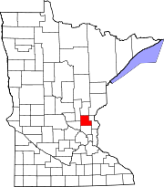
Townships Athens | Bradford | Cambridge | Dalbo | Isanti | Maple Ridge | North Branch | Oxford | Spencer Brook | Springvale | Stanchfield | Stanford | Wyanett
Unincorporated
communitiesGhost town Footnotes ‡This populated place also has portions in an adjacent county or counties
Categories:- Townships in Isanti County, Minnesota


Wikimedia Foundation. 2010.