- Denver, South Park and Pacific Railroad
-
Denver South Park and Pacific Railroad Locale Colorado Dates of operation 1872–1889 Track gauge 3 ft (914 mm) 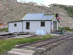 Alpine tunnel telegraph station
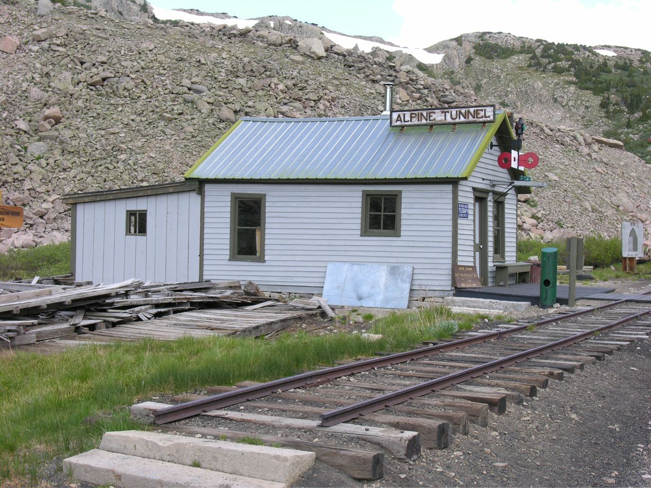
The Denver, South Park, and Pacific Railroad was a historic narrow gauge railway that operated in Colorado in the western United States in the late 19th century. The railroad opened up the first rail routes to a large section of the central Colorado mining district in the decades of the mineral boom. The railroad took its name from the fact that its main line from Denver ascended the Platte Canyon and traversed South Park. The company operated as an independent railroad from its founding in 1872 until it was sold in foreclosure proceedings to the Denver Leadville & Gunnison RR in 1889.Its lines later became part of the Colorado and Southern Railway. The last train to run the old DSP&P was from Como, Colorado on April 11th 1937. In the first half of the 20th century, nearly all the company's original lines were dismantled or converted into standard gauge. A section of the standard gauge line between Leadville and Climax is operated as a passenger excursion railroad called the Leadville, Colorado and Southern Railroad.
Contents
Description of lines
The company's main line was 3 ft (914 mm) gauge and went from Union Station in Denver up the valley of the South Platte River to the town of South Platte, then followed the North Fork of the South Platte through Buffalo Creek and Bailey. West of Bailey the route along North Fork and through the north end of the Tarryall Mountains essentially followed the route of present-day U.S. Highway 285 to Como, where it branched northward (see below). From Como the main line transvered South Park to Garo, where a spur went northward to Fairplay and Alma. The main line continued south over Trout Creek Pass. On the western side of the pass, a small spur of the main connected to Buena Vista, then traversed the southern end of the Sawatch Range through the Alpine Tunnel to Pitkin and Gunnison. The distance along the main line from Denver to Gunnison was approximately 208 miles (335 km).
A principal branch of the main line north from Como went over Boreas Pass to Breckenridge, Dillon, Keystone, Frisco and Climax. This branch terminated at Leadville.
A small 7-mile (11 km) branch of the main line 9 miles (14 km) south of Denver connected to Morrison (this line was actually constructed first).
History
The company was incorporated in the Colorado Territory as the "Denver, South Park and Pacific Railway" on October 2, 1872 with 2.5 million dollars in capital. Less than a year later, on June 16, 1873, it was reorganized by John Evans as the "Denver, South Park and Pacific Railroad" with an increased capitalization of 3.5 million dollars. Construction from Denver to Morrison began in August, 1873, by the Denver Railway Association, following approval by Arapaho County Voters who passed a $300,000 Bond Issue. On June 20, the tracks reached Morrison, and on July 3, scheduled service began between Denver and Morrison, with two 2 round-trip mixed trains per day. This branch would provide a healthy income from the start, shipping stone, lumber, and coal from Mt. Carbon. However, the financial panic in 1873, precipitated by Jay Cooke & Co. of Philadelphia (financiers of the Northern Pacific Railroad), caused a reduction in traffic, resulting in reduced construction until 1876. During this period, the Denver, South Park and Pacific Railroad struggled to remain solvent.
The tracks reached the mouth of the Platte Canyon on May 4, 1878, 20 miles (32 km) from Denver, and by June 2, the tracks reached 12 miles (19 km) up the canyon. The tracks reached Buffalo Creek on June 17. The following year, on May 19, 1879, the tracks reached to the summit of Kenosha Pass and on June 27 they reached Como. The railroad was earning about $1,200 a day, with only a daily operating expense of $480. This made the railroad very profitable, while also allowing a steady flow of money to help with construction cost. In November 1879, with the tracks only as far as South Park, the company contracted for the initial construction of the Alpine Tunnel, with an expected finish date of July 1, 1880. The following month, the tracks reached to the summit of Trout Creek Pass.
Leadville mining boom
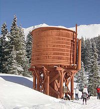 Cross-country skiers traveling along the old railroad grade pass the restored Bakers water tank in Summit County, west of Boreas Pass
A mining boom near Leadville resulted in a construction race between Denver, South Park and Pacific and Denver and Rio Grande Western Railroad. Work began on the branch line ("High Line") to Leadville, and on July 2, 1880, the first train arrived in Leadville. Denver, South Park and Pacific completed construction first, but rather than both companies laying track to Leadville, Jay Gould pressured the two companies to make a deal called the "Joint Operation Agreement" of October 1, 1879. The companies agree that "...for the purpose of harmony and mutual profit...", the Denver and Rio Grande would lay tracks to the north from Buena Vista to the Leadville mining district, but that the Denver, South Park and Pacific would share equal traffic rights. Similarly, when Denver, South Park and Pacific were given rights to build into the Gunnison Country via Chalk Creek, equal traffic rights were given to the Denver and Rio Grande. Construction continued past Mount Princeton to what would become the Alpine Tunnel
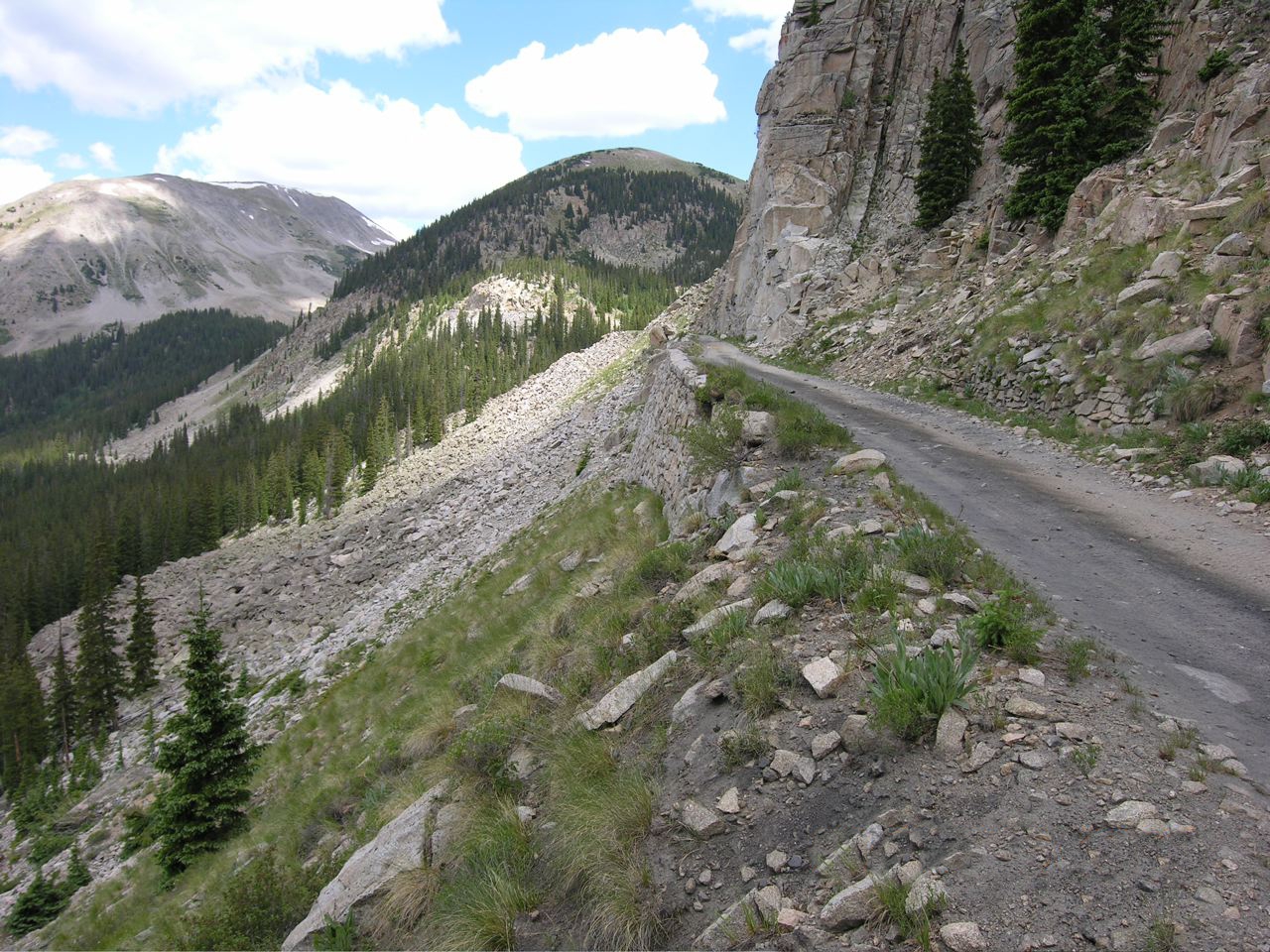
The Alpine Tunnel
Main article: Alpine Tunnel Approach to the Alpine tunnel
The Alpine Tunnel was "holed through" on July 26, 1881. Location of the tunnel portals and establishing a center line of the bore were completed in December 1879. Construction of the Alpine Tunnel took place between 1880-1881, by Cummings & Co. Construction company. This was the highest and most expensive tunnel built up until that time. It exceeds two miles (3 km) above sea level, with its highest point at 11,523.7 feet (3,512.4 m). It is 500 feet (150 m) under Altman Pass, later to be named Alpine Pass to prevent confusion, with a 1,825-foot (556 m) bore. It took 18 months to complete, with most of the construction done during the winter months. The tunnel only had a thirty year life span, with the last locomotive passing through the tunnel on November 10, 1910.
The line exited the west portal of the Alpine Tunnel, to Alpine Tunnel Station, the highest railroad station in the United States. There also was a turntable, water tank, and a two-story frame boarding house that replaced the stone boarding house and engine house, which burned down in 1906. Parlin, located at milepost 189.78 is where the tracks of the Denver, South Park and Pacific and the Denver and Rio Grande joined up and ran along each other to Gunnison. The land for the track was given to the railroad by local dairy rancher John Parlin around 1877, with the condition that the railroad would build a depot, and stop for at least five minutes so passengers could buy milk. The main line reached Gunnison the following year in 1882.
After reaching Gunnison
The Denver, South Park, & Pacific built north of Gunnison up the Ohio Creek Drainage to the Castelton and Baldwin Areas. Then planning to cross over Kebler Pass to Delta, Grand Junction, and points west and south. Track was laid four miles (6 km) past the Baldwin Mine, and another eight miles (13 km) were graded, but after losing right of ways to Lake City, and the San Juan Mining District, no more construction would be done west.
The railroad went into receivership on in May 1888. On July 17, 1889, the company was sold at foreclosure proceedings to the Denver, Leadville and Gunnison Railway, a new railroad which was formed to operate the DSP&P lines. The successor company went into receivership on August 4, 1894. The Colorado and Southern, charted in 1898, took over the former DSP&P lines in January 1899. The Colorado and Southern started dismantling in 1910 with the closure of the Alpine Tunnel. In 1930, the C&S attempted to shut down the main line through the Platte Canyon, in cooperation with the Denver Board of Water Commissioners, who desired to build a dam in the canyon (the dam was never built). Nevertheless, the construction of modern roads in the Rockies led to a decrease in revenue and traffic. The last freight and passenger trains between Denver and Leadville operated in April 1937, and on April 10, 1937, the South Park Line officially closed down. The last regular freight train operated between Denver and Como on April 25. The last narrow gauge section, between Leadville and Climax, was converted to standard gauge on August 25, 1943.
Remaining Locomotives
There are two locomotives that still exist from the original Denver, South Park and Pacific Railroad:
#51, a 2-8-0 built in 1880 by Baldwin Locomotive Works. #51 was renumbered in 1885 to #191 and still bears this number, currently residing at the Colorado Railroad Museum in Golden, Colorado, on static display. #191 is the oldest remaining authentic Colorado locomotive in the state.
#72, a 2-6-0 built in 1884 by Cooke Locomotive Works. #72 was renumbered by the Colorado & Southern Railroad as their #9, and has been restored for operation in Breckenridge, Colorado. Currently on display at the Rotary Snowplow Park in Breckenridge.
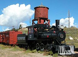
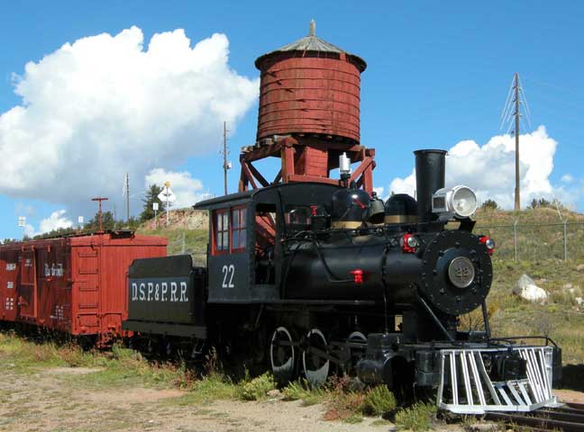
Note: The locomotive pictured above is not an authentic D,SP&PRR locomotive. It is indeed a 36" narrow-gauge locomotive built by H K Porter in 1914 for a railroad in Guatemala.
References
- "The South Park Line: A concise history" Colorado Rail Annual No. 12 by Gordon Chappell
- "Race To Gunnison" by Russell Lallier
- "The Gunnison Country" by Dr. Duane Vandenbusche
- "The Historic Alpine Tunnel" by Don Helmers
External links
- A Mason locomotive used by the DSP&P
- Denver, South Park, and Pacific Railroad overview
- Railwayeng.com: Denver, South Park, and Pacific Railroad
- Narrowgauge.org: Denver South Park, and Pacific map with links to old photos
- Library of Congress photos of the Denver, South Park and Pacific
Categories:- Defunct Colorado railroads
- 3ft gauge railways
- Narrow gauge railroads in Colorado
- 285 corridor
- Predecessors of the Colorado and Southern Railway
- Railway companies established in 1873
- Railway companies disestablished in 1889
- Denver, South Park and Pacific Railroad

Wikimedia Foundation. 2010.