- Okreek, South Dakota
-
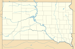
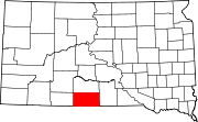
Okreek — Unincorporated community — Location within the state of South Dakota Coordinates: 43°21′44″N 100°23′9″W / 43.36222°N 100.38583°WCoordinates: 43°21′44″N 100°23′9″W / 43.36222°N 100.38583°W Country United States State South Dakota County Todd Population (2010) – Total 269 Time zone Central (CST) (UTC-6) – Summer (DST) CDT (UTC-5) ZIP codes 57563 FIPS code GNIS feature ID Okreek is an unincorporated community in Todd County, South Dakota, United States. As of the 2010 Census, the population was 269. The town is wholly within the jurisdiction of the Rosebud Indian Reservation, and the populace is almost entirely Sioux-American. Okreek consists primarily of two long blocks of inhabited tract housing, and has about 30 private telephone subscribers within town limits. There is also an elementary school and a Post Office which has been assigned the ZIP Code of 57563.[1]
References
- ^ "Okreek, SD ZIP Codes". SD HomeTownLocator. HTL, Inc.. http://southdakota.hometownlocator.com/zip-codes/ZIPCodes,city,Okreek,nd,0.cfm. Retrieved 2008-09-12.
Municipalities and communities of Todd County, South Dakota City Town CDPs Antelope | Parmelee | Rosebud | Spring Creek | Two Strike | White Horse
Unincorporated
communityOkreek
Indian reservation Footnotes ‡This populated place also has portions in an adjacent county or counties
Categories:- South Dakota geography stubs
- Populated places in Todd County, South Dakota
- Unincorporated communities in South Dakota
Wikimedia Foundation. 2010.


