- Norris, South Dakota
-
Norris, South Dakota — Township — Coordinates: 43°26′7″N 101°11′28″W / 43.43528°N 101.19111°WCoordinates: 43°26′7″N 101°11′28″W / 43.43528°N 101.19111°W Country United States State South Dakota County Mellette Area – Total 21.3 sq mi (55.1 km2) – Land 21.2 sq mi (54.9 km2) – Water 0.1 sq mi (0.1 km2) Elevation 2,530 ft (771 m) Population (2010) – Total 152 – Density 7.2/sq mi (2.8/km2) Time zone Central (CST) (UTC-6) – Summer (DST) CDT (UTC-5) ZIP code 57560 Area code(s) 605 FIPS code 46-45460[1] GNIS feature ID 1268591[2] Norris is an unincorporated community in Mellette County, South Dakota, United States. Although not tracked by the Census Bureau, Norris has been assigned the ZIP code of 57560.
References
- ^ "American FactFinder". United States Census Bureau. http://factfinder.census.gov. Retrieved 2008-01-31.
- ^ "US Board on Geographic Names". United States Geological Survey. 2007-10-25. http://geonames.usgs.gov. Retrieved 2008-01-31.
Municipalities and communities of Mellette County, South Dakota City 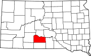
Town Unincorporated
communityNorris
Indian reservation Footnotes ‡This populated place also has portions in an adjacent county or counties
Categories:- Populated places in Mellette County, South Dakota
- Unincorporated communities in South Dakota
- South Dakota geography stubs

Wikimedia Foundation. 2010.