- County of Beilstein
-
Lordship of Winneburg and Beilstein
Herrschaft Winneburg und BeilsteinState of the Holy Roman Empire ← 
1488–1801  →
→
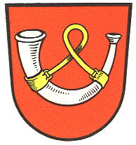
Coat of arms
Capital Beilstein Government Principality Counts - 1488-1652 Archbishop of Trier - from 1652 House of Metternich Historical era Middle Ages - Lordship founded 13th century - Fiefdom of Trier 1488 - Joined Westphalian
Imperial Circle1500 - County 1679 - Ceded to France 1801 - Acquired by Prussia 1815 The Lordship of Winneburg and Beilstein was a state of the Holy Roman Empire situated on the Moselle River around Winneburg Castle near Cochem.
The Lords of Winneburg were firstly mentioned in a 1304 deed, they also acquired the estates of the neighbouring Beilstein Castle in 1362. In the following decades the Lords of Winneburg and Beilstein were forced to give their lands in pawn to the Archbishops of Trier, who after a feud finally seized the property in 1488, only to lend it back as a fiefdom a few years later.
After the Winneburg-Beilstein line had become extinct, the descendants of the Trier archbishop Lothar von Metternich (1551-1623) from 1635 on called themselves Freiherren von Metternich-Winneburg zu Beilstein and were elevated to Imperial counts in 1679. The last Count Franz George Karl lost his territory to France by the 1801 Treaty of Lunéville. He was however compensated by Emperor Francis II with the possession of secularised Ochsenhausen Abbey and the princely title in 1803.
According to the Final Act of the Congress of Vienna, Winneburg-Beilstein together with the Rhineland fell to Prussia in 1815. Franz George Karl's son, Prince Klemens Wenzel von Metternich took the chance to buy the ruin of Winneburg Castle in 1832 but never rebuilt it.
 Lower Rhenish–Westphalian Circle (1500–1806) of the Holy Roman Empire
Ecclesiastical 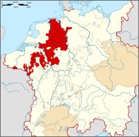 The Lower Rhenish–Westphalian Circle (color) within the Holy Roman Empire (white)
Prelates Secular Counts
and lordsfrom 1500Bentheim · Bronkhorst (until 1719) · Diepholz · East Frisia (until 1667) · Horne3 (until 1614) · Hoya · Lingen3 · Lippe · Manderscheid (until 1546) · Moers (until 1541) · Nassau (Diez · Hadamar · Dillenburg (until 1664)) · Oldenburg (until 1777) · Pyrmont · Ravensberg3 · Reichenstein · Rietberg · Salm-Reifferscheid · Sayn · Schaumburg · Tecklenburg · Virneburg · Wied · Winneburg and Beilstein · Zimerauff?from 1792Anholt · Blankenheim and Gerolstein · Gemen · Gimborn · Gronsfeld · Hallermund · Holzapfel · Kerpen-Lommersum · Myllendonk · Reckheim · Schleiden · Wickrath · Wittemstatus
uncertainCities 1 from 1792. 2 until 1792. 3 without Reichstag seat. ? status uncertain. Categories:- Former principalities
- Former countries in Europe
- States of the Holy Roman Empire
- States and territories established in 1488
- States and territories disestablished in 1801
- 1801 disestablishments
- Rhenish-Westphalian Circle
- Counties of the Holy Roman Empire

Wikimedia Foundation. 2010.