- Milton railway station, Brisbane
-
Milton 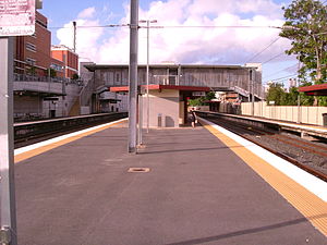
Station statistics Address Milton Road, Milton Coordinates 27°28′08″S 153°00′19″E / 27.4689°S 153.0052°ECoordinates: 27°28′08″S 153°00′19″E / 27.4689°S 153.0052°E Lines Ipswich LineSpringfield LinePlatforms 4 total (2 side platforms, 1 island platform) Other information Accessible 
Owned by Queensland Rail Fare zone 1 (TransLink) Services Preceding station Queensland Rail Following station Roma Streettoward Bowen HillsIpswich Line Auchenflowertoward RosewoodRoma Streettoward Bowen HillsSpringfield Line Auchenflowertoward RichlandsMilton Station is a railway station in Milton, Brisbane, Australia on the Ipswich and Rosewood and Springfield lines.
The station includes a walkbridge to Suncorp Stadium and is also immediately adjacent the famous Castlemaine Perkins brewery in Milton.
Contents
History
Milton Station opened in 1877, which was followed by the intensified development of Milton in the 1880s. [1]
On Friday June 11, 2010, The Queensland Government approved mixed use development at Milton station, which will see Milton station covered with office and/or apartment buildings. [2]
See also
References
- ^ "Northern Link - Cultural Heritage". SKM Connell Wagner. p. 12.11. http://www.northernlinkeis.com.au/pdf/eis/Vol1/Vol1_Chapter%2012_Cultural%20Heritage.pdf. Retrieved 12/06/2011.
- ^ Stirling Hinchliffe. "Minister approves Milton Transit Oriented Development". Queensland Government. http://www.cabinet.qld.gov.au/mms/StatementDisplaySingle.aspx?id=70163. Retrieved 12/06/2011.
External links
Categories:- Railway stations in Brisbane
- Queensland rail transport stubs

Wikimedia Foundation. 2010.