- Orford, Tasmania
-
Orford
Tasmania
Township of Orford
 Orford
Population: 553 (2006 Census)[1] Postcode: 7190 Location: LGA: Glamorgan Spring Bay Council State District: Lyons Federal Division: Lyons 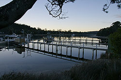 Jetties along the Prosser River
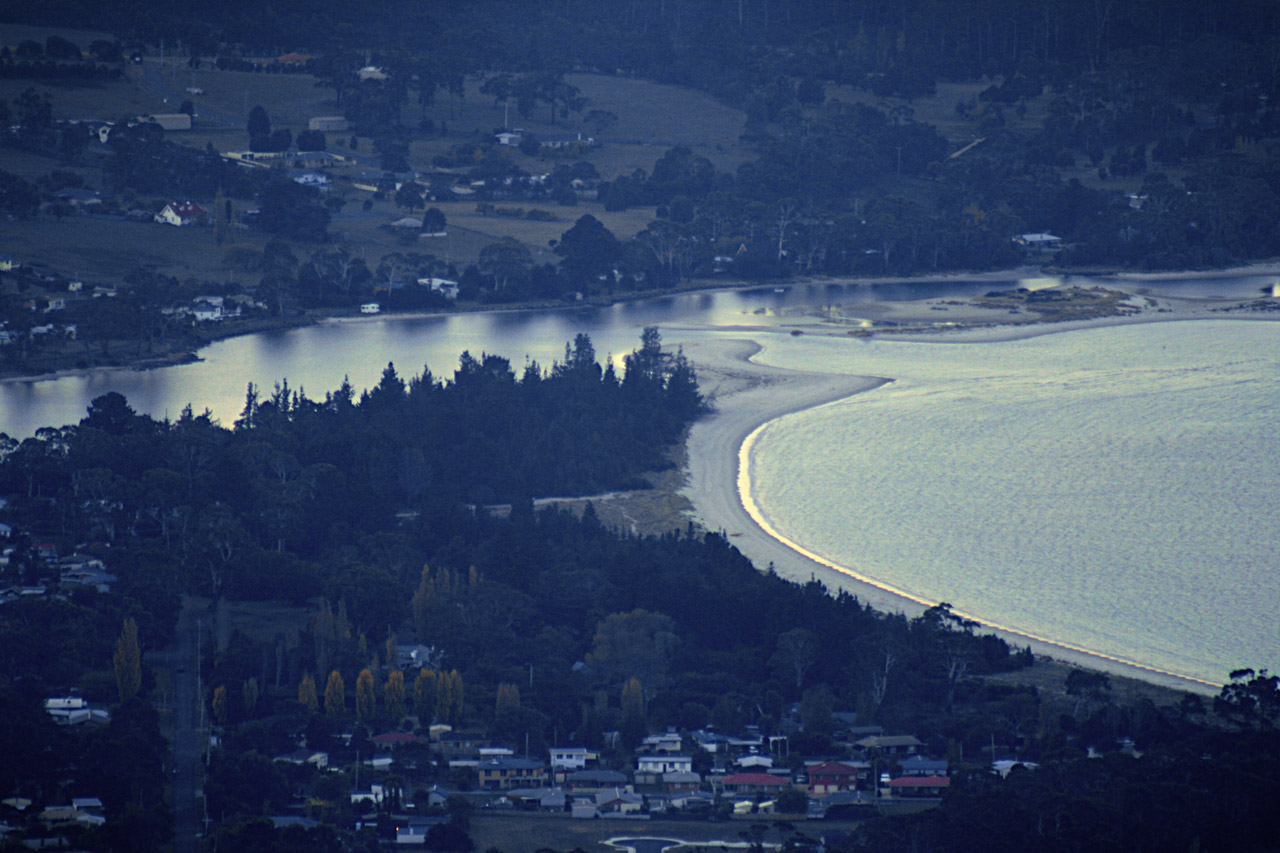
Orford is an attractive coastal hamlet situated on the east coast of Tasmania, some 73 kilometres northeast of Hobart. The village is centred around the mouth of the Prosser River, on the southern margin of a substantial coastal inlet called Prosser Bay. Beyond this bay are the waters of the Mercury Passage, with the strong relief of Maria Island providing a spectacular backdrop to the view. At the 2006 census, Orford had a population of 553.[1]
Contents
History
The town was named by Edward Walpole, who was granted 1,000 acres (4 km²) in the area in 1831. He named his grant “Strawberry Hill”, after the London residence of his relative Horace Walpole who was the Second Earl of Orford. The town was first established as a mainland port for the convict settlement on Maria Island. However, the marine infrastructure never consisted of more than a few short jetties in shallow waters just inside the mouth of the river which still remain today. The narrow channel at the river's mouth is flanked by a substantial sandbar, rendering the river unsuitable for larger vessels. The larger township of Triabunna approximately 6 km north is the main port in the area, and is home base for the region's fishing and timber industries, as well as the ferry service operating to and from Maria Island.
A quarry situated between Orford and Spring Beach provided sandstone for use in buildings in Hobart and Melbourne, including the Melbourne General Post Office. A quarry still operates at the nearby town of Buckland.
Environment
The weather in summer is typically warm and sunny, hence the area's popularity with holidaymakers. Winters are colder but generally mild. Rainfall is not very high but can occur at any time of the year.
The surrounding areas are generally hilly, with poor, leached soil. These tracts are in the main covered in dry eucalyptus forest. Where the soil is better, the land had been cleared and these paddocks are used to graze sheep and, to a lesser extent, to grow wheat, oats or barley. The production of grain has decreased steadily over the past fifty years as profitability has fallen.
Orford Important Bird Area
A 3 ha site consisting of a sandspit, within the 4 ha Raspins Beach Conservation Area on the northern side of the river mouth, has been identified by BirdLife International as an Important Bird Area (IBA) because it regularly supports 15-25 breeding pairs of vulnerable Fairy Terns.[2] It also supports breeding populations of Red-capped (10 pairs) and Hooded Plovers (5-6 pairs), and Pied Oystercatchers (5-7 pairs). Flocks of up to 50 Red-necked Stints are present in summer.[3]
The spit varies in shape and size according to the tides and outflows from the Prosser River. It is composed mainly of bare sand within a metre of high water mark, with some patches of marram grass, and is subject to inundation by seawater during winter storms. Both north and south of the IBA are sandy beaches used recreationally by people and their dogs, causing high levels of disturbance to nesting birds, despite attempts by the Tasmanian Parks and Wildlife Service to exclude pedestrian traffic from the site during the summer breeding season.[3]
Population
Orford has a small permanent population of approximately 485 (2001 census). There is however a significant number of non-resident 'shack' (Australian colloquial term for weekender or holiday home) property owners who come into the area on weekends and during holiday periods. The area is very popular with tourists; the influx of visitors over the summer months (December to February) swells the population to over 3,000.
Despite its small size and population Orford is well serviced with one supermarket, two cafes and eateries, a hotel and other accommodation, police and fire brigade, a primary school and a library.
Tourist attractions
Orford has several clean, picturesque beaches - including Raspins, Millingons, Spring and Rheban - with a popular campsite at Raspins Beach. Nearby is the well-regarded 9-hole Orford Golf Course and the Darlington Vineyard. There are several walks, including the Convict Trail along the Prosser River, the coastal walk along the cliff tops between East Shelly Beach and Spring Beach, and the scenic Thumbs lookout in the nearby Wielangta Forest, which offers a spectacular view of the region. Prosser Bay and the Mercury Passage provide excellent fishing, with flathead, trevally, trumpeter, abalone and southern rock lobster (crayfish) sought-after species.[4]
In February 2007 an artificial reef and dive site was created from the scuttling of the ship the Troy D in the Mercury Passage approximately 1 km off Maria Island, to further bolster the area's reputation as a premier location for scuba diving, thanks to its unpolluted water and abundant sea life.[5]
Louisville Point Development
The Solis residential and tourism development was approved in May 2004. The estimated A$150 million development at Louisville Point (to the north of Orford) will include 550 residential allotments, 60 'eco-tourism' cabins, a central precinct with retail shops, a day spa, restaurants and bars, and an 18-hole golf course designed by Greg Norman. Construction began in 2007 and is expected to take 10 years to complete.[6][7]
External links
 Media related to Orford, Tasmania at Wikimedia Commons
- Orford/Triabunna Region Chamber of Commerce
- East Coast Artificial Reef and Dive Site
- Solice Tasmania
- Maria Island Ferry and other information
References
- ^ a b Australian Bureau of Statistics (25 October 2007). "Orford (L) (Urban Centre/Locality)". 2006 Census QuickStats. http://www.censusdata.abs.gov.au/ABSNavigation/prenav/LocationSearch?collection=Census&period=2006&areacode=UCL612000&producttype=QuickStats&breadcrumb=PL&action=401. Retrieved 21 November 2011.
- ^ "IBA: Orford (Tasmania)". Birdata. Birds Australia. http://www.birdata.com.au/iba.vm. Retrieved 2011-09-12.
- ^ a b BirdLife International. (2011). Important Bird Areas factsheet: Orford (Tasmania). Downloaded from http://www.birdlife.org on 12/09/2011.
- ^ "Orford/Triabunna Region Chamber of Commerce". Orford/Triabunna Region Chamber of Commerce. http://www.orfordtriabunnacc.com.au/orford_triabunna_region.html. Retrieved 2007-07-04.
- ^ "East Coast Artificial Reef and Dive Site". Orford/Triabunna Region Chamber of Commerce. http://www.troyd.com.au. Retrieved 2007-07-04.
- ^ "About Solice". Solice Tasmania. http://www.solistas.com.au. Retrieved 2007-07-04.
- ^ "Tourism Major Projects". Infrastructure and Resource Information Service (IRIS). http://www.iris.tas.gov.au/tourism/major_projects. Retrieved 2007-07-04.
Categories:- Towns in Tasmania
- East Coast Tasmania
- Important Bird Areas of Australia


Wikimedia Foundation. 2010.